This walk around the southern tip of Eday provides the perfect opportunity to reflect on our present and future energy needs and how they sit within our dynamic landscape.
Warness is the testing site for some of the world’s most cutting-edge tidal energy devices.
But it’s also home to an abundance of wildlife and beautiful sea views.
Distance
5.3km
Grade
Grading: 3
Duration
2hrs
Terrain
Tussocky grass on coastal sections, farm track and open hill ground. Care should be taken around cliffs, which are brittle and outward sloping.
Map description
OS Explorer 465; OS Landranger 5
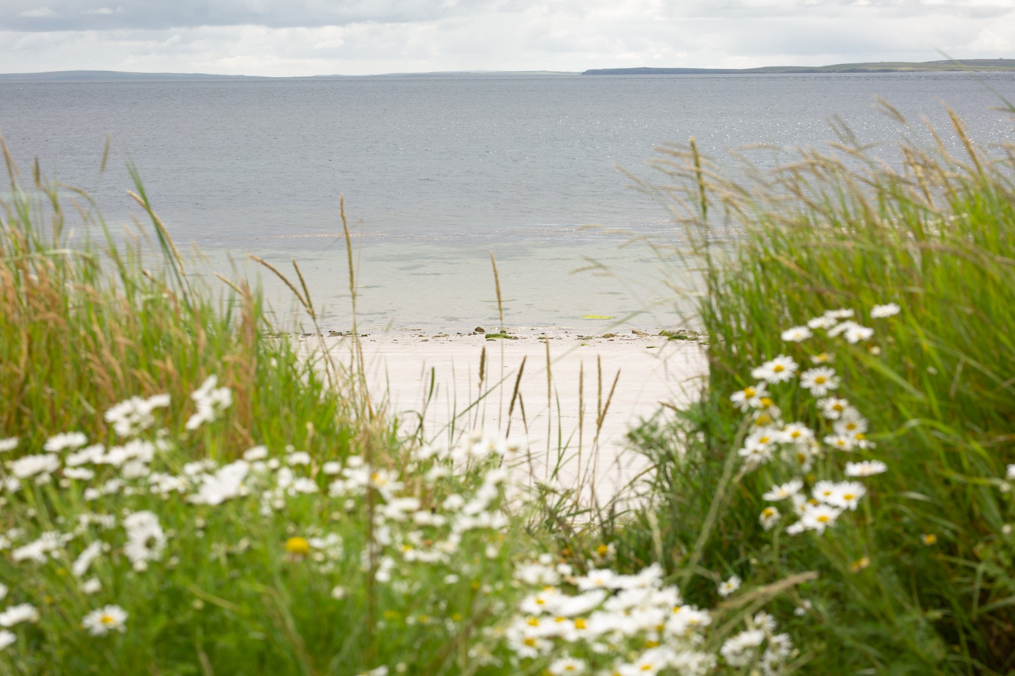
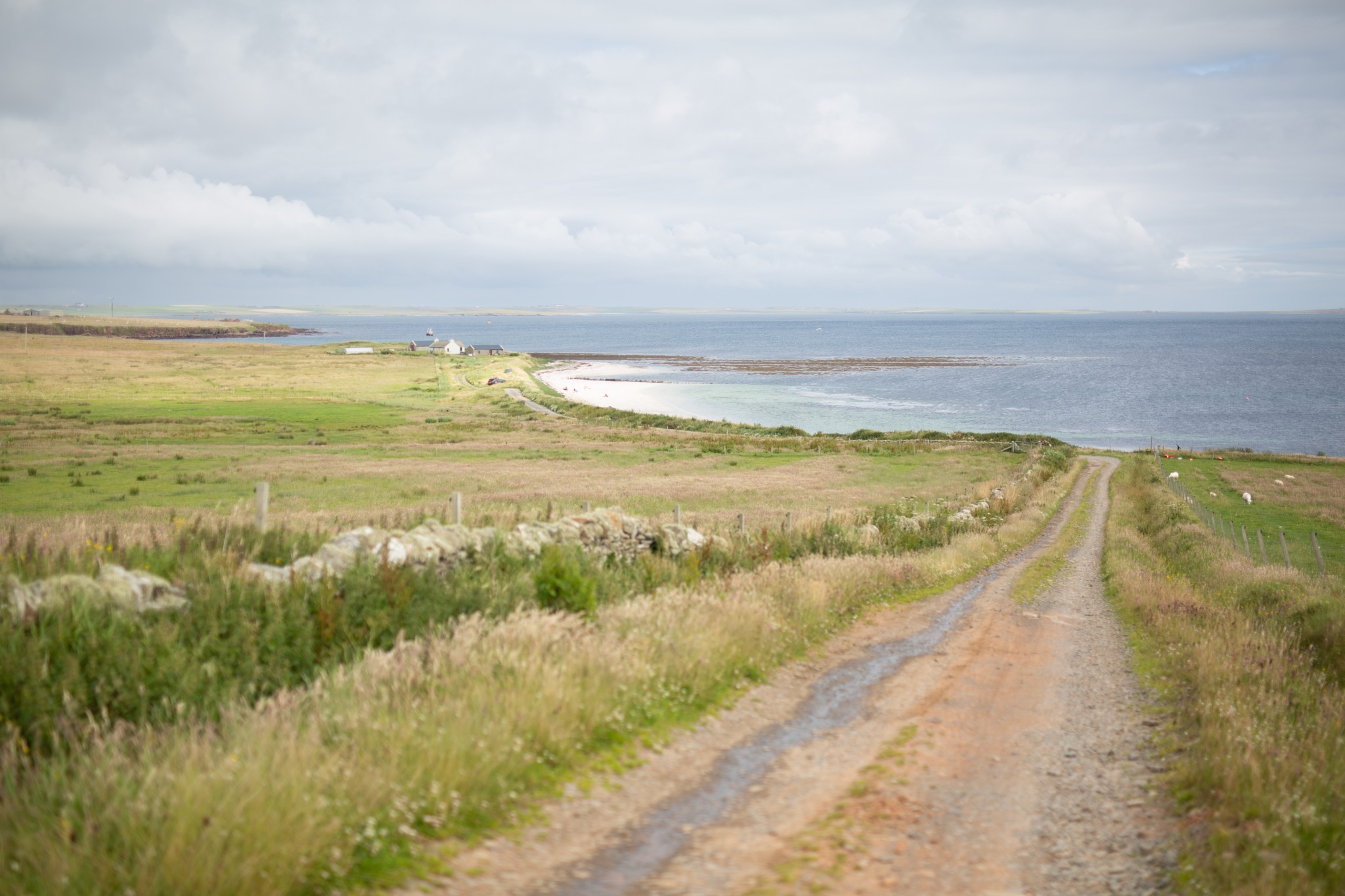
Start at the Bay of Greentoft where the public road ends (HY5610 2890). There’s just about space here for two vehicles to park (if you’re the only one there then do try and leave space for another). Follow the vehicle track that runs west, parallel to the head of the beach. As the track turns right cross a wooden stile on your left to follow the coast southwest.
The grass is a little tussocky underfoot, dotted with wildflowers. After about 1km you reach the headland of Warness. The beach and small cove here are a good place for spotting otters, so do approach quietly and keep your eyes peeled. Offshore, gannets can be seen diving in the rich waters that swirl round the headland.
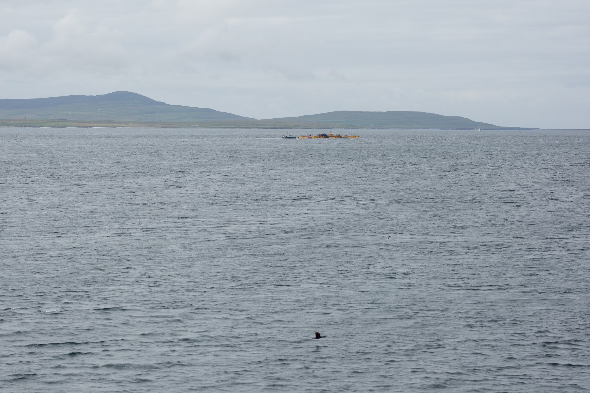
A wooden stile stands over a fence which has long since disappeared. From here you may well get a good view of the activity going on around the tidal energy test site to the west. It’s operated by the European Marine Energy Centre (EMEC). Based in Stromness, the centre is a major player in the field of marine renewables.
Developers come here from around the world to put their devices through their paces in these exceptionally strong tides and you’ll see workboats buzzing through the waters at all times of day. Energy production and energy research are major contributors to the Orkney economy.
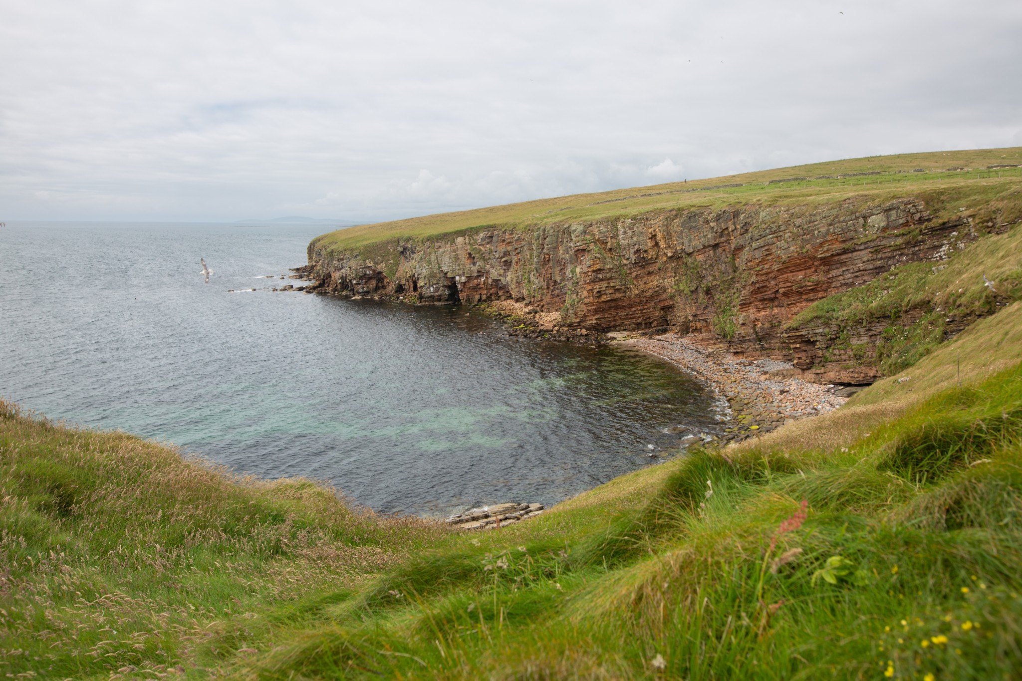
Head north along the coast for around 1km until you reach the bouldery inlet of Dyke End. Turn right through a small gate to head east then northeast, following the line of a drystone dyke for about 300m to reach an old sheepfold. Turn left here to follow the dyke before emerging onto open hill ground. An old concrete water tank provides a convenient point for mounting small satellite dishes – part of the discreet 24hr monitoring of the nearby tidal energy devices.
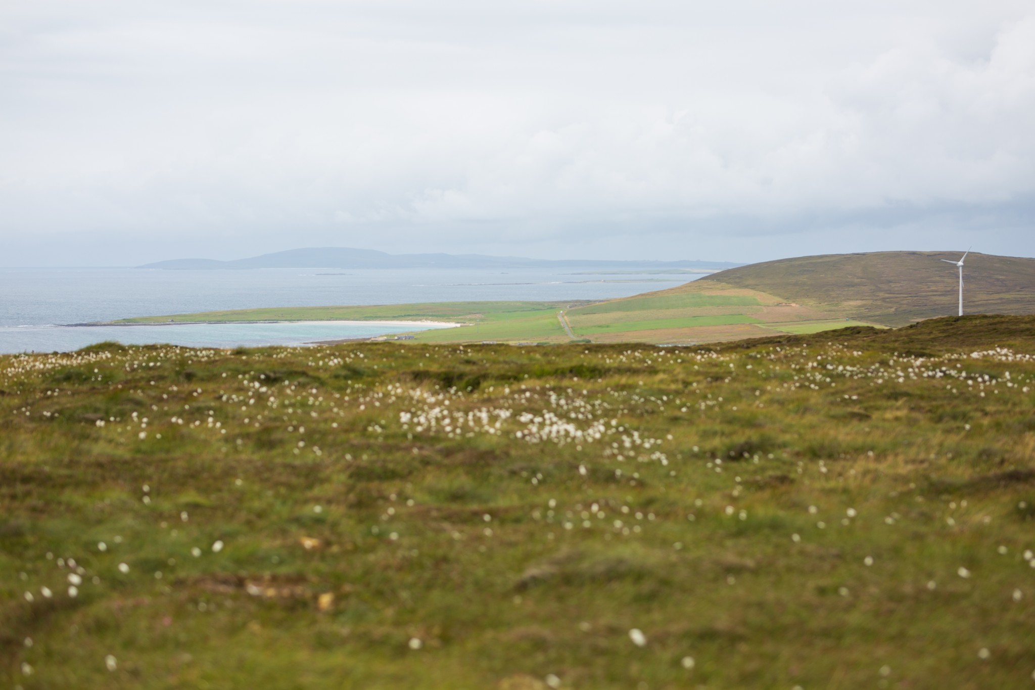
Carry on northeast for around 500m to reach the summit of Ward Hill. Varða is the Old Norse word for a beacon and any placename featuring ‘ward’ or ‘wart’ is likely to have been used for lighting fires – warning of approaching enemies or signalling major events.
There’s a large stone cairn here with good views across the north isles. From here you can see Eday’s community-owned wind turbine, tucked into the landscape to the northwest. Alongside the tidal energy devices, it’s used to create hydrogen which is then used locally to power vehicles and eventually, it’s hoped, a ferry. It’s just one of a number of turbines owned by individual island communities, the proceeds of which are helping support a range of local initiatives.
Return to the sheepfold before passing through a metal farm gate (if tied tightly, you may have to climb over this. Make sure and do this as close as possible to the hinges to minimise any strain on them). Head straight towards the farm of Greentoft.
Bear left as you head carefully into the farm yard – keeping in mind this is a working farm - before turning right onto the track to pass the farmhouse, then left to head sharply downhill and back to the start of the walk.
Visit the Scottish Outdoor Access Code website for more information and advice on how to enjoy the outdoors responsibly.
Further information
- Places of interest
Eday is almost an ‘Orkney in miniature’, offering sweeping sandy beaches, beautiful coastline, ancient history, wonderful wildlife attractions and the gentle pace of island life. It's also home to some fascinating historical sites, many of which you can see on the island's Heritage Walk.
The island also has an excellent Heritage Centre, packed full of information, artefacts and images from the past. Housed in a renovated Baptist Kirk, the centre has exhibitions over two floors and is the perfect place to explore family connections, as well as Eday’s historical and natural heritage.
There’s an incredible array of wildlife to enjoy in Eday, including one of the UK’s densest populations of red-throated divers at Mill Loch. Elsewhere, expect to see oystercatchers, hen-harriers, waxwings, guillemots and everything in-between. The island is also ideal for spotting both grey and harbour seals, and you might even catch a glimpse of an orca or otter too. A trip to Eday wouldn’t be complete without a walk on one of the wonderful beaches either – try the sands at Mussetter or the neighbouring Doomy.
- Food & drink
Eday has an excellent community shop, found at the start of this route. It's extremely well-stocked (though opening hours may be limited), and anything you spend here will help support the island economy.
- Transport & services
Daily ferries connect Eday and Kirkwall for passengers and vehicles. View timetables on the Orkney Ferries website.
You can also fly to the island with Loganair's inter-isles service. Visit the Loganair website to view the current timetable.
Public toilets are available at the Eday pier. Petrol and diesel are available from the island shop too.