A walk along a wonderfully atmospheric stretch of coastline, with hints of human habitation stretching back through millennia.
If you’re planning a trip to Stronsay, then it’s likely that taking in the impressive collapsed sea cave at the Vat of Kirbister will be high on your list of priorities, along with relaxing on one of the island’s fabulous beaches.
This walk combines the impressive geology of the Vat with a challenging but rewarding coastal walk.
If the significant section of road walking at the end of the route doesn’t appeal, then leaving bikes at Housebay will help tackle the final miles.
Distance
11.4km
Grade
Grading: 4
Duration
4hrs
Terrain
Mainly coastal heath and rough grazing. Wet in places during winter. Significant stretch of tarmac and concrete road.
Map description
OS Explorer 465; OS Landranger 5
Start at the car-park for the Vat of Kirbister (HY68152408). Pass through the wooden gate, then along a hard-surfaced footpath 500 metres towards the coast.
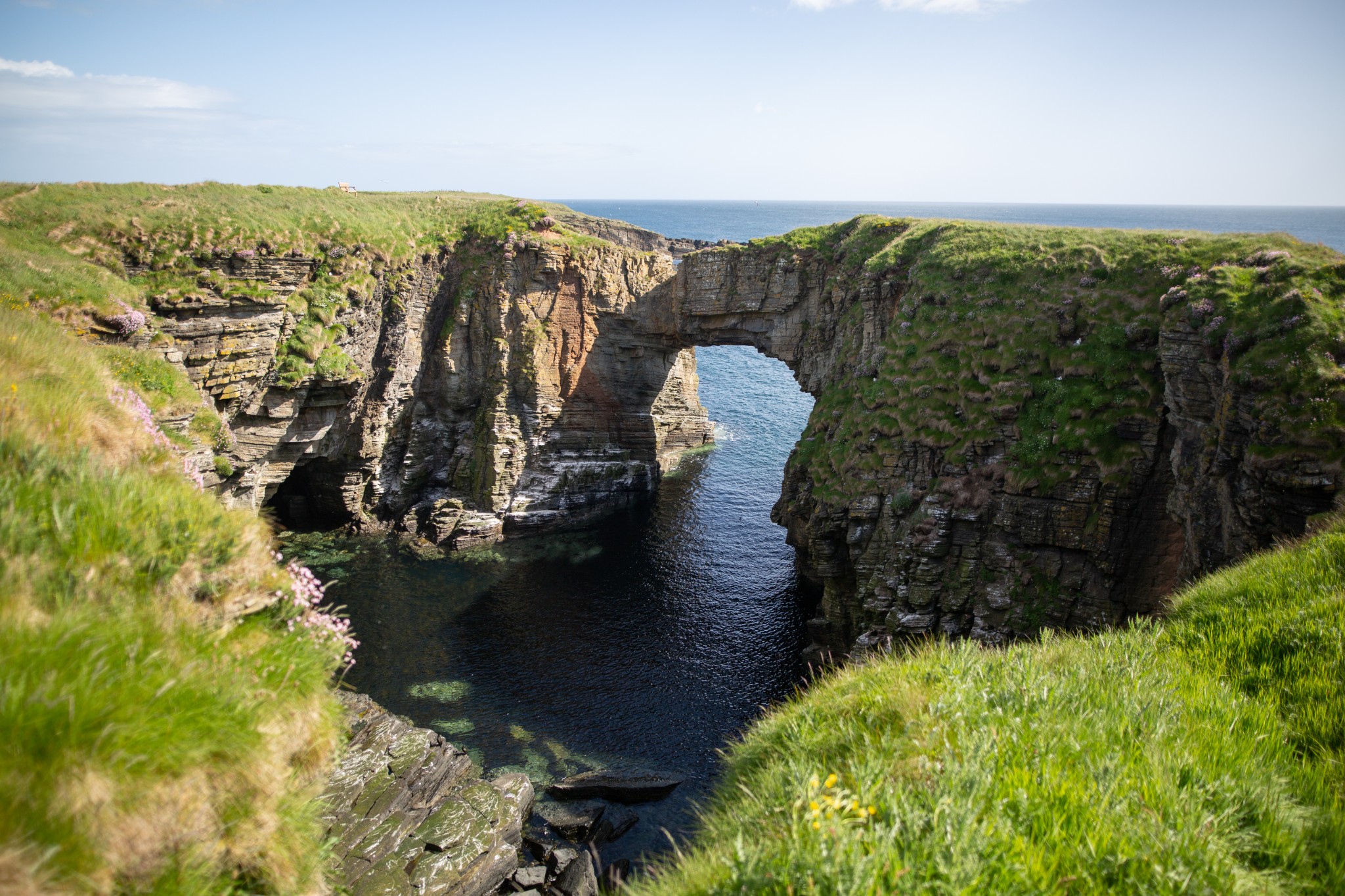
After passing through the last of a series of gates to arrive at the clifftops, turn right to head south along the coast. After a further 400 metres you’ll arrive at the impressive Vat of Kirbister. This collapsed sea cave has Orkney’s finest natural rock arch. The walkway across the tiny burn that flows into the Vat provides the best, and safest, viewpoint. Fulmars nest amongst the pink thrift near the top of the crumbling cliffs, while a little lower down the dark shape of shags stand out, sharp against their white guano-encrusted ledges.
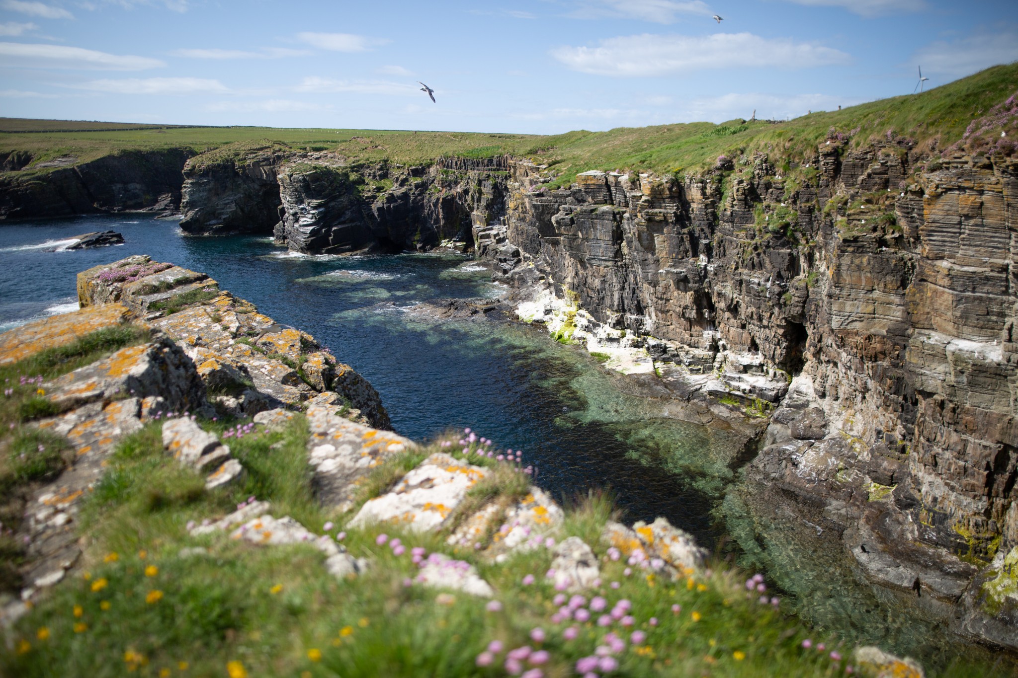
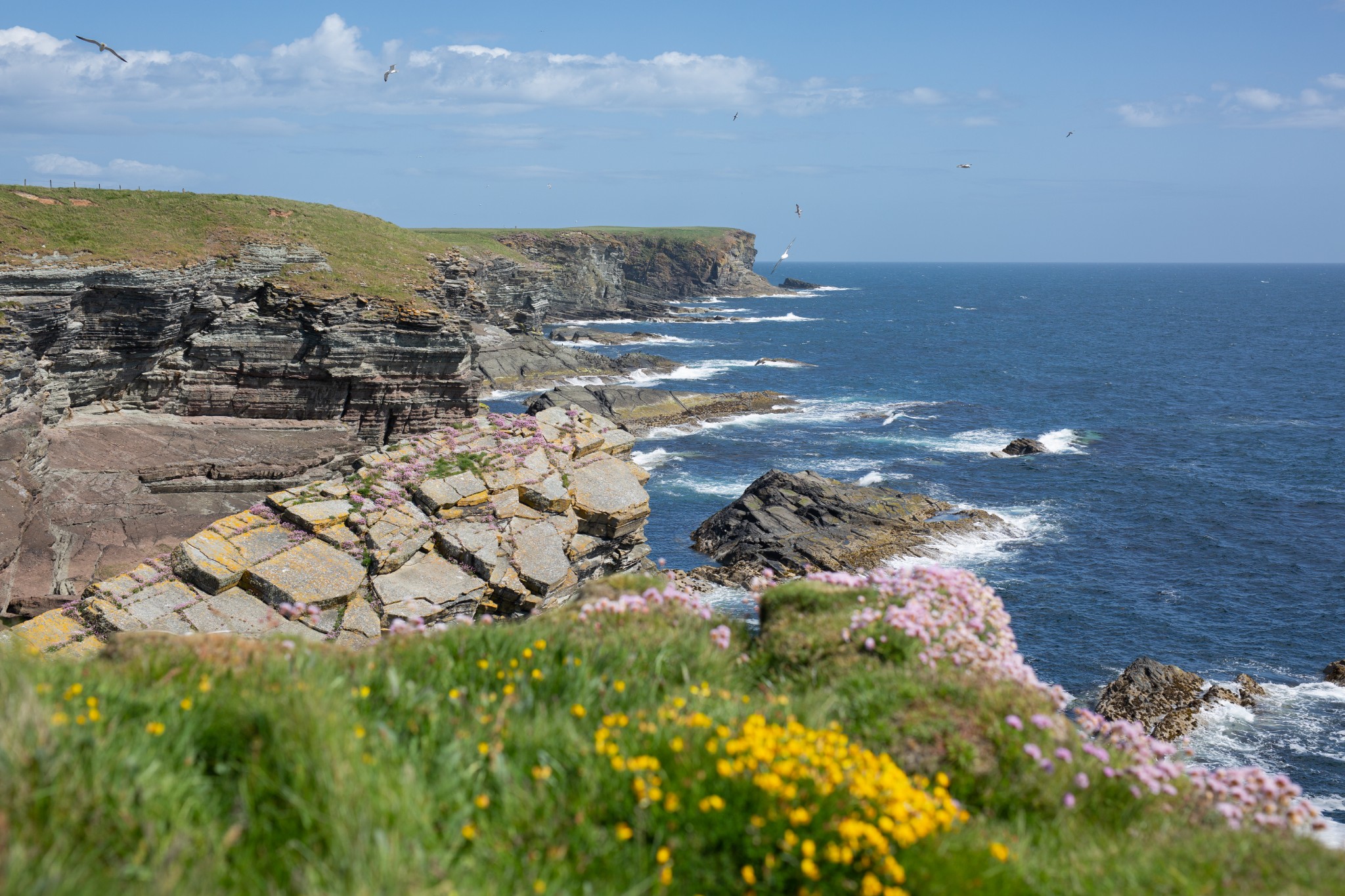
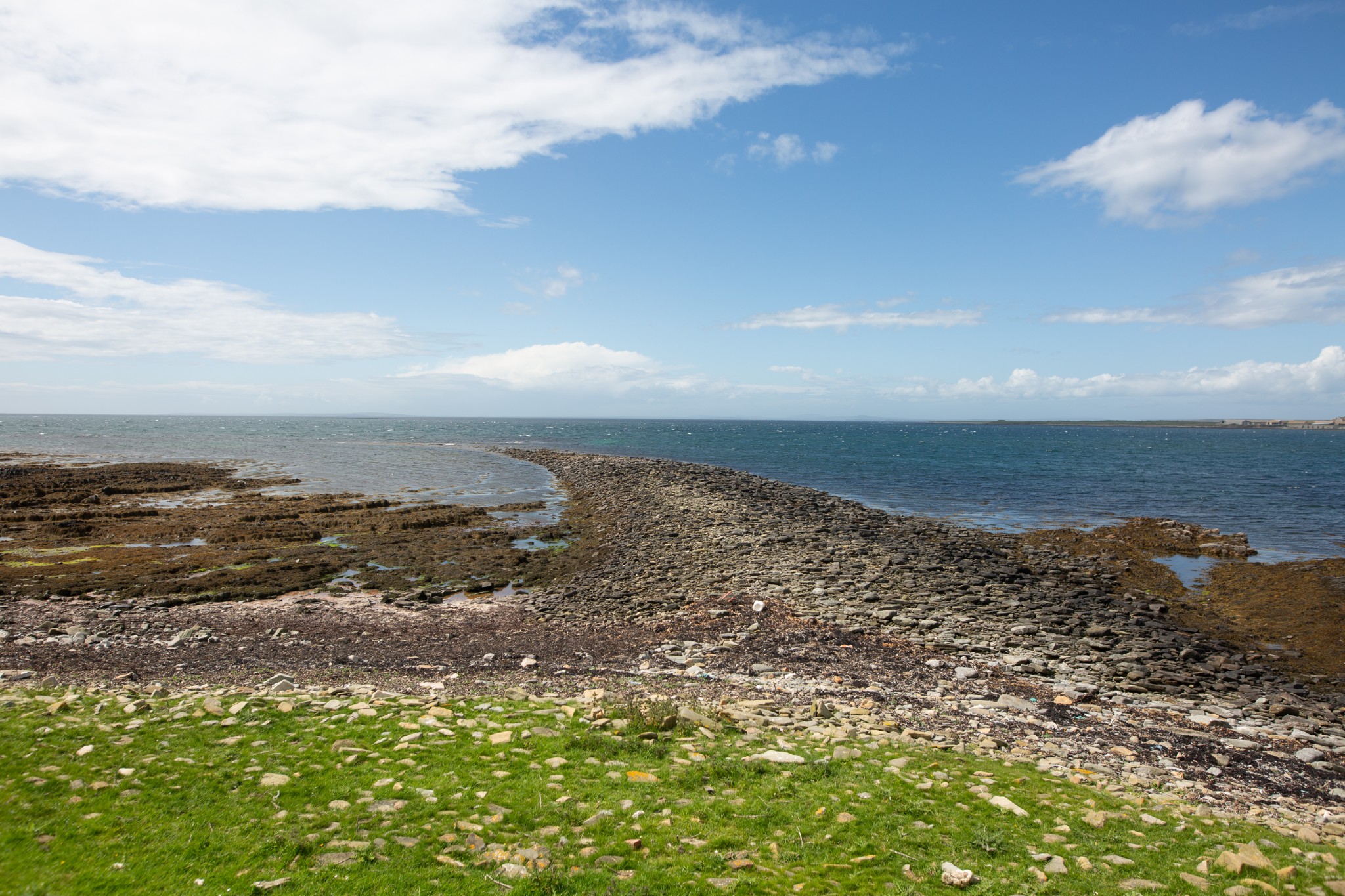
Carry on down the coast till you pass over a wooden stile that crosses a drystone dyke (1.25km). The next section is predominantly short coastal heath, which makes for comparatively easy walking. Near the clifftops blankets of wildflower takeover. As you approach Burgh Head the going becomes a little tougher, with tussocky grass underfoot.
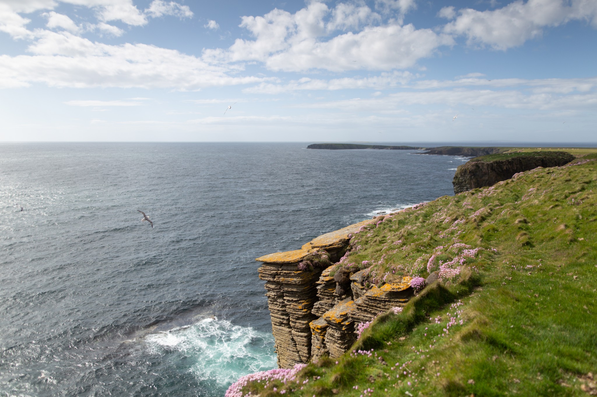
The headland itself (2.7km) may only stand at a very modest 37 metres, but on a clear day it gives fine views north past Odiness towards the island of Sanday. To the south, the distinctive outline of your next destination, Lamb Head, is echoed further across the waves by the tiny island of Auskerry, with its lonely lighthouse.
On the southern side of Burgh Head is the Brough. On the summit of this broad sea stack are archaeological remains, including stonework and upright slabs. The inaccessibility of the Brough means that it’s yet to be fully explored, but it’s believed to have been some prehistoric fortification which is likely to have been connected to the land during its occupation.
Carry on south along the coast, gently descending all the while as you pass around the heads of a number of impressive inlets, or geos, where countless fulmar hang, rafted on the updrafts.
Lamb Head itself (4.8km) is connected to the mainland of Stronsay by a narrow neck of land. With bays on either side offering shelter during different airts of wind, it must have been an obvious place to build an impressive Iron Age broch. Only the foundations of the great stone tower remain, but two holes opening down into the roots of its massive cavity walls give a real sense of its former scale.
It's a fine spot to take a break. And while you sit on the remains of the broch look west, where you’ll see a boulder spit which stretches out from the land. Known as the Danes’ Pier, at one time it was thought to have been manmade, but is now believed to be a natural phenomenon, caused by strong tidal conditions around the headland. Whatever its origins, the ‘pier’ must have made a convenient landing place for the inhabitants of the Iron Age broch and later for the Norse settlers, to whom it no doubt owes its name.
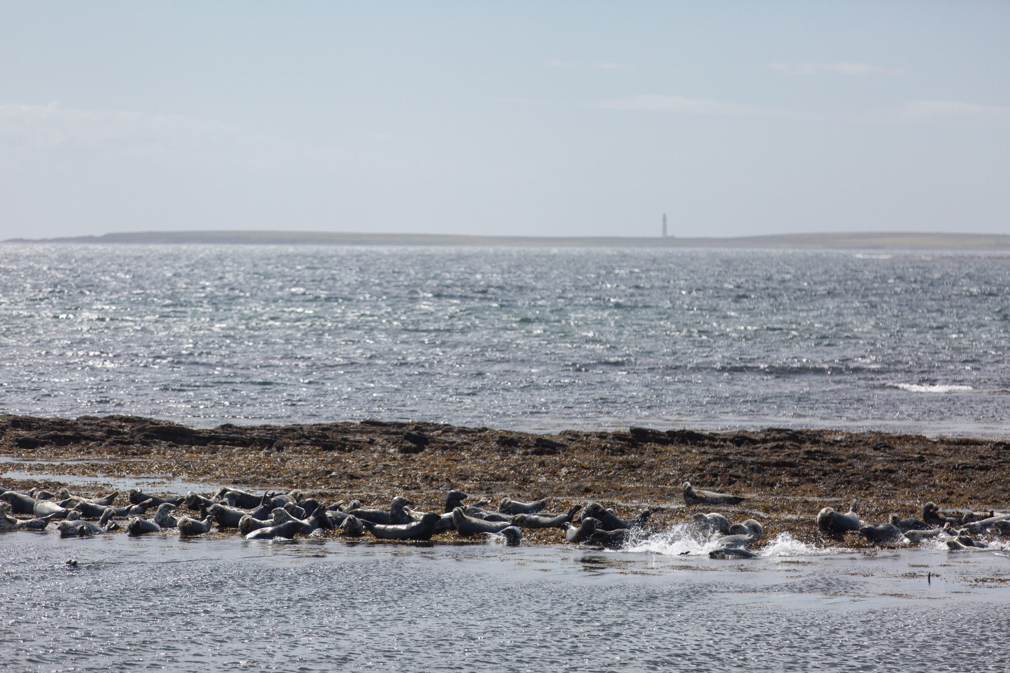
Retrace your steps back across the neck of land to where a wooden stile leads over the fence on your left. Once over the fence head straight along the coast, following the long sweep of the bay of Housebay. At this point you may well be serenaded by the plaintive cry of seals on your left, as these bays provide an important breeding area for both common and grey seal populations.
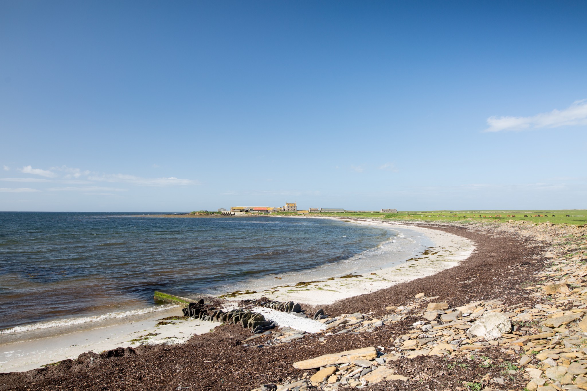
As you reach a small sandy bay with a large farm at its far end lookout for a cattle grid, leading onto a well-maintained concrete farm road (6.7km - this would be the ideal spot to have stashed a bike earlier in the day). Branch right to head along this long straight road, which joins the tarmacked public road after about a kilometre.
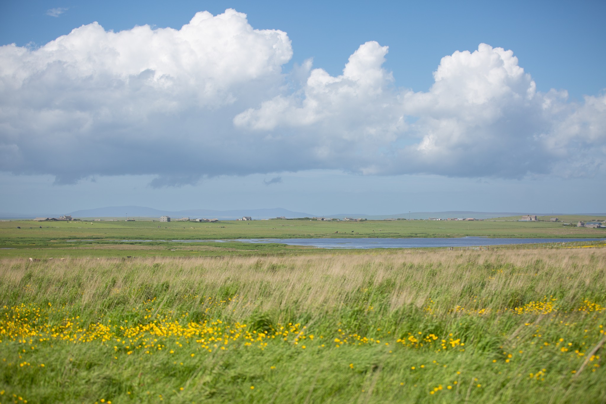
Keep on this road as it heads north, then northeast and north again. As it rises gently uphill look left across Meikle Water into the heart of the island. After around 2km on the public road you’ll reach a junction, from where the signs to the Vat of Kirbister will lead you right and right again on the final 1.5 km back to the carpark and the start of the walk.
Visit the official Stronsay website to find information on more walks in the island.
Visit the Scottish Outdoor Access Code website for more information and advice on how to enjoy the outdoors responsibly.
Further information
- Places of interest
Stronsay is Orkney's 'island of bays' and is home to many beautiful beaches, including those at St Catherine’s Bay, Mill Bay and Rothiesholm. The peaceful village of Whitehall welcomes you off the ferry and is home to a community-run hotel and a shop. There’s also a small heritage centre where you can learn more about Stronsay’s history.
Stronsay has an enterprising spirit too. There’s a healthy creative community, offering a craft trail experience that also substitutes as an ideal way to see much of the island. You can visit Airy Fairy, Marion Miller Jewellery, and Star Island Soap, but check in advance before popping past.
- Food & drink
The excellent Fish Mart Hostel & Café can be found in Whitehall, offering light bites and more.
The Stronsay Hotel also offers meals and refreshments. Check opening times in advance. There are two well-stocked shops too, Ebenezer Stores in the village, and at Olivebank in the centre of the island.
- Transport & services
Daily ferries connect Stronsay and Kirkwall for passengers and vehicles. View timetables on the Orkney Ferries website.
You can also fly to the island with Loganair's inter-isles service. Visit the Loganair website to view the current timetable.
Bike hire is available at the Stronsay Development Trust in Whitehall but booking in advance is recommended. Our Stronsay Beach Circuit showcases some of the island's best locations.
Public toilets are available at the Stronsay pier. Petrol and diesel is available from the Olivebank shop.