A fine circular route taking in some of Sanday’s finest beaches.
Sanday is an island well-named.
Renowned for its spectacular beaches, which stretch for unbroken miles around its scalloped coastline, this is a place for those who appreciate the sensation of sand beneath their feet.
While Cata Sand may have the biggest ‘wow factor’, this walk around the north-eastern tip of the island at Burness takes in some of our favourite beaches, combined with fine areas of wetland, adding variety to the flora and fauna.
Distance
8.6km
Grade
Grading: 4
Duration
3hrs
Terrain
Mainly beach, though with option for walking above shore in most sections. Some short road and farm track stretches.
Map description
OS Explorer 465; OS Landranger 5
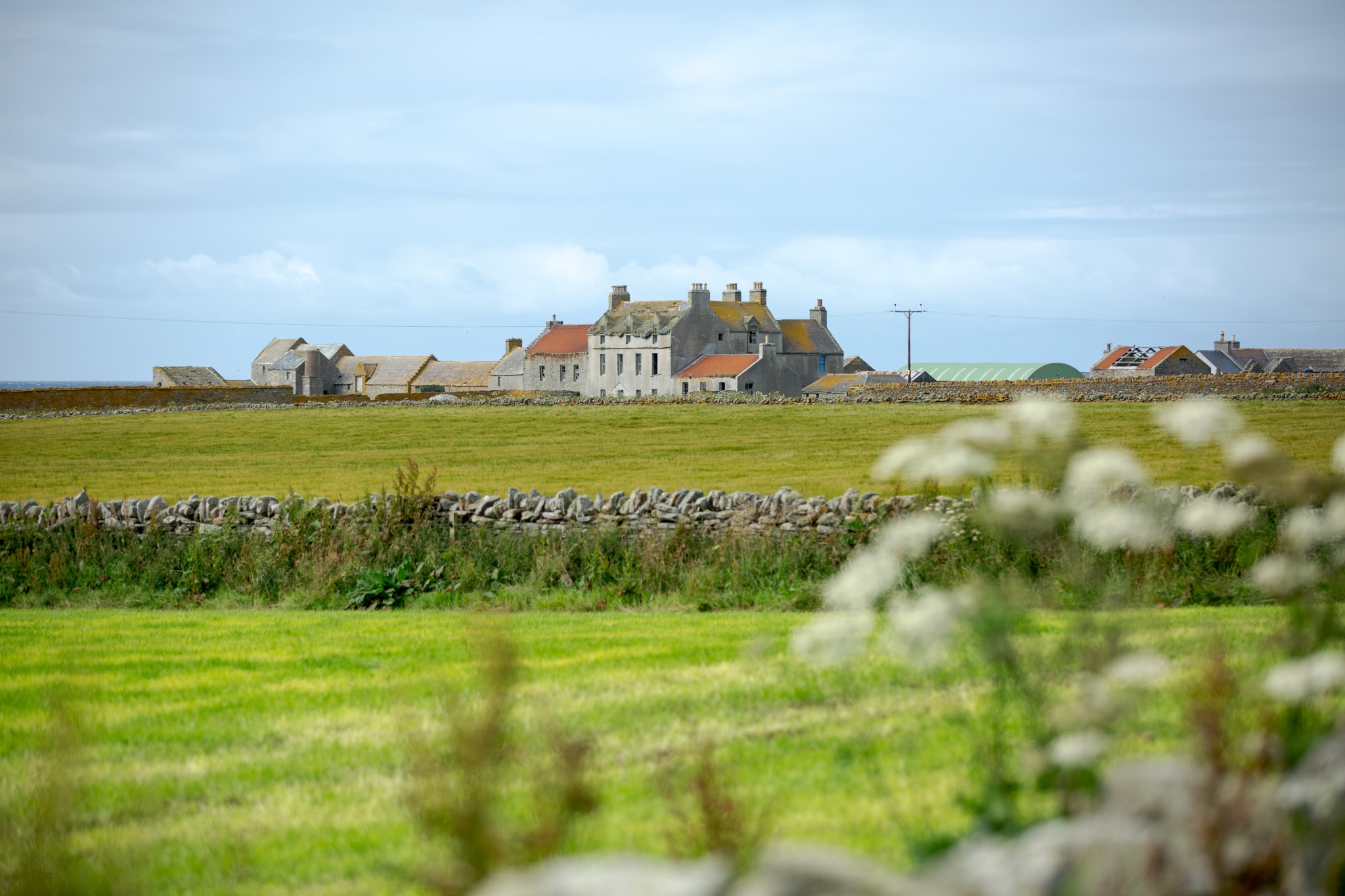
Start at the Burness Cemetery where there’s plenty of parking for vehicles (though do check locally to ensure there are no funerals scheduled).
Turn left to head northwest, passing with care between farm buildings behind the historic grand house of Scar. Just after the farmyard a track to the right carries you to the shore at Sand Ayre, the first of many fine beaches. Turn right to head northeast. For much of this route you can either walk on the beach or – in most parts – above the beach, along the ‘banks’.
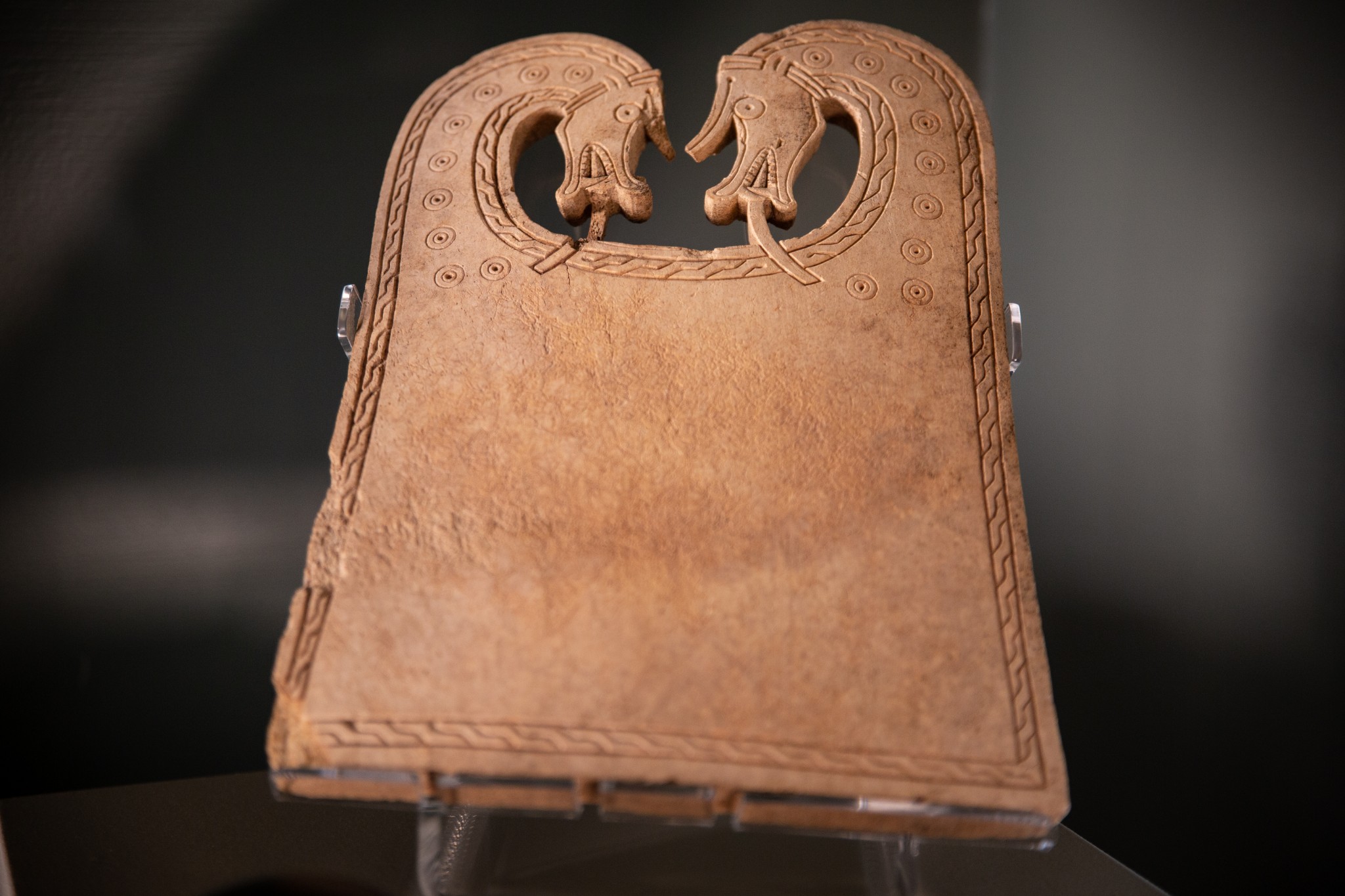
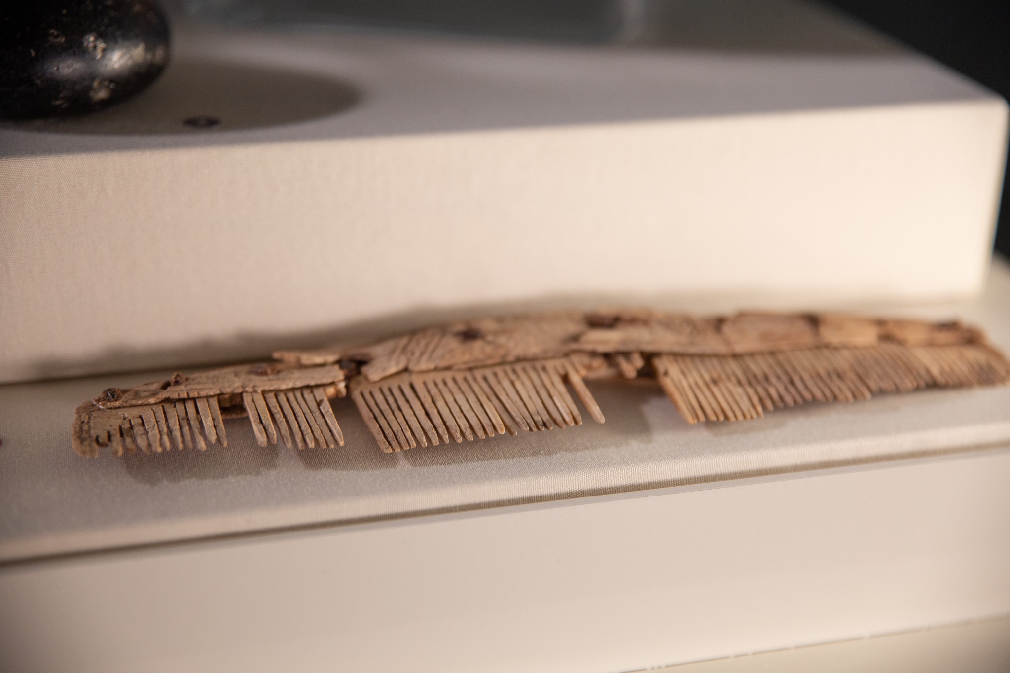
Sand Ayre is split from the next bay of The Crook by the blunt headland of Quoy Banks. It’s here, in the early 1990s, that one of Orkney’s most remarkable archaeological finds of recent times was made. A Viking boat burial appeared out of the eroded coastline. Among the grave goods was the Scar Plaque – a wonderfully ornate whalebone carving. It can be viewed, along with many of the other finds, in the Orkney Museum, while the story of the excavation is well-told in the Sanday Heritage Centre.
Carry on a further kilometre or so to the northeast to the headland at Riv. Don’t be tempted at low tide to head out along the tidal spit towards the beacon tower, as it’s easy to get cut-off by fast-rising waters. As you round the point look for a small, marshy lochan to your right. It’s a good spot to see wildfowl and a variety of waders.
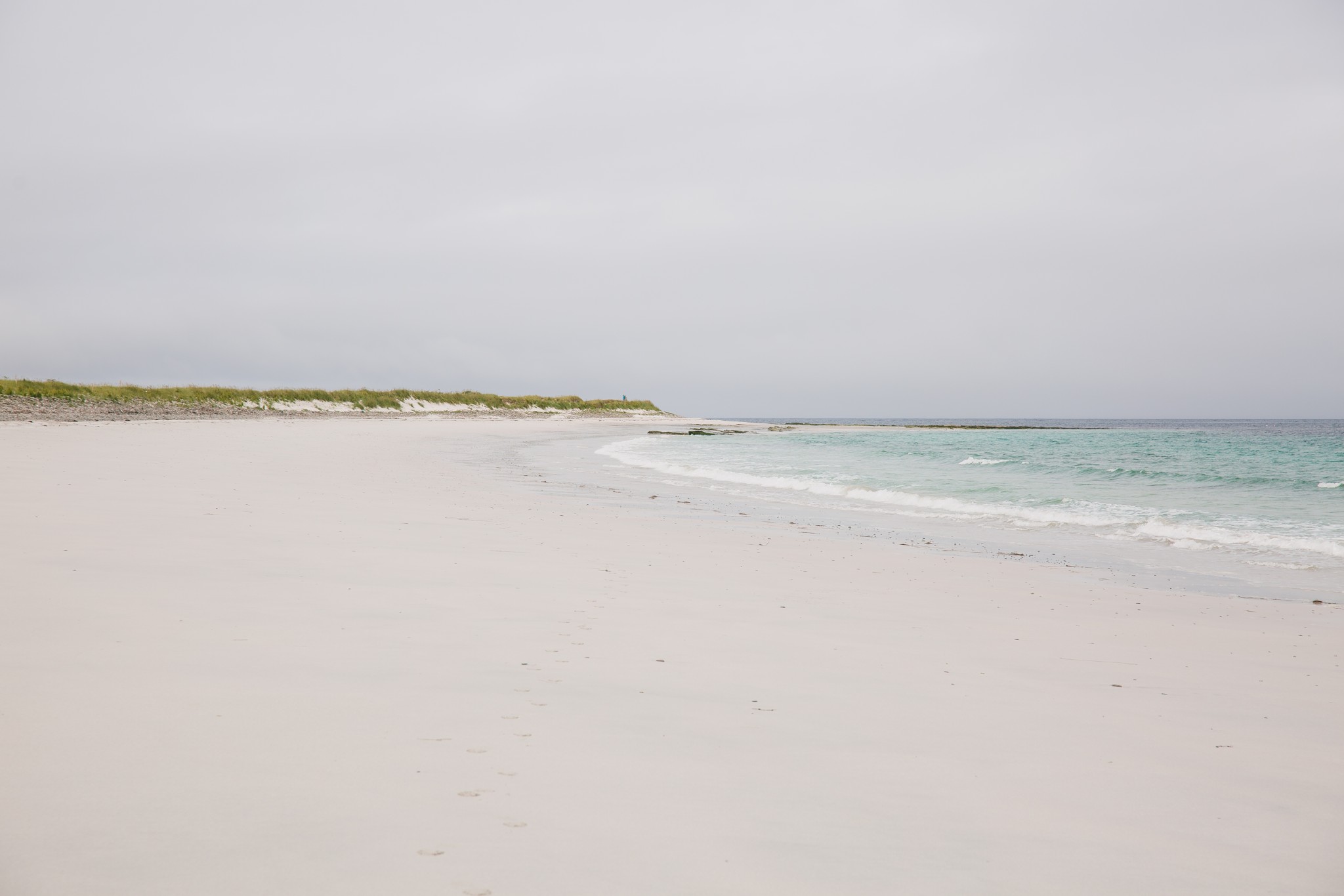
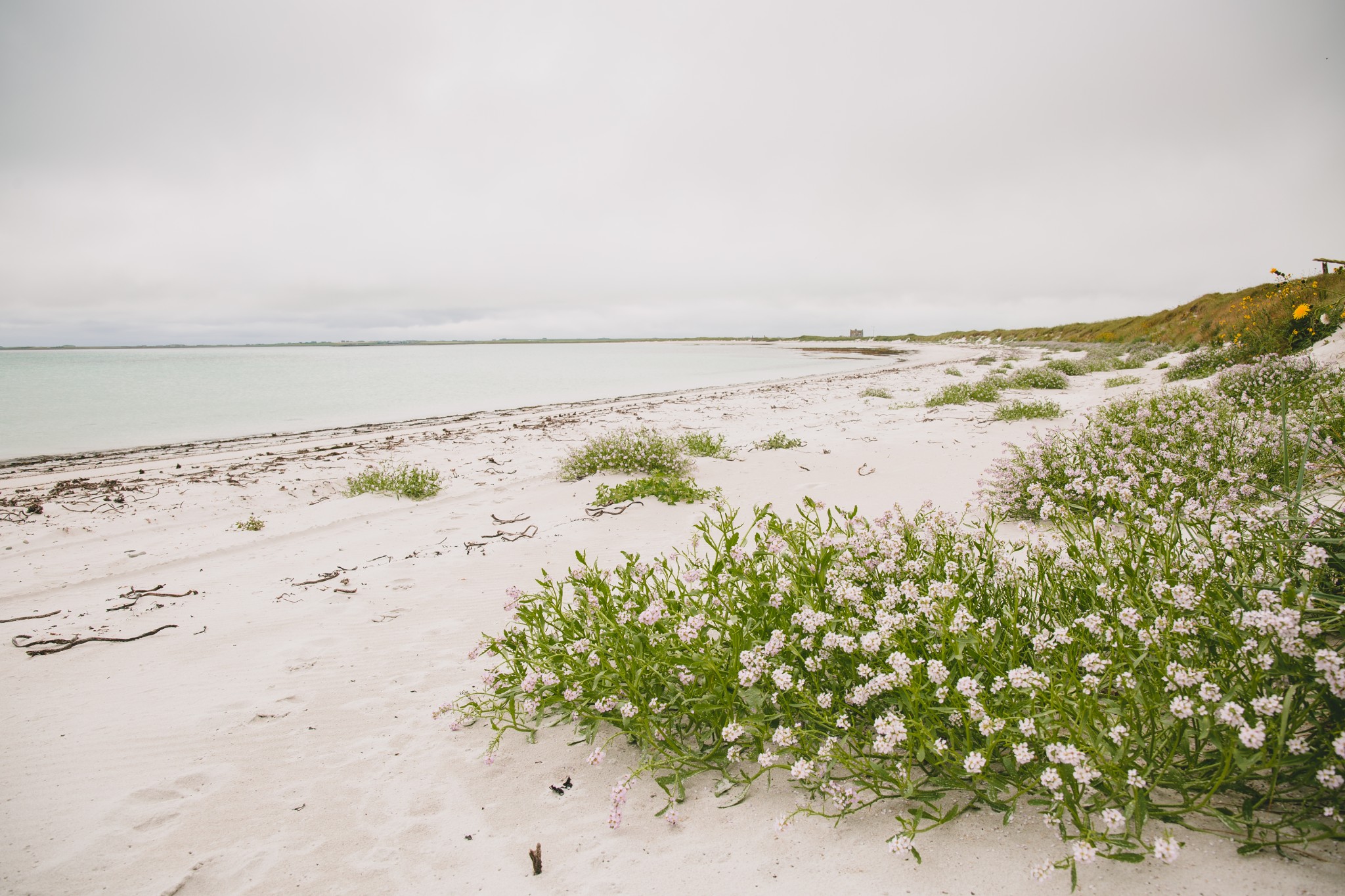
Whitemill Bay is one of Sanday’s finest beaches – and it faces some stiff competition. Around a mile long, its white sands are edged by the most turquoise of waters. On a summer’s day it has a positively tropical feel – visually, if not climatically.
Whitemill Point is a fine spot to stand and appreciate why this island and neighbouring North Ronaldsay – which lies across the water to the northeast – were so feared in the days of sailing ships. Low-lying, they were barely visible until a ship was often too close at hand to fight against a driving wind and find clear water in the Fair Isle channel to the north.
Sanday throws its limbs in all directions, each with its own tentacles of hidden reefs and skerries. Just below a curious knoll is a large section of rusted steel. This is part of the wreck of the ‘Wanja’, a large cargo ship which ran aground here in October 1939. All 26-crew survived, but the subsequent salvage operation saw the loss of seven men when their vessel was driven ashore on the island of Stronsay in 1941. While most of the crew were from Lancashire, a Sanday man, William Clark, was among those lost. A married father, he’d lived at Ortie – one of the houses just to the southeast of where you’re standing now.
Continue south then southwest along the coast. Carry on past the ruined farm of Helliehow to the point of Taing Ayre. From here, to the south and southeast, you’re looking into the shallow inlet of Otterswick. The bay which curves away for almost two unbroken miles to your right is just part of this complex tidal expanse - the inner bay beyond Lama Ness being almost entirely tidal. Just beyond the shoreline here lies a surprising secret.
Following a storm in the 1840s, tree roots were discovered sticking out of the sand at low tide. More recent excavations have revealed a large area of former woodland submerged beneath the sands, believed to date back around 6500 years. It shows how the islands have been gradually sinking through millennia – a process being accelerated recently by a rapid sea-level rise.
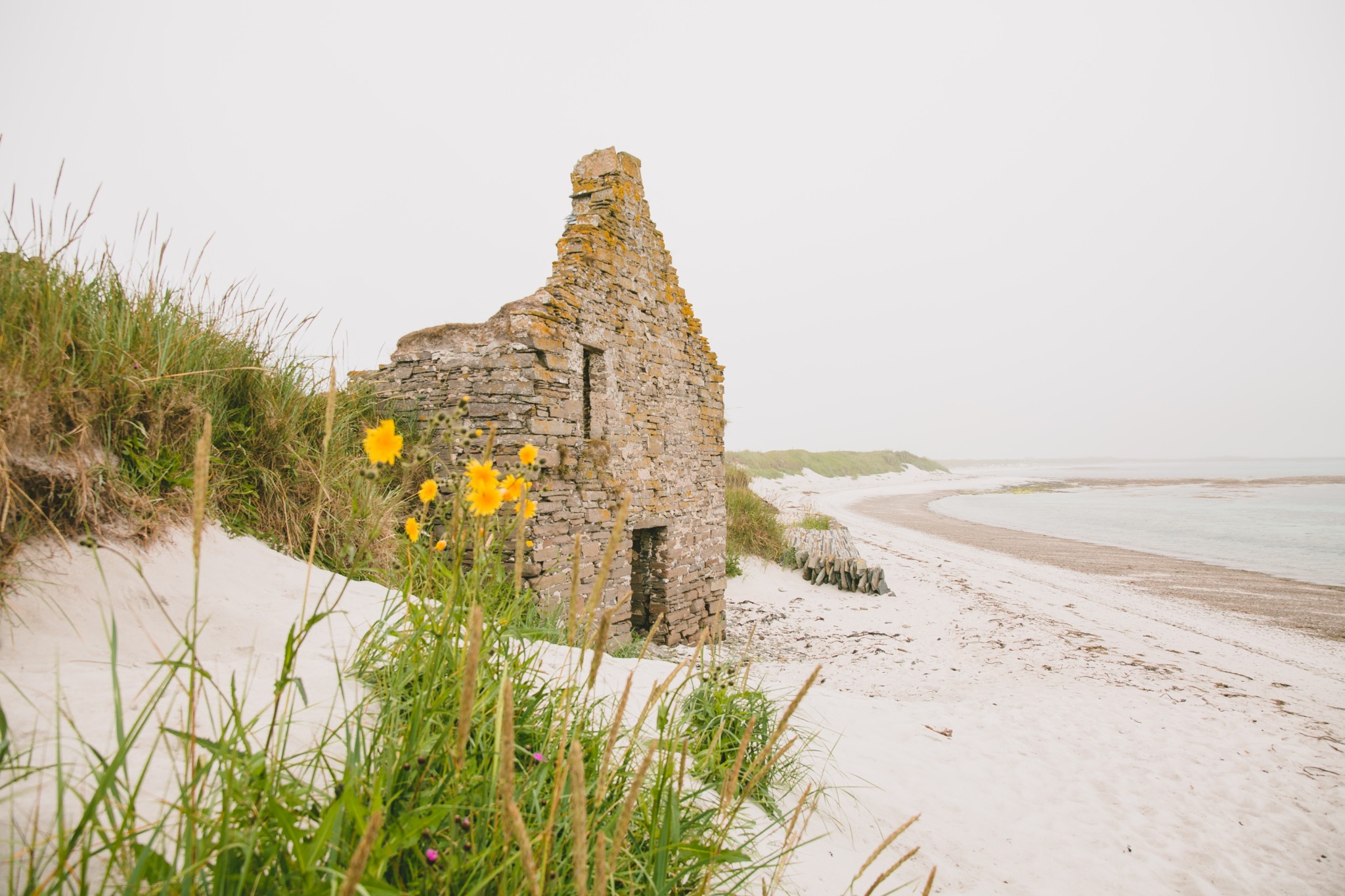
Follow the beach for around a kilometre and a half until you reach the substantial house of Saville. You’ll see the ruin of an old storehouse half-buried in the sand dunes here. Don’t be tempted to step inside as it’s extremely unstable.
Retrace your steps north along the beach for around 20 metres before heading west over the dunes to pick up a track which quickly joins the end of the public road. Where the road turns left, head instead to the right before taking a sharp left to pick up a farm track to continue westwards. Turn right at the public road for 350m before turning left onto another grassy track, passing to the north of Mill Brae. The round tower on the top of the brae looks like a miniature bronze age broch, but is in fact the base for a 19th century windmill.
At the end of the track turn left to arrive back at the start of the walk.
Visit the Scottish Outdoor Access Code website for more information and advice on how to enjoy the outdoors responsibly.
Further information
- Places of interest
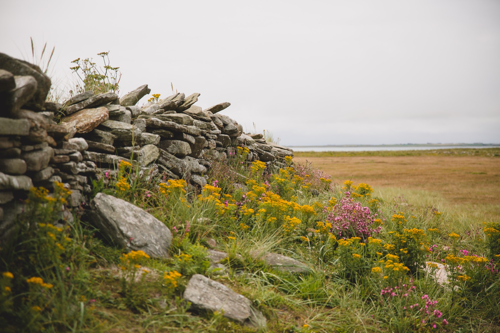
The natural environment is very much the main attraction in Sanday. The island's beaches are irresistable, with another glorious stretch of sand around almost ever corner. Aside from the ones mentioned above, you should also visit and visit the beaches at Backaskaill, Doun Helzie, and Lopness too.
Sanday is full of wildlife habitats, with otters and seals present and plenty of birdlife, including lapwings, curlews and oystercatchers. The island has a history stretching as far back as the Neolithic too, and Quoyness Chambered Cairn is a fascinating place to visit - check our our walking route. The Sanday Heritage Centre and Croft House also offers a glimpse into generations of island life.
There are a whole range of talented makers on the island's Craft Trail, with open studios and exhibitions on offer.
Our two Sanday cycling routes - the Sanday Big Cycle and the Sanday Central Circular - also offer the chance to explore the island.
- Food & drink
There are two excellent shops in Sanday. Sinclair General Stores offers everything from groceries to animal feed. The island's well-stocked Community Shop in Lady village also offers a Post Office service.
There are a range of eating out options too. The UK’s most northerly wood-fired pizzeria at 59 Degrees North is a modern café-style premises offering delicious pizzas and a range of other homemade treats, with takeaways also available. Opening times change according to the season so check ahead before visiting. Booking ahead is recommended during the summer months.
In Kettletoft village, The Belsair Hotel serves up a range of tasty bar food, and it’s a licensed bar too. Check opening times before arriving.
The Sanday Community Craft Hub also has a tearoom offering light bites, cakes, and teas and coffees. Check opening times in advance on Facebook.
The team at Ayre's Rock have launched Ayre's Kitchen, offering takeaway breakfasts and fresh home-cooked ready meals.
- Transport & services
Daily ferries keep the island connected with Kirkwall. View timetables on the Orkney Ferries website. Loganair operates inter-island flights from Kirkwall Airport daily too, visit the Loganair website for more information.
The on-demand Sanday Bus service can pick folk up from any public road in Sanday and bring them to the ferry terminal. Seats should be booked well in advance by contacting 07513 084 777 or posting a message on Facebook. Seats can be booked up to 6pm the day before travel, subject to availability.
There is also a taxi service available - contact Ayres Rock on 01857 600 410.
Petrol is available at Sinclair General Stores and at the Community Shop, where bicycles can be hired too.
Public toilets are available at Loth Pier and in Kettletoft.
This is only one of the amazing walks in Sanday, but one that gives you great sea views and seals watching you all the time to keep you company. One is never really alone! Enjoy.