This route was developed by Orkney Cycling Club in 2023 to mark the visit to Hoy by namesake, Olympic cyclist Sir Chris Hoy, for the opening of the Scapa Flow Museum.
The museum however is just one of the highlights of this fantastic route.
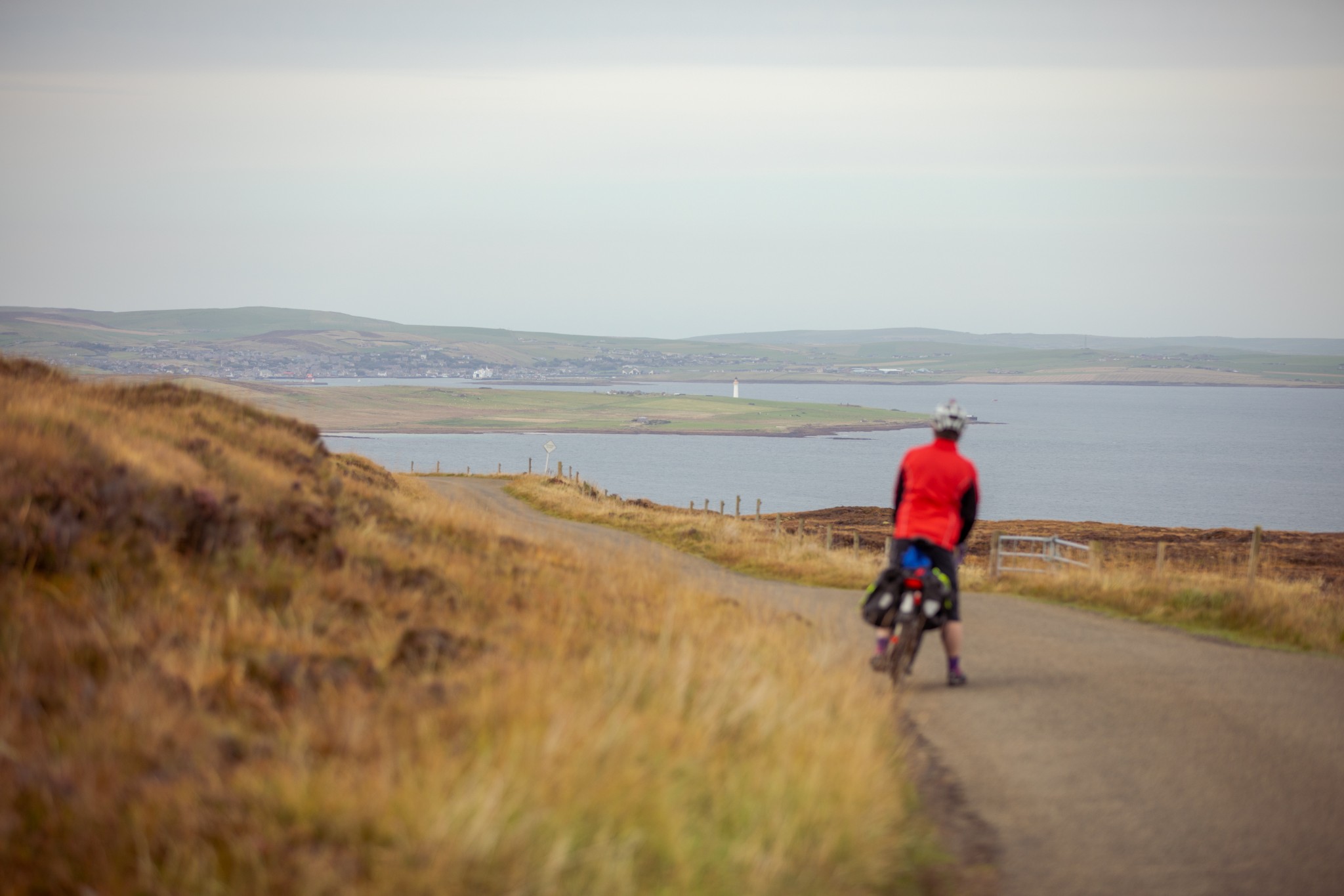
It links the two ferries which connect Hoy to the Orkney Mainland and at its heart is a tough, though steady, climb with fabulous views across Scapa Flow.
It can be cycled in either direction, depending on wind, and can even be made into a fully circular route by cycling, on the Orkney Mainland, between Stromness and the Houton ferry terminal – an addition that negates the need for two vehicles.
To start at Lyness, the more southerly end of the route, take the ferry from Houton in Orphir. After leaving the ferry look for the Scapa Flow Museum, which is a short 100m distance directly ahead.
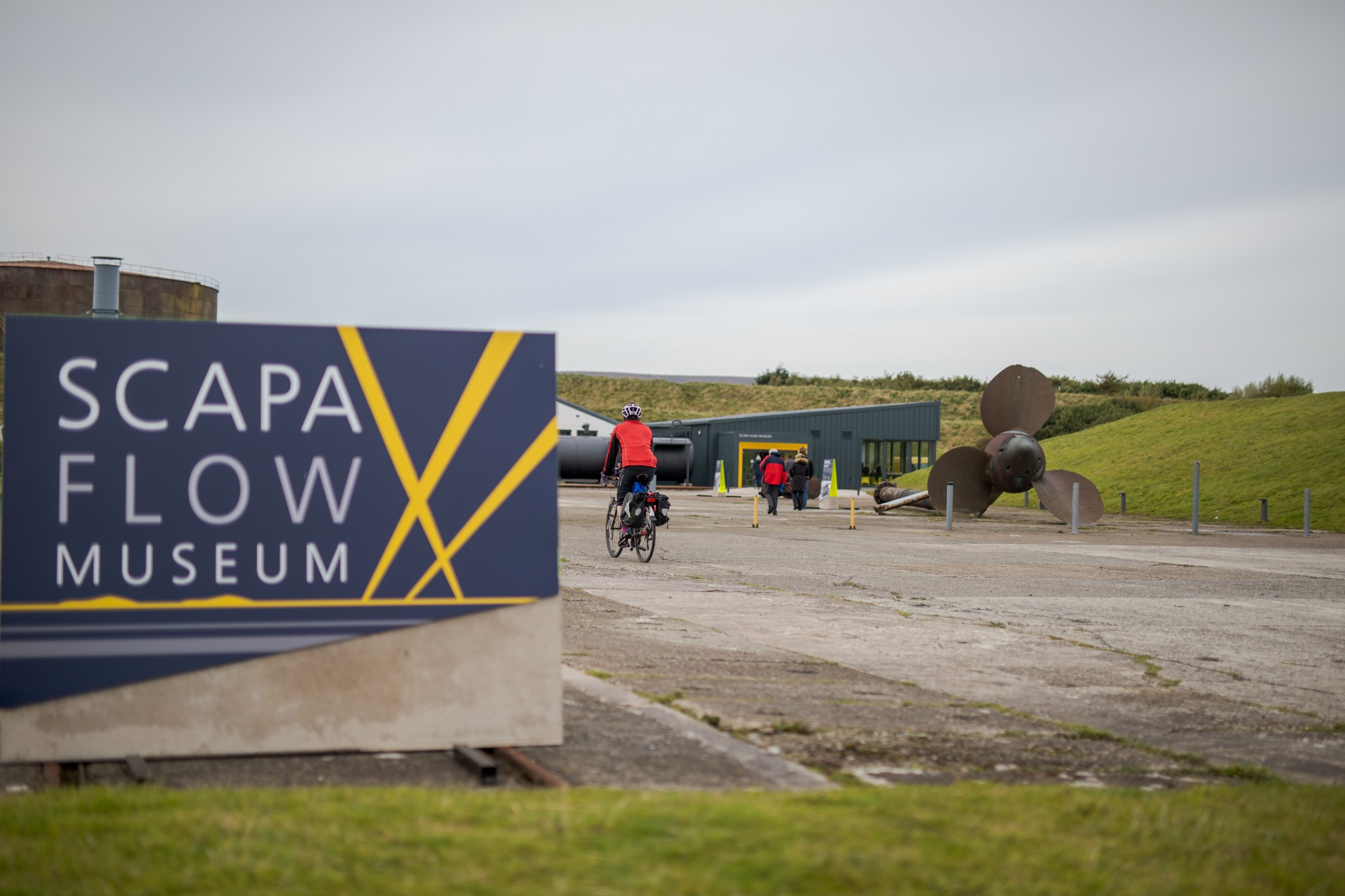
The museum re-opened in 2022 after an extensive renovation and has received international recognition since. It tells the tale of Scapa Flow’s vital strategic role in two World Wars, as well as the fascinating story of the scuttling, and subsequent salvage, of the German High Seas Fleet after World War One.
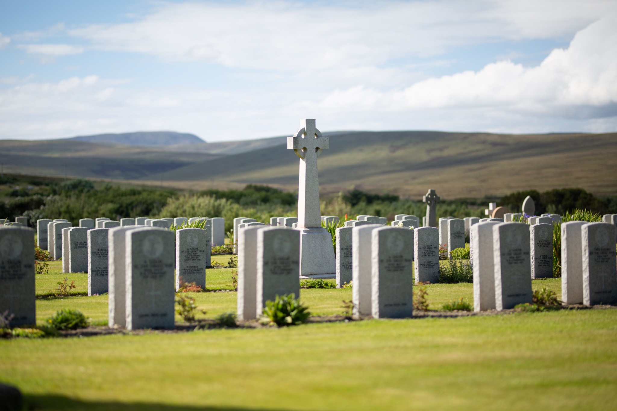
After leaving the museum turn right to follow the road along the shore, passing through the remains of the former naval base. The road heads inland for around 800m before arriving at a T junction. Turn right here, before taking a sharp left after 150m. On your left is the Lyness Naval Cemetery. It’s a poignant place to stop and is beautifully cared for by the Commonwealth War Graves Commission. Here you’ll find the graves of some of those killed at the Battle of Jutland, just a short distance away from the graves of German sailors, shot during and after the scuttling of their fleet in Scapa Flow in 1919.
Particularly poignant is the knowledge that these graves represent only a tiny fraction of naval losses in and around local waters. The vast majority of fatalities have no graves, other than the ships they went down in.
Carry on following the road north as it curves around Mill Bay. Around 1.5km after the cemetery look for Emily’s Tea Room on the right-hand side, which offers delicious snacks, meals and refreshments during the spring and summer months.
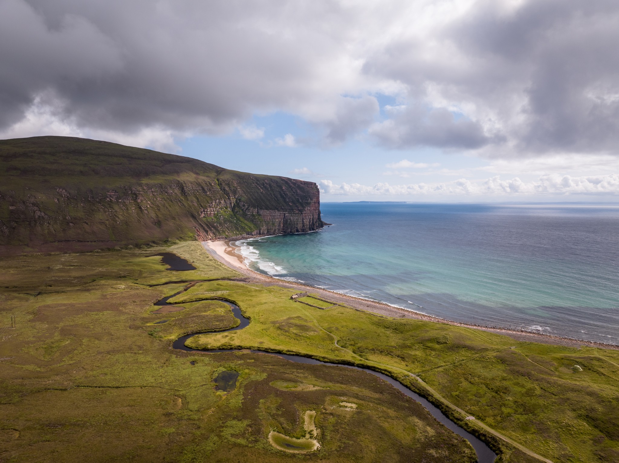
As the road becomes single track be aware of vehicles looking to overtake and use passing places where appropriate. The road heads downhill then steeply back uphill before turning left. From here the views begin to open up to the right across Scapa Flow. After 1.5km the road descends to reach the head of Pegal Bay. The picnic benches here provide a good spot to take a break and prepare for the toughest section of the route, which lies just ahead.
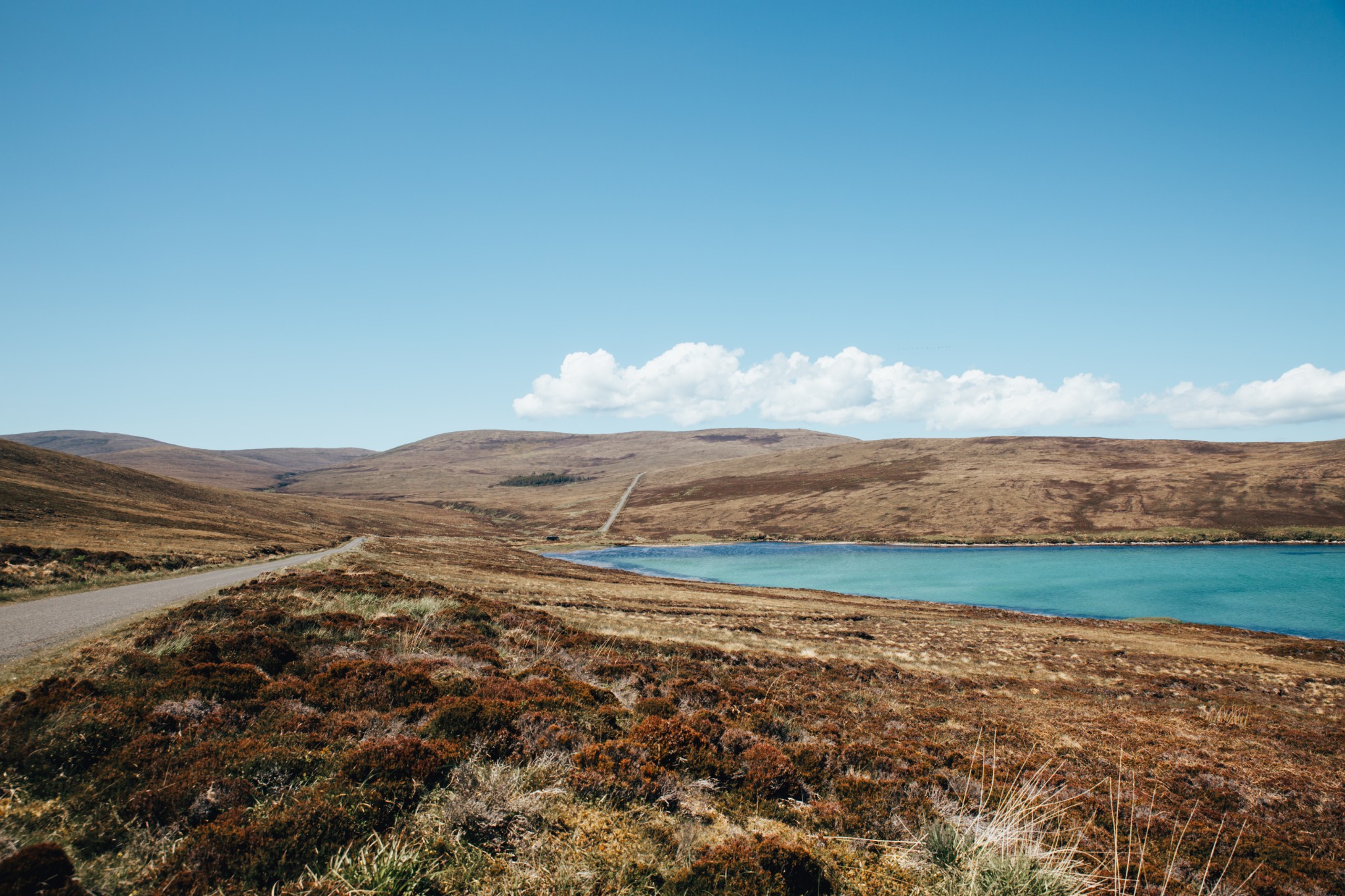
After crossing the stone bridge at the head of Pegal Bay, follow the road as it rises gently to curve around the slope of Pegal Hill. As you descend towards the head of Lyrawa Bay, take a moment to enjoy the colours of the waters to your right – rich in blues, greens and turquoise. After the stone bridge the main climb begins. At just over 100m ascent in 1.5km, it’s probably in the ‘steady’ rather than ‘killer’ category.
Just before the summit look for a small, white, lonely gravestone on the left, surrounded by a low white fence. This is the grave of Betty Corrigall. The young woman was buried on the parish boundary after taking her own life in the late 18th century, her suicide meaning that she was denied burial in consecrated ground or anywhere on the property of the two local landowners. She lay, forgotten, until the grave was discovered in the 1930s, the body remarkably well-preserved in the peat. In the 1970s, two centuries after her death, this simple headstone was created by local customs officer and artist, Harry Berry.
Around 50m beyond the grave look for a track heading off to the right. This leads a short distance to the summit of Lyrawa Hill – a fabulous viewpoint across the waters of Scapa Flow.
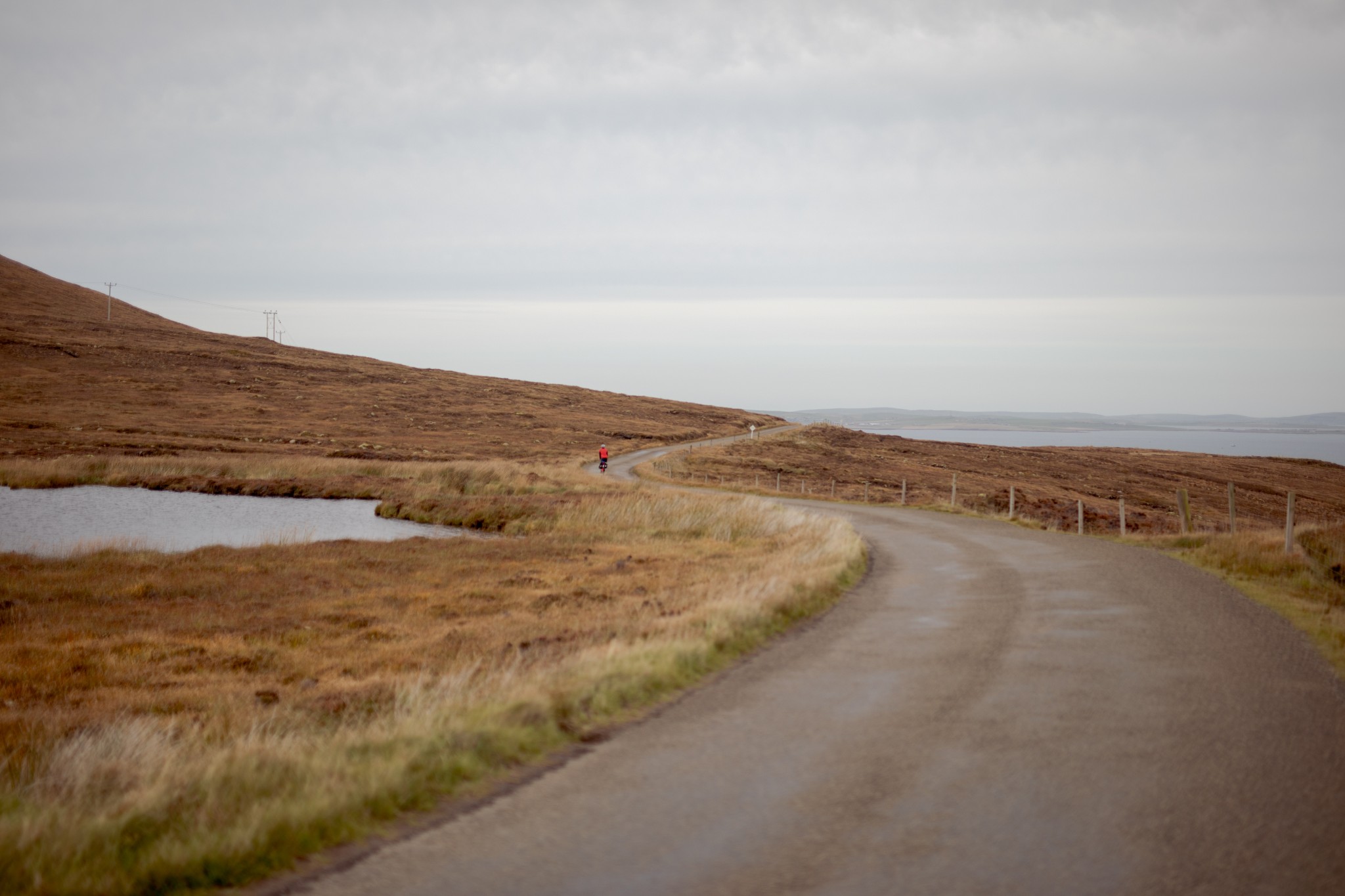
Carry on following the road as it heads north then northwest, rewarding your earlier climb with a fabulous 4.5km of gentle downhill cycling. The views open up here, first over the island of Graemsay to Stromness, and latterly the slopes of Ward Hill and Cuilags begin to dominate the skyline.
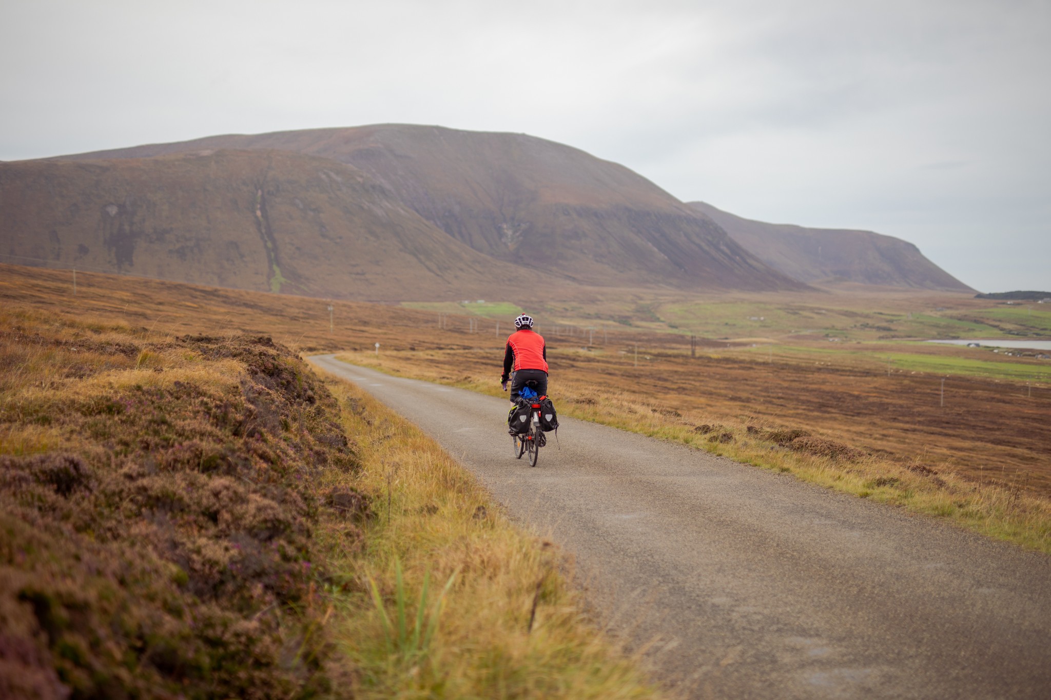
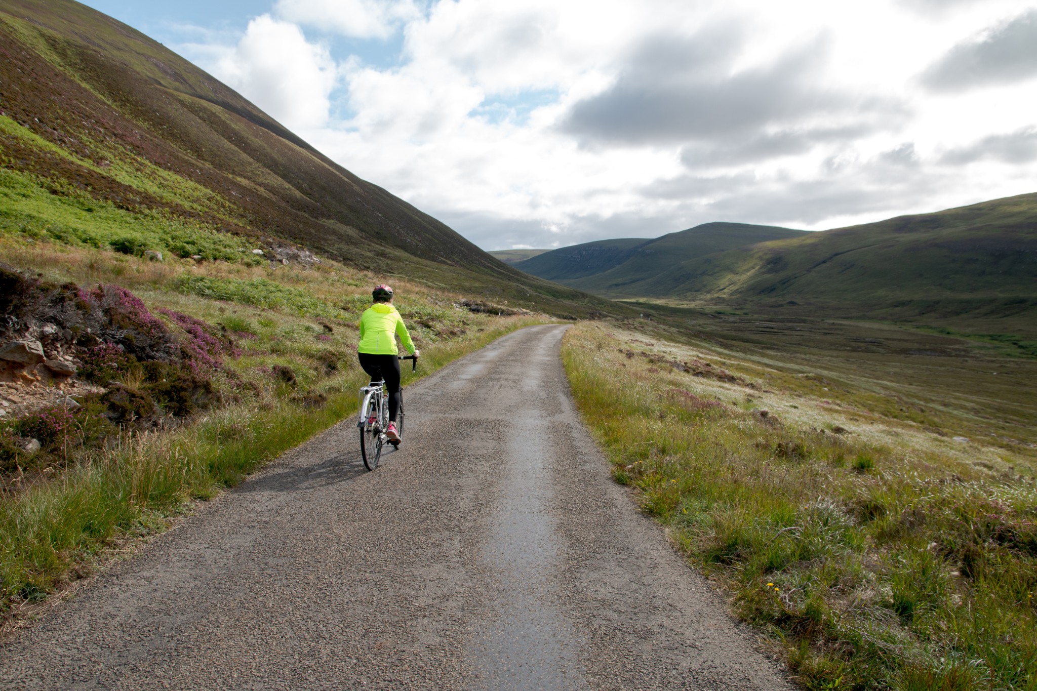
Shortly after the road reaches its low point you’ll arrive at a crossroads. Turn sharply left to follow the sign for Rackwick. (At the time of writing this next section is in a fairly rough state. Those on skinny tyres will need to exercise a degree of caution.)
The cycle through the glen is a joy, particularly in springtime and autumn. There’s been a significant amount of regeneration of native trees in the north end of the glen – both natural and assisted. White-tailed and golden eagles can sometimes be spotted in the skies above, both species having tentatively begun nesting in Hoy again after many decades of absence.
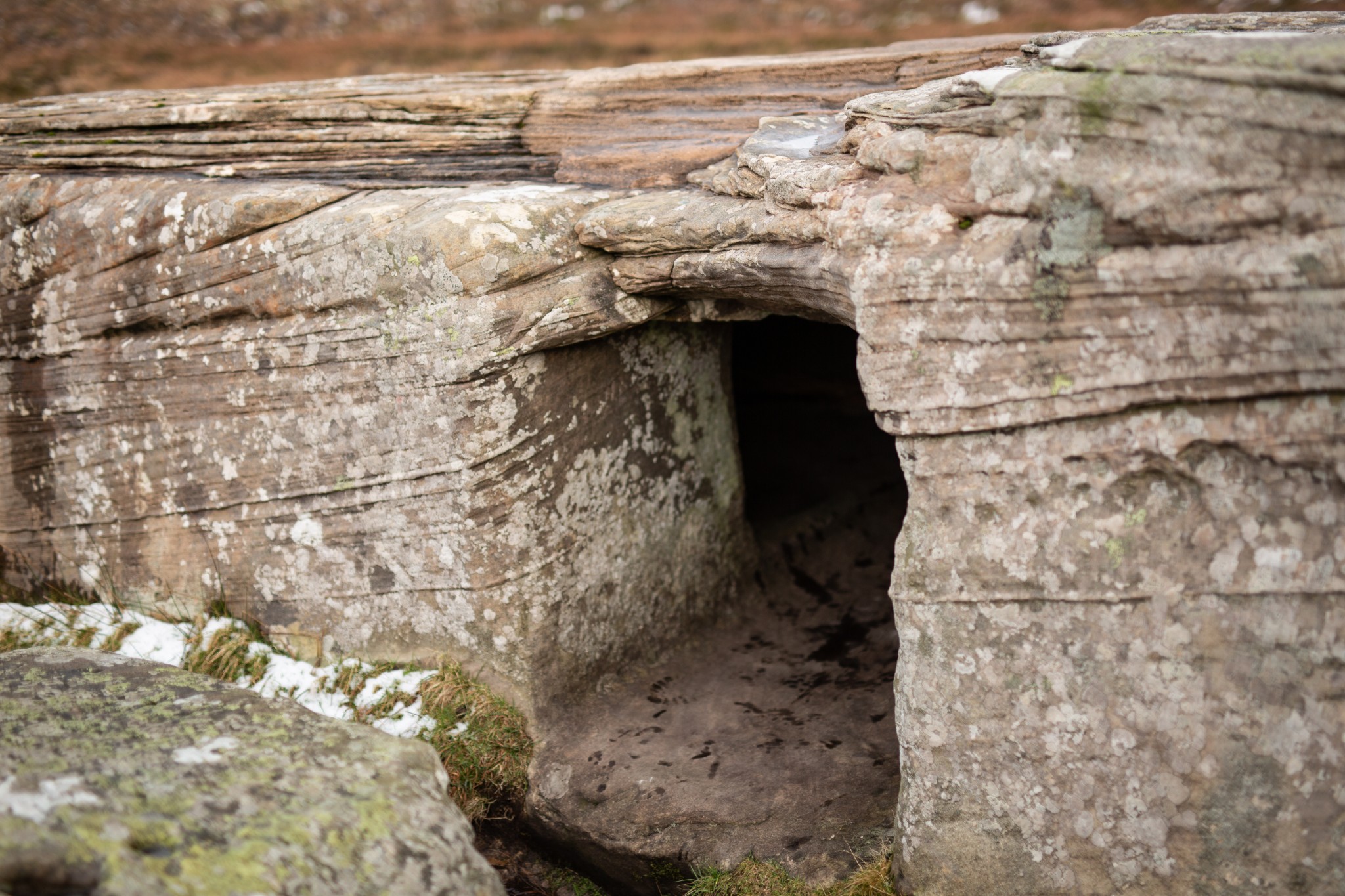
The short walk over to the Dwarfie Stane is well-worth the effort. At 5000-years-old it’s thought to be the UK’s only example of a rock-cut tomb. To crawl inside and look back out at the surrounding landscape is a humbling experience.
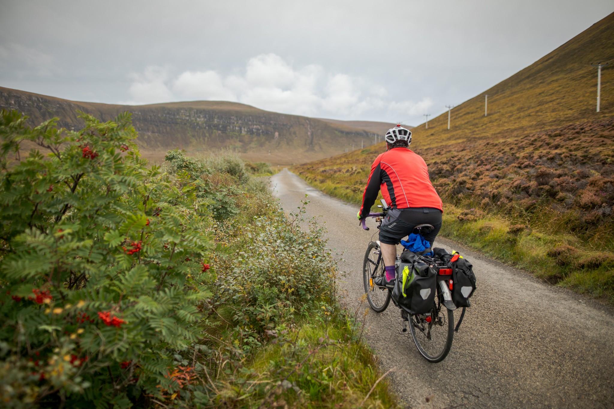
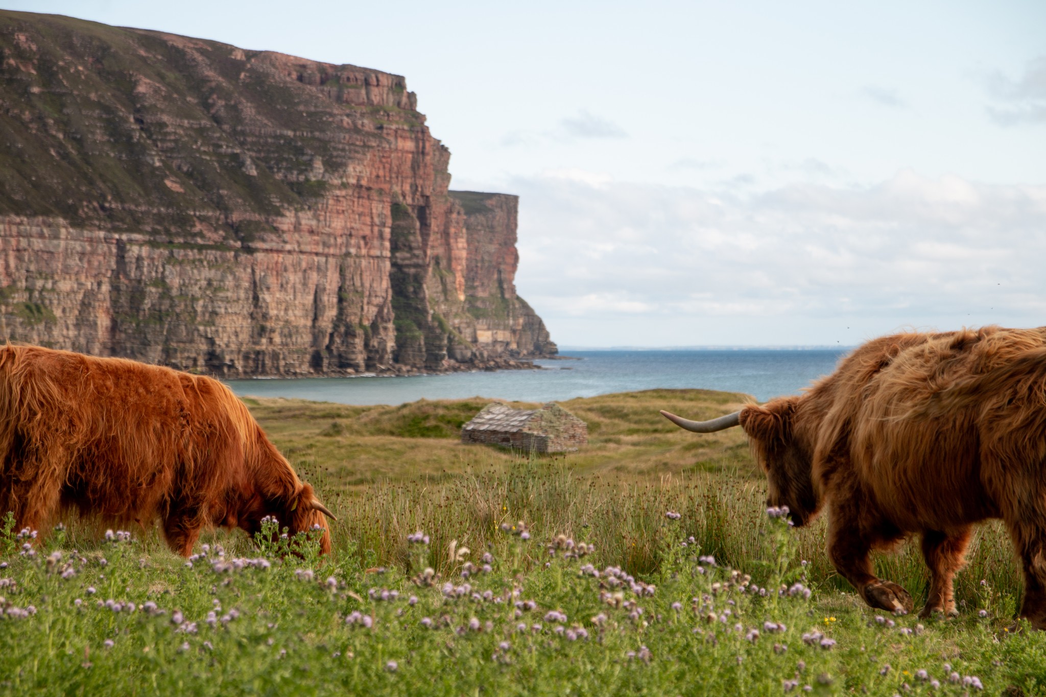
Carry on along the road as it snakes through the quiet glen to reach the settlement of Rackwick. This scattering of small crofts, with its beach, its boulders and its beetling cliffs, was an inspiration for artists, writers and musicians, including the poet George Mackay Brown and composer Sir Peter Maxwell Davies.
Leave your bikes at the car-park before passing the public toilets to follow the track towards the beach, which is dwarfed by the huge sandstone cliffs beyond.
When you’re ready to leave Rackwick, return back through the glen past the Dwarfie Stane to reach the crossroads. This time turn left to head gently uphill for just over a kilometre to reach the Hoy Kirk and Heritage Centre. A beautifully-curated collection of displays and resources gives a real insight into life in the north end of this island throughout the centuries.
Beyond the heritage centre turn right at the T junction to head downhill for the final 1.5km to reach Moaness and the ferry to Stromness. Around 300m before the pier is the Beneth’ill Café, where you may want to treat yourself to one of their legendary scallop and black pudding rolls before the short sailing, with its fabulous views back across the hills of Hoy and along the famous Stromness waterfront.
If you're planning on spending more time in Hoy, check out our other local cycling route, between Lyness and Longhope, and our spectacular walking route over Cuilags to the Old Man of Hoy and Rackwick.
- Plan your trip to Hoy
Daily ferries connect Hoy at Lyness with the Orkney mainland at Houton. There is also a passenger only ferry that runs between Stromness and Moaness, at the north end of the island, via Graemsay. View timetables and book online via the Orkney Ferries website. Booking in advance is highly recommended, especially during the summer months. Bikes can be carried for free.
Public toilets are available at the piers at Longhope, Lyness and Moaness.
Find out more about Hoy on the island's Explore page, or visit the official island website.
- Food & drink
At Lyness, the Scapa Flow Museum has a small cafe, and Emily's Tea Room is nearby too. At the north end of the island, close to the pier at Moaness, you'll find the Beneth'ill Cafe, which offers light bites, meals and refreshments. It's best to check opening times online before travelling.