North Ronaldsay is Orkney's most northerly island and a truly unique place, with a special sense of community and culture.
At around 6km from one end to the other, the island is perfect for exploring by bike. This relatively simple route takes in most of North Ronaldsay, making good use of the local hire bikes.
Arriving by plane (the inter-island air service is extremely regular, ferries are less-so), walk from the terminal towards the small car park, looking for a wooden shed on the left where the island’s hire bikes are stored. Pre-booking bike hire is recommended but outwith busy periods you may simply take a chance. Payment is via cash in an honesty box (welcome to island life!)

From the airfield, follow the road for around 150m to arrive at a crossroads at the island’s war memorial. Go across the road, diagonally, passing the memorial on your right-hand side. After around 150 metres you’ll pass the Memorial Hall. This black-tarred wooden hall is the venue for North Ronaldsay’s legendary harvest homes, though most events these days take place at the community school, which sits a little further along the road as a prominent feature on your right.
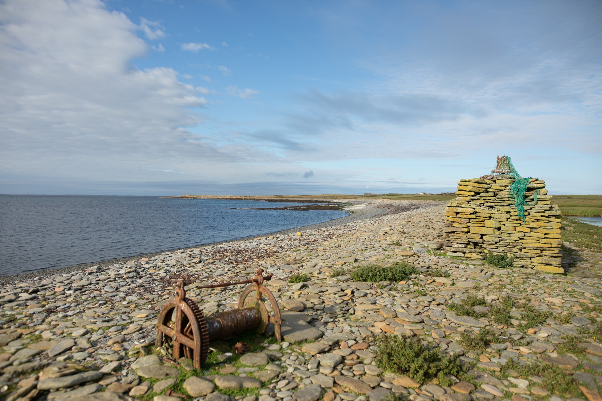
Just after passing the school take the first road on the left. Follow this road for 1.5km, where it comes to an end at Bridesness, named after the St Bride’s Kirk and former burial ground. A small lochan and adjoining wetland to the right make a fine spot to see a wide variety of bird life. This is also the first point in today’s route where you come in contact with North Ronaldsay’s famous sheep dyke.
The listed structure is 13 miles long and encircles the entire island, keeping the unique seaweed-eating sheep away from precious grazing. A gate leads through the dyke here onto the stony shore and a nearby cairn is topped with a ship’s bell (take care to ensure all island gates are well secured after use).
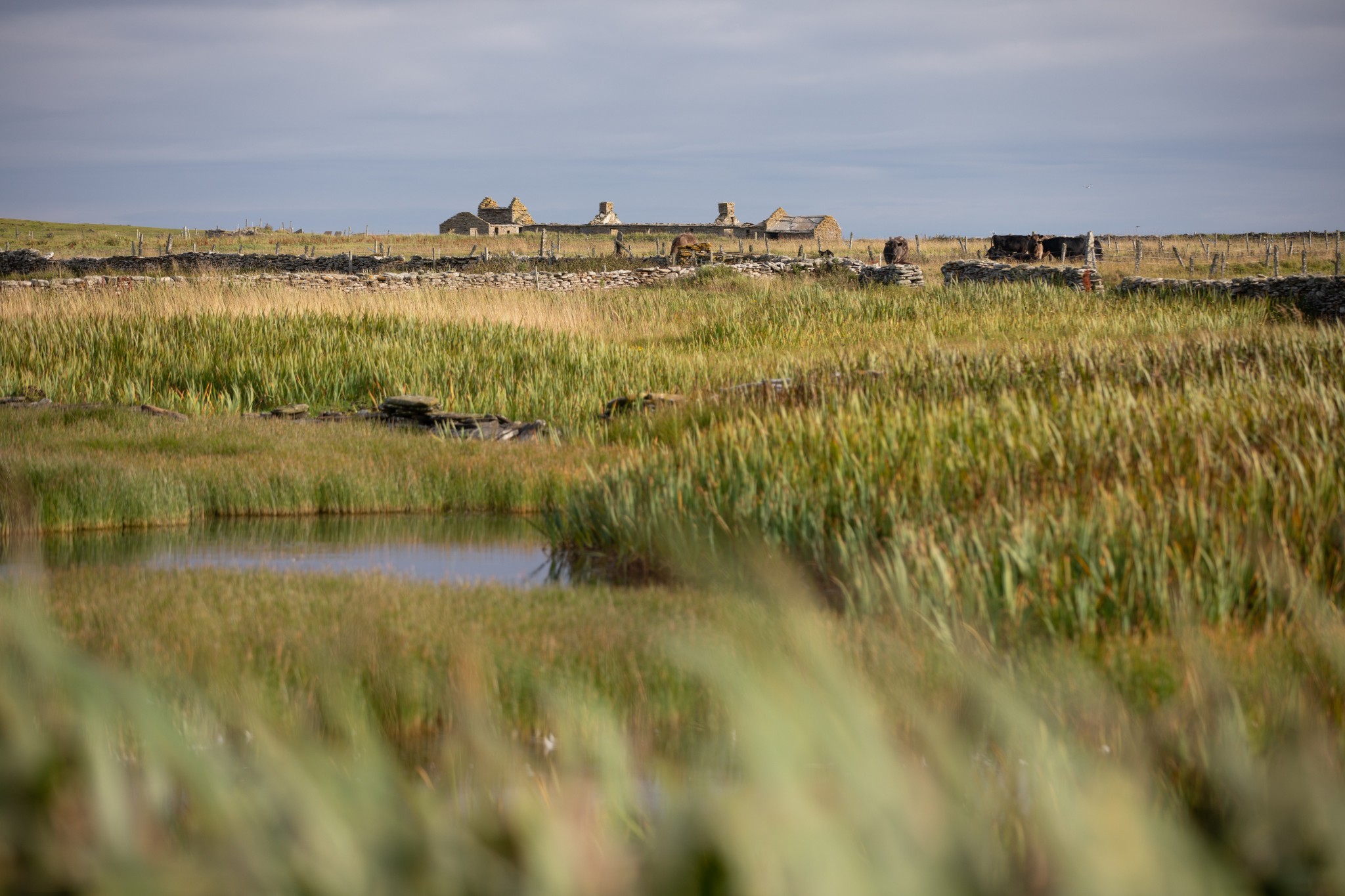
Head back the 1.5km along the road to the junction near the school. This time go straight across towards the prominent form of Holland House and its surrounding farm buildings (there is an option here to turn left at the crossroads to visit the Broch of Burrian, which would involve leaving your bikes behind and a short coastal walk - see our map for more details).
Follow the road as it skirts to the right of the buildings to arrive at a T-junction. Turn left here to head southwest along the road for around 200m. Look for a small metal gate at the lower end of the field on your right. Pass through the gate to head towards the obvious standing stone. This beautiful monolith, the Stan Stane, is of the hand-fasting type, with a hold bored right through it, through which young lovers would hold hands as a sign of fidelity and betrothal.

Returning to the bike, carry on downhill to Nouster and the island pier. On the right is a short track leading to the North Ronaldsay Bird Observatory. As well as providing accommodation, it’s also home to the island’s small shop, while lunches, evening meals and drinks can all be enjoyed in its cosy hexagonal sunlounge, looking out across the North Ronaldsay Firth.
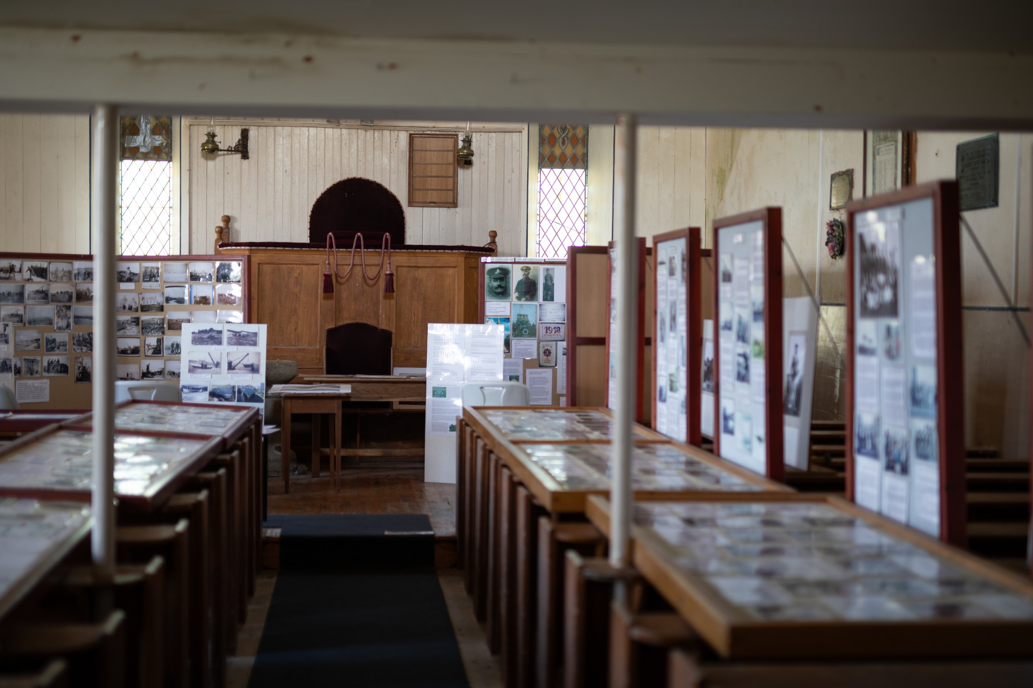
Return back along the main island road, heading straight past Holland House. Just after the airfield look out for an old church on the left-hand side. North Ronaldsay’s New Kirk contains a huge collection of photographs and documents, painstakingly curated by local writer, artist and crofter Ian Scott. Ian also produced a beautiful hand-drawn map of the island, copies of which can be picked up for free at various locations in the island.
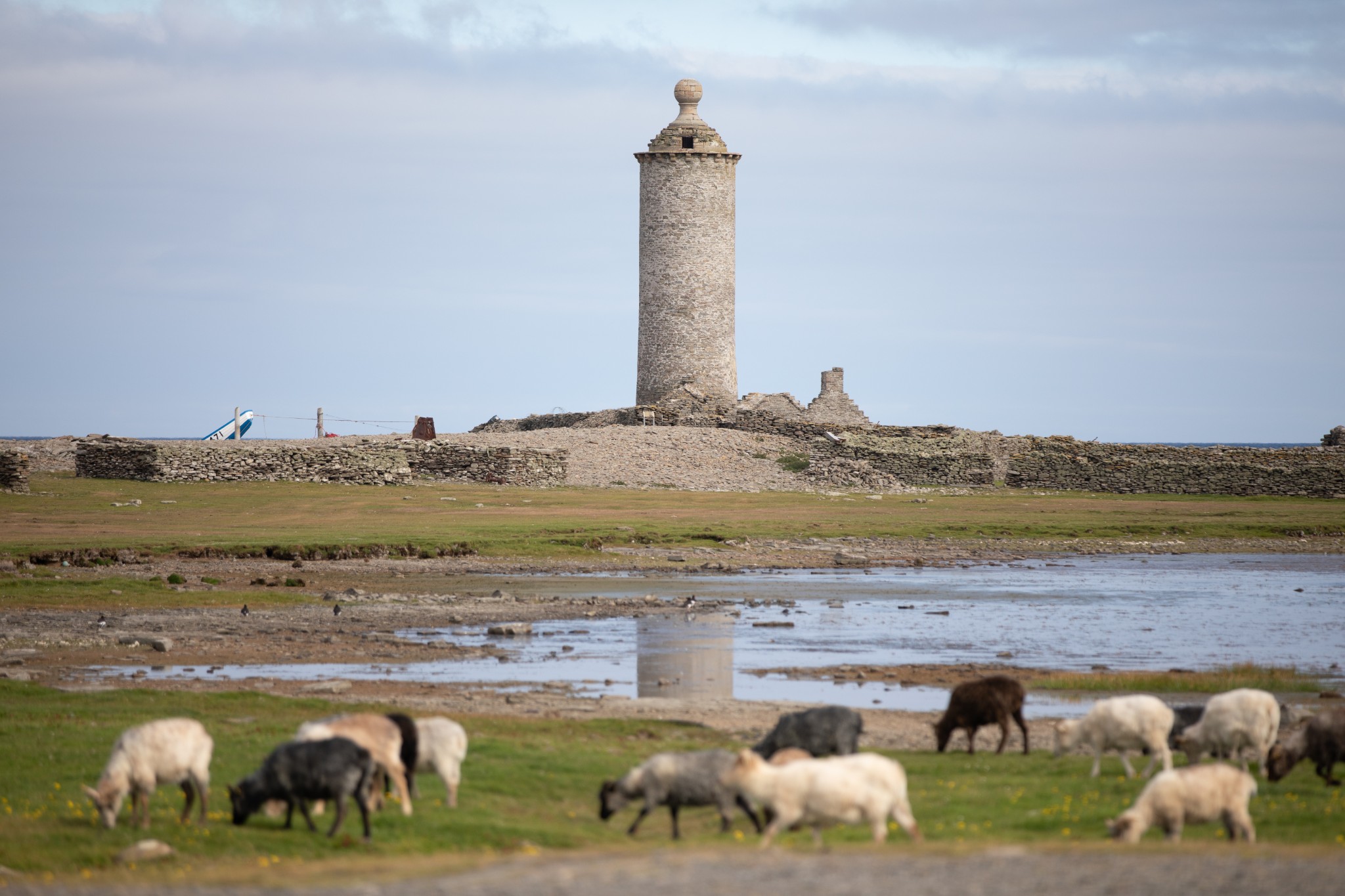
Follow the road as it carries on northeast then east for around 4km. Shortly after, cross a cattle grid and leave the bike to walk 300m around Dennis Loch to reach the Old Beacon of Dennis Head. The tower, topped by its distinctive stone ball, was first lit in 1789 but ceased operation in the early 19th century, when it was replaced by Start Point Lighthouse across the water in Sanday. But North Ronaldsay’s low-lying landscape and fearsome skerries and reefs meant that this decision was soon rethought, with the impressive modern lighthouse, standing around 1km to the northwest, being established in 1854.

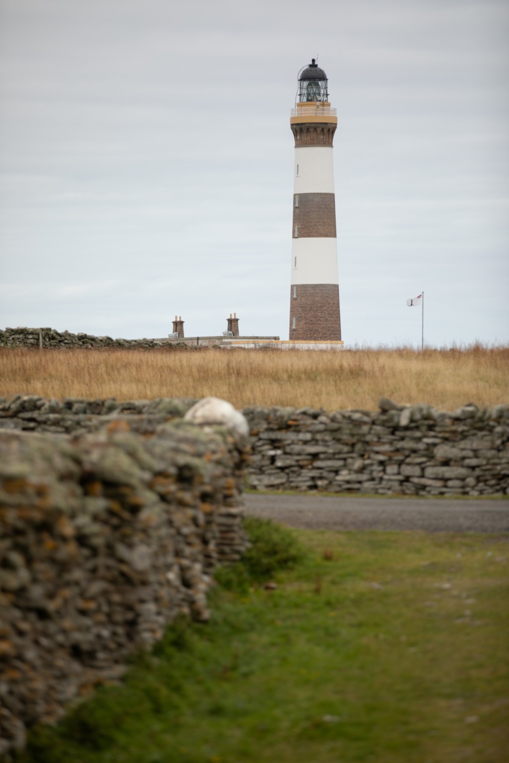
The lighthouse buildings are now home to a fabulous café, offering lunches, snacks and a mouth-watering selection of baking, as well as a shop selling local goods and wool from the wool mill next door. Tours of both the mill and the lighthouse are available.
Return towards the airfield along the island’s main road. Around 500m before the airfield look for the first road on your left. After 600m the road comes to an end at a metal gate. Pass through the gate and walk around 300m across sandy machair to reach the beautiful Linklet Bay, the arc of which dominates North Ronaldsay’s eastern coast.

Returning to the bike, head around 250m back up the road, looking out for a minor road leading off to the left. Follow this road as it winds left then right to arrive at a T-junction. Turn right here to head gently uphill back towards the war memorial and from here to the airfield. Make sure the doors of the shed are properly secured after returning your bikes back inside.
- Plan your trip to North Ronaldsay
Daily flights with Loganair's inter-isles service connect North Ronaldsay and Kirkwall. Visit the Loganair website to view the current timetable.
There is also a weekly ferry service to the island. View timetables and book online via the Orkney Ferries website. Booking in advance is recommended, and bikes can be carried for free.
There is a public toilet at the island's pier.
Find out more about North Ronaldsay on the island's Explore page, or visit the official island website.
- Food & drink
The North Ronaldsay Bird Observatory offers lunches and evening meals, and is also home to the island's small shop.
At the opposite end of the island, the North Ronaldsay Lighthouse Cafe offers fantastic lunches, snacks, and homebakes. Do check opening times before travelling. Elsewhere, the Iolaire Croft Shop is open daily offering light refreshments, homebakes, groceries and local arts, crafts and produce. Find the shop on Facebook for latest opening information.
This cycle route information was funded through the North Isles Landscape Partnership Scheme by the National Lottery Heritage Fund.