Eday lies right at the heart of Orkney’s north isles.
The island packs a lot of contrasting landscape into its compact form and its position offers some superb views over its neighbours near and far.
This is primarily an out-and-back route but with a circular element at each end and plenty of interest throughout.
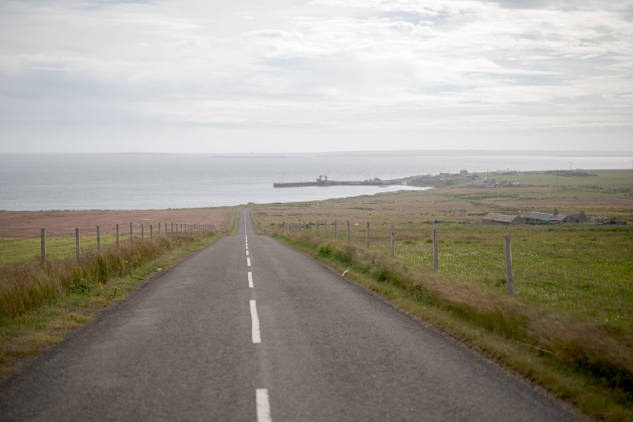
As you come off the ferry turn right at the top of the pier to head northwest around the bay before the road turns left and heads uphill for around 800m. At the junction turn right to head north past the island’s school on an elevated route which gives great views east over Eday Sound towards Sanday and Stronsay.
At around 4km you’ll come to the island’s airport, known as London Airstrip, sitting as it does alongside the nearby Bay of London. A little further on is the Eday Hostel - a great place to base yourself for a longer stay – and beyond that, a little further up the brae, is the Eday Heritage Centre. Here you’ll find fascinating displays shedding light on the island past and present, as well as tea and coffee-making facilities. (Please note, as of 17/10/23, the Eday Heritage Centre is currently closed - we will update this page when it re-opens.)
Carrying on heading north, just a little after the Heritage Centre, you’ll come to the top of the brae from where it’s generally downhill for the next 1.5km to reach the Eday Co-operative Shop. It’s amazingly well-stocked but does keep limited opening hours, so do check those in advance.
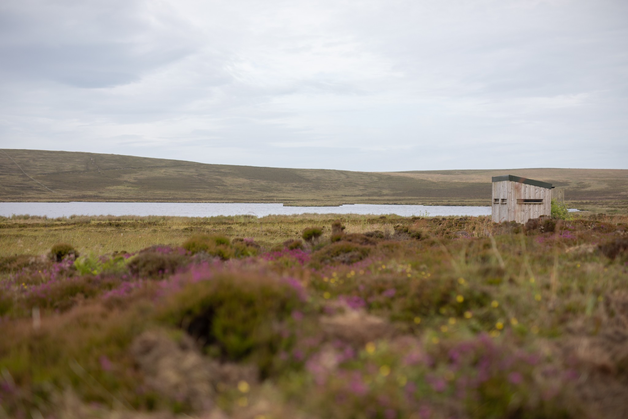
Immediately after the shop take the first road on the left, leading past Mill Loch. There’s a bird hide beside the road with information on the wide range of species to be seen here.
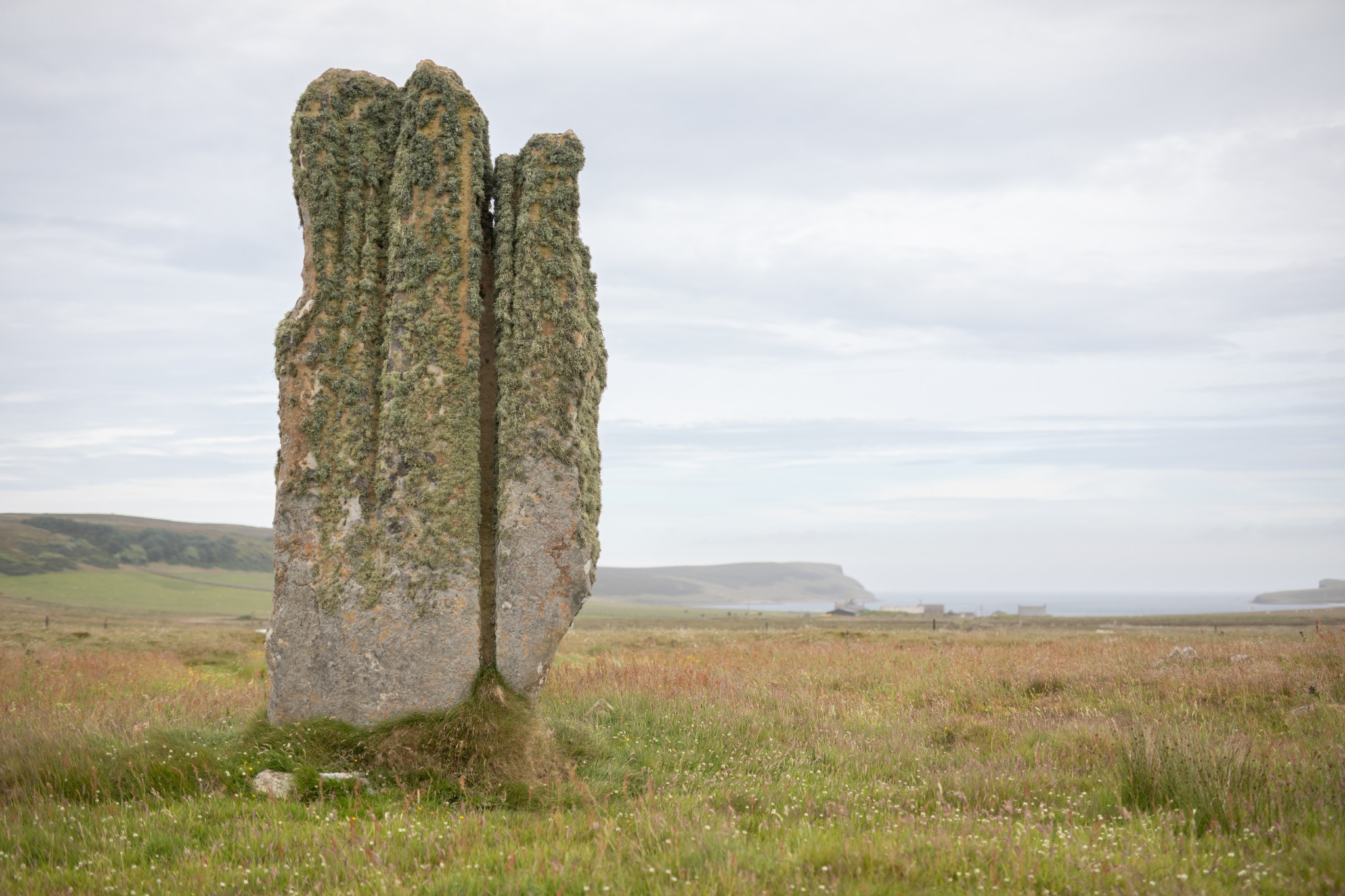
Around 200m further along the road there’s a gate on the right leading to the Stone of Setter. One of Orkney’s most impressive Neolithic standing stones, it’s a short walk from the road and gives good views down towards Carrick House and the sheltered waters of Calf Sound beyond.
Carry on westwards to pass over the brow of Vinquoy Hill. Look for a gate on the right to walk around 150m uphill to Vinquoy Chambered Cairn. From here you get great views across to Westray and Rousay before returning to the road for a fast descent to the area known as Cusbay. At the road junction, turn left to head south for two kilometres before following the road as it swings gradually left and east over high ground to return to the main road just south of the shop. If you're spending more time in the island, check out our Eday Heritage Walk to explore more of this beautiful area.
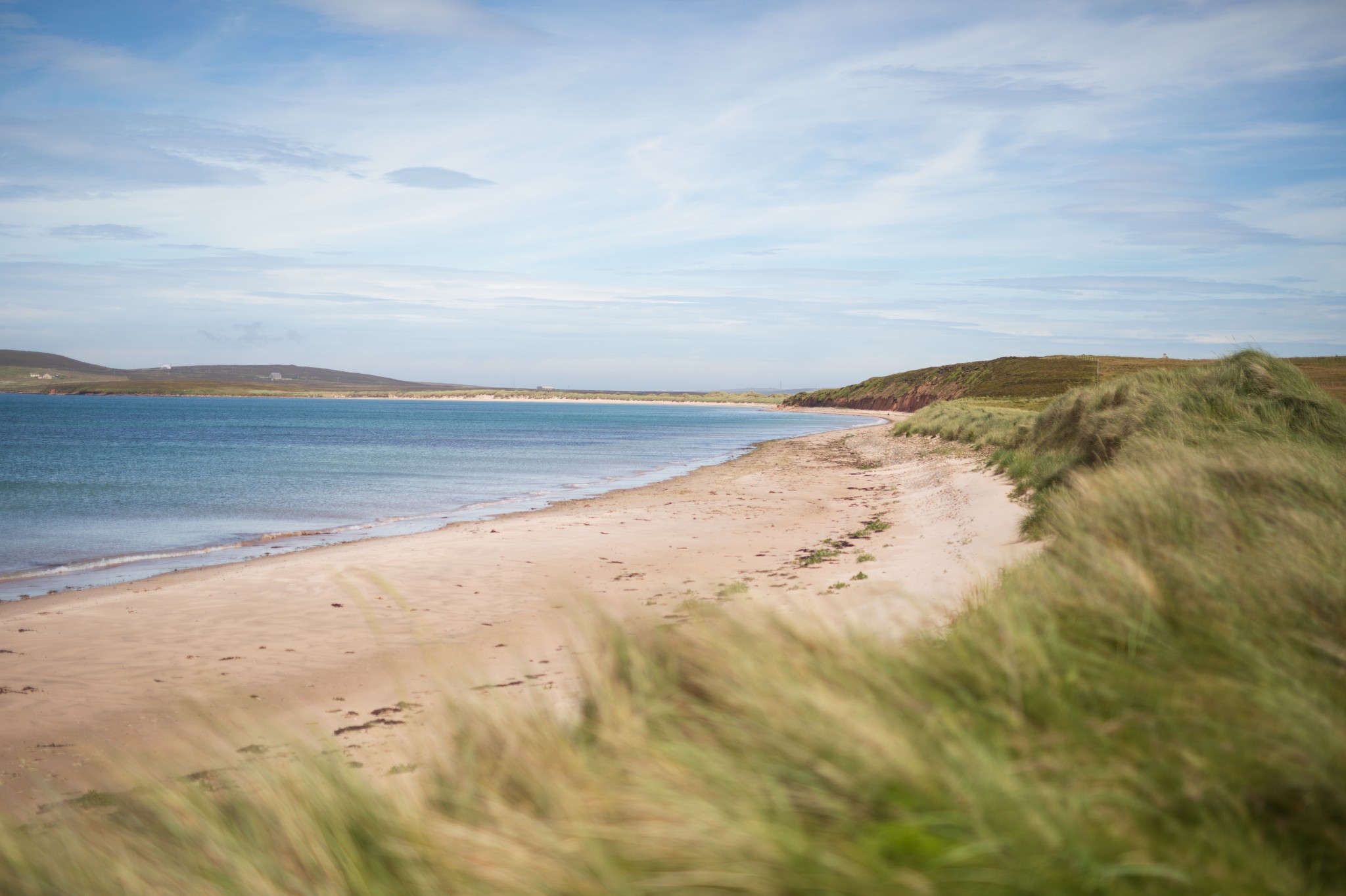
Turn right at the junction to head south, retracing your outbound route to the island’s airstrip at Bay of London. Around 600m beyond the airfield look for a road heading off to your right. Follow this road for around 2km as it gently descends. When it reaches its lowest point and curves right look for a stone bridge. Just before the bridge is a track heading off through sand dunes to the beautiful Sands of Mussetter. You can either admire the view from here or walk the 1km or so northeast along the beach to the Sands of Doomy.
Head back along your outbound route. Turn right at the junction, rejoining the main road south down the island.
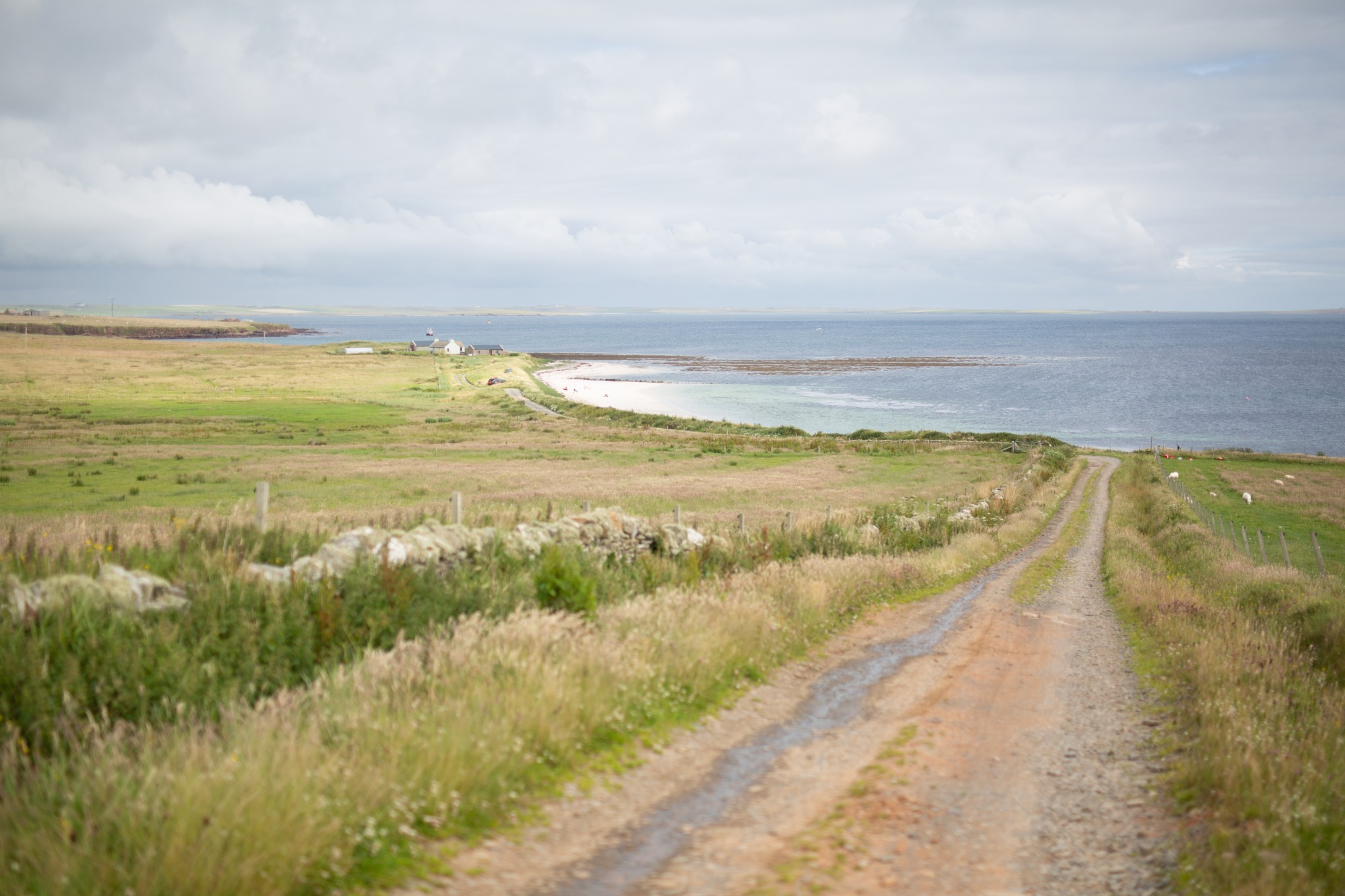
After passing the school don’t take the first turning on the left back to the ferry (unless you're short of time or energy) but instead carry straight ahead for a further 2km. The road ends at the Bay of Greentoft, a small but charming beach looking across to Stronsay and Shapinsay.
Head back north the way you came on the road for around 600m before taking the first turn-off on your right. Follow the road left after 1km to arrive back at the pier.
- Plan your trip to Eday
Daily ferries connect Eday and Kirkwall. View timetables and book online via the Orkney Ferries website. Booking in advance is recommended, and bikes can be carried for free.
You can also fly to the island with Loganair's inter-isles service. Visit the Loganair website to view the current timetable. Please note there is currently no bike hire available in Eday, though.
Public toilets are available at the Eday pier.
Find out more about Eday on the island's Explore page.
- Food & drink
Eday has an excellent community shop, found en-route towards the north of the island. It's extremely well-stocked (though opening hours may be limited), and anything you spend here will help support the local economy.
 This cycle route information was funded through the North Isles Landscape Partnership Scheme by the National Lottery Heritage Fund.