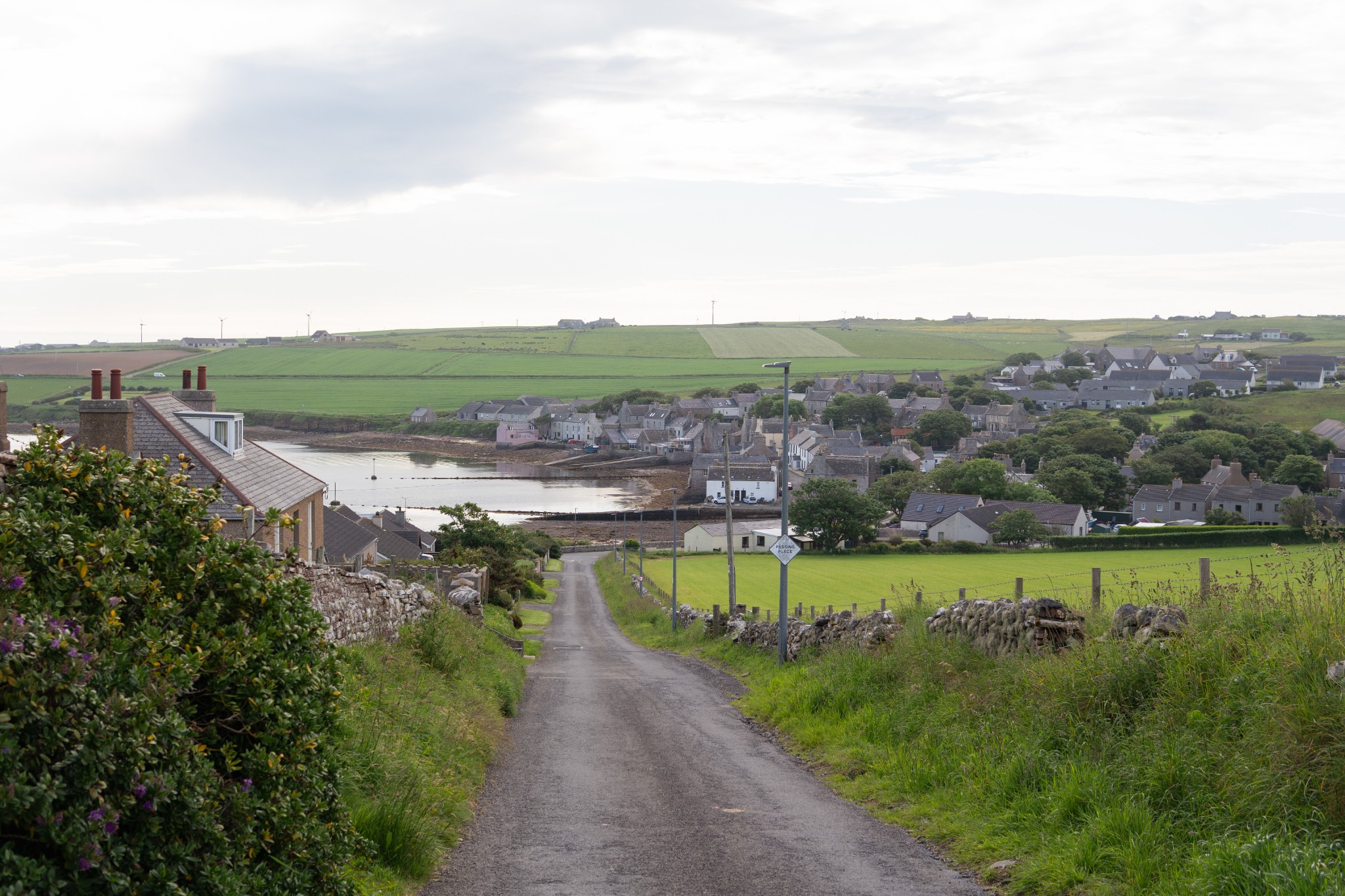
This is a lovely walk which is relatively easy-going throughout as it passes along quiet, wildflower-rich backroads around the beautiful village of St Margaret’s Hope.
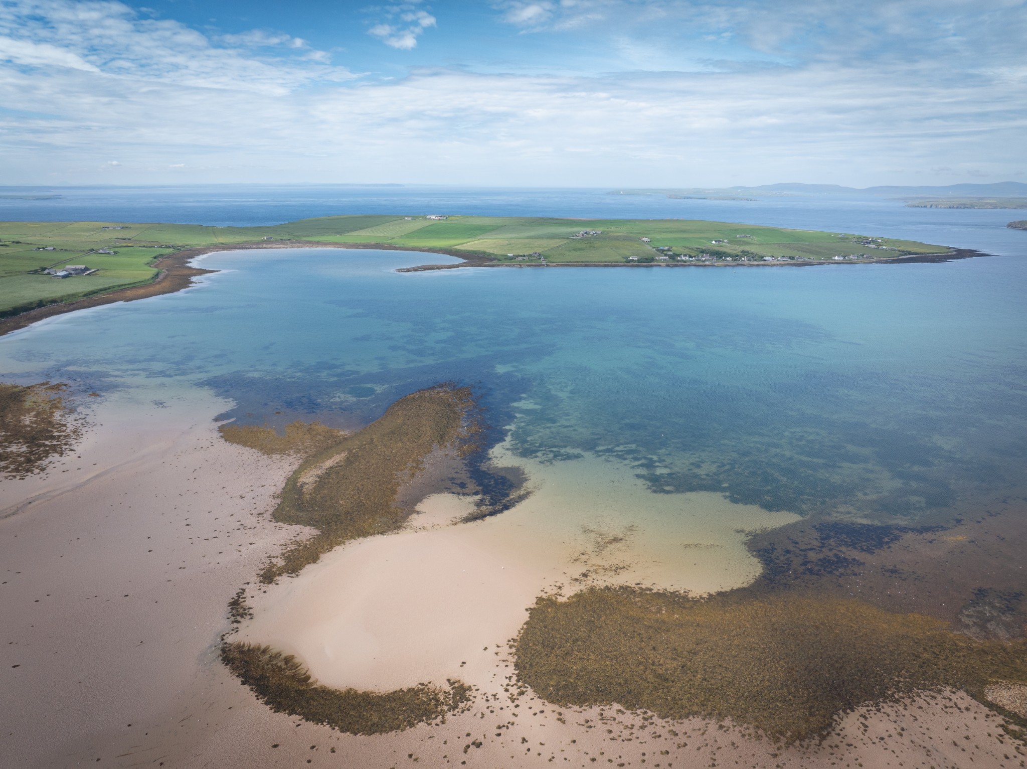
A very modest ascent gives some fabulous views across Scapa Flow and its southern approaches.
There’s a beach or two, public toilets at the halfway mark, and a choice of eateries and shops at the start/finish of the route.
Distance
7km
Grade
Grading: 2
Duration
2.5hrs
Terrain
Primarily quiet single-track roads, some well-maintained vehicular track and short section of shore walking. 110m of ascent/descent.
Map description
OS Explorer 461; OS Landranger 7
Begin at Cromarty Square in St Margaret’s Hope. Heading towards the waterfront, take the road on your left, which curves north out of the village towards the pier.
After 100m take the first road on the left to head uphill, steeply at first. As you reach the top of the brae, take a moment to turn round and admire the view back over the village. Views also open up to your left across the sandy inlet of Ronaldsvoe and Widewall Bay beyond – an important sheltered anchorage in Viking times.
Follow the road as it turns sharply to the right to head north for 400m, before turning left to head gently uphill.
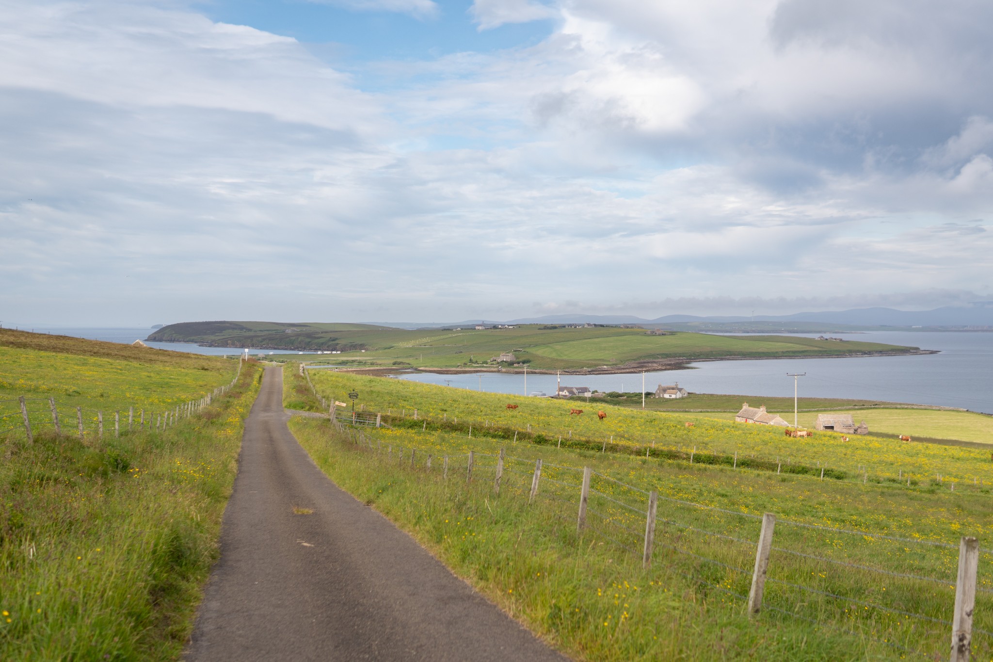
From here there are fine views across the expanse of Scapa Flow. Directly to the north is the island of Hunda, connected to the larger island of Burray by its narrow causeway, built during WW2 to shelter vessels providing barrage balloon cover for this important naval anchorage.
From the high point in the road, admire the view ahead across Dam of Hoxa and Sands of Wright towards the prominent headland of Hoxa. The islands of Flotta and Hoy lie beyond.
Carry on to the end of the public road, before going straight ahead on a concrete vehicular track, followed by a short grassy section to reach the shore at Dam of Hoxa. There’s a faint track through the vegetation just above the high-water mark.
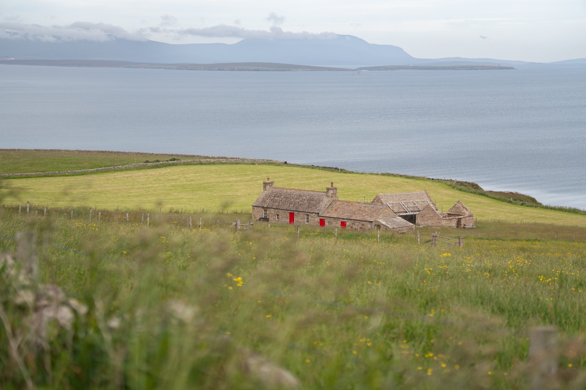
Around halfway around the bay there’s a small stone cottage just above the shore. In all but the highest tides you should be able to keep on the seaward side of the large stone sea defences. If you need to take a higher route please do so discreetly and respect the privacy of the residents.
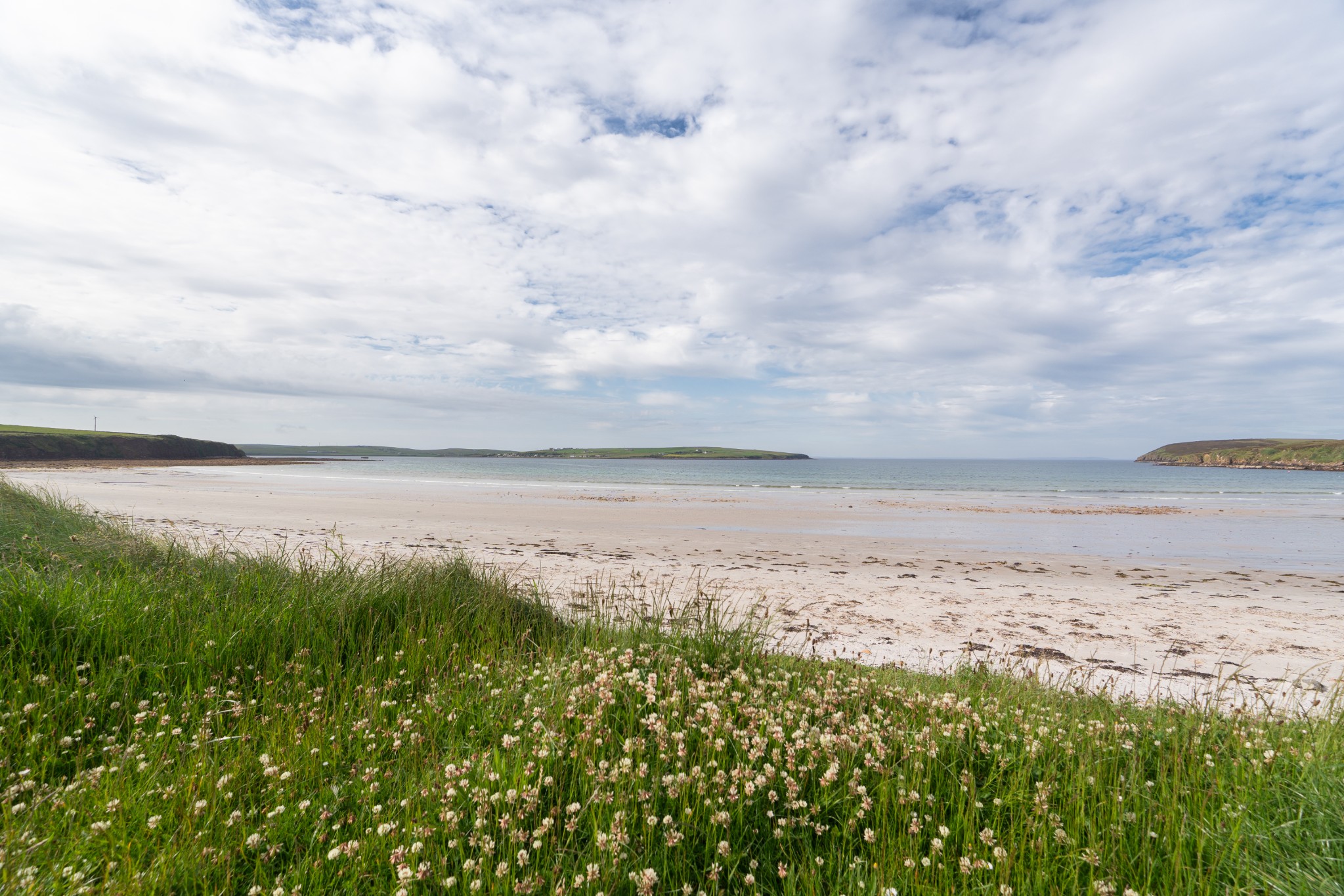
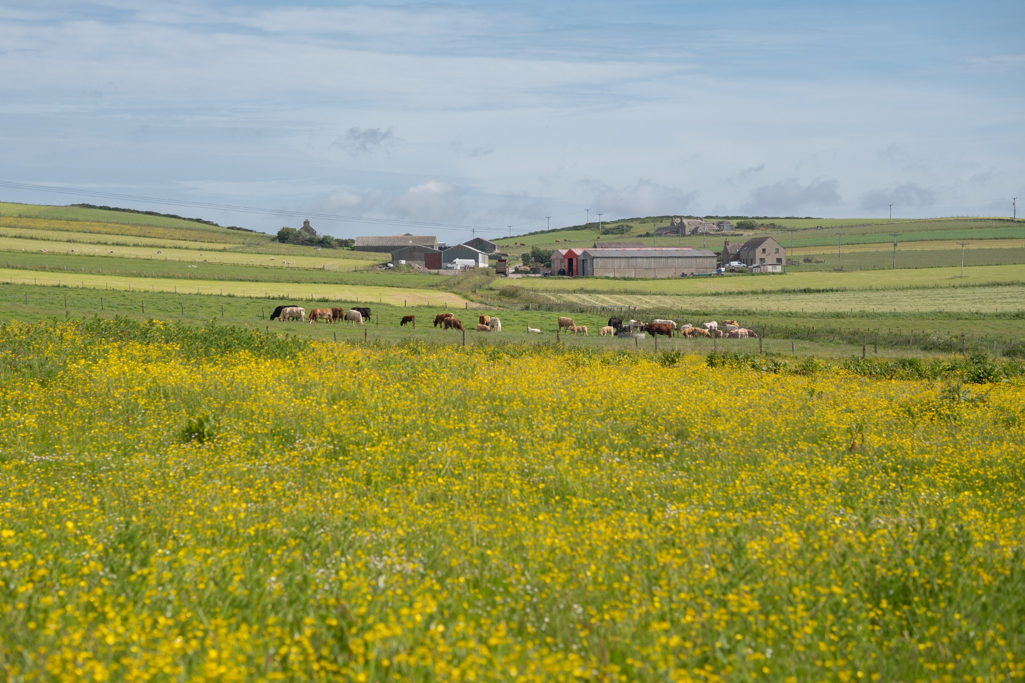
Just after the cottage, a well-maintained vehicle track carries on for 300m, passing an area of wetland, before turning sharply to the left, then right again to head uphill. Take the first road on your left, then turn left again at the junction to reach the Sands of Wright. It’s a popular beach and is frequently used by locals and visitors as an unofficial camping area. It’s also the location for the traditional Boys’ Ploughing Match, part of South Ronaldsay’s Festival of the Horse, which has its origins deep in Orkney’s agricultural traditions of horsemanship. There are public toilets just above the beach.
From here simply follow the public road uphill, passing the impressive Roeberry House, for 3km, admiring the views across Widewall Bay towards the picturesque village of Herston to arrive back in St Margaret’s Hope.
Visit the Scottish Outdoor Access Code website for more information and advice on how to enjoy the outdoors responsibly.
Further information
- Places of interest
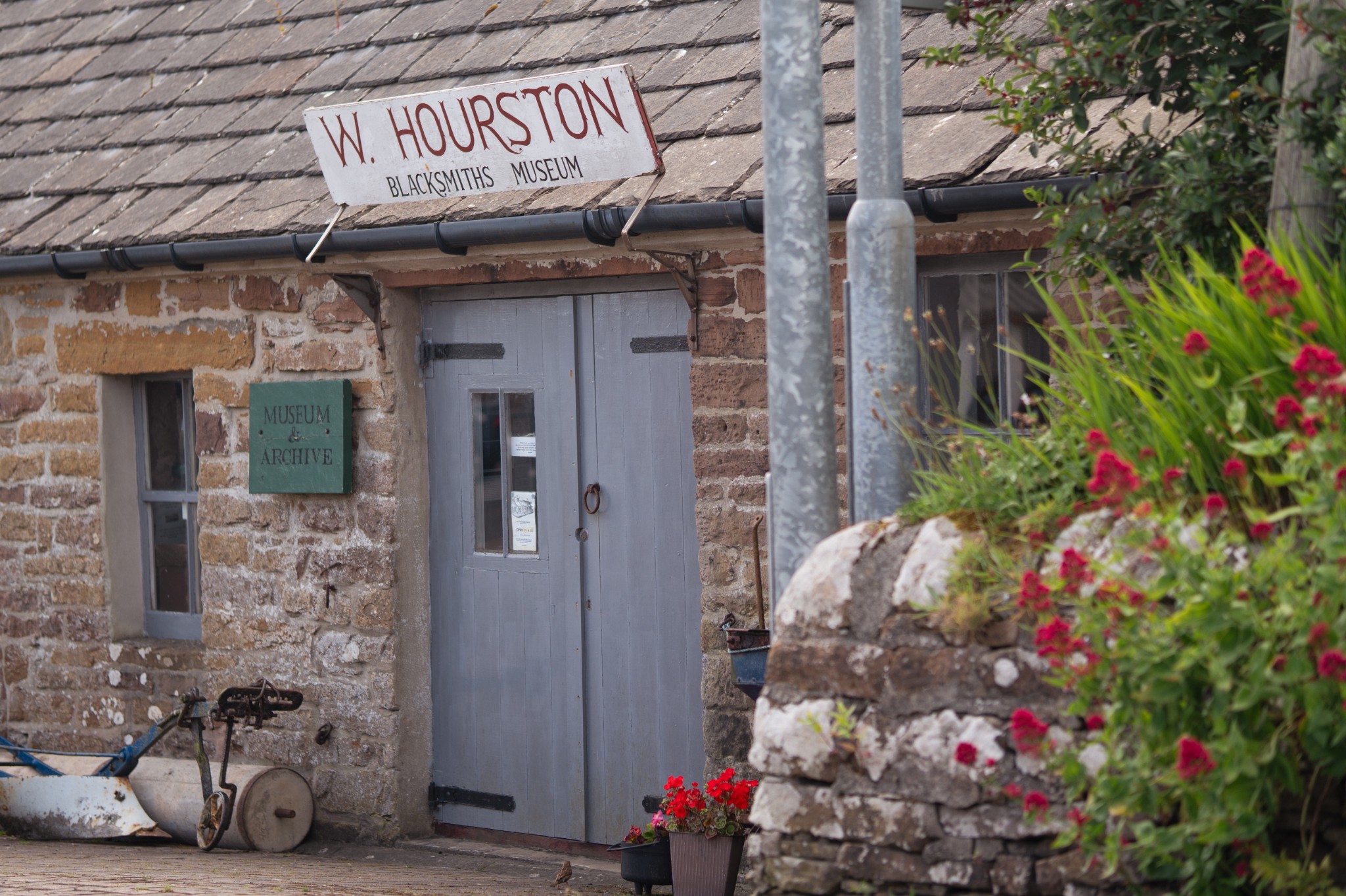
There are plenty of other attractions to be found in South Ronaldsay. In St Margaret's Hope you'll find the Workshop & Loft Gallery and the Smiddy Museum, and you can enjoy a round at South Ronaldsay Golf Club too. The family-run Hoxa Tapestry Gallery is also worth a visit.
Further south in the parish you'll find the beautiful beach at Eastside, and the viewpoint at Olad Summit. It offers a great vantage point across Scapa Flow, the Pentland Firth and North Sea. Windwick is another viewpoint with views towards sea stacks and a busy seal-pupping beach during the autumn months.
At Burwick on the island's southern coast you can visit the St Mary's Church, built on what’s claimed to have been the site where the first Christian missionaries arrived in Orkney. The church, which has been taken on by a local trust, contains the Ladykirk stone. Legend says that St Magnus crossed the Pentland Firth standing on the stone, but it’s actually thought by experts to have been a Pictish coronation stone. You can also take our Burwick to Barth Head walking route here.
Nearby, Tomb of the Eagles has re-opened, offering tours of its Neolithic burial cairn, clifftop walks, and an excellent visitor centre.
- Food & drink
The village of St Margaret's Hope has a number of food & drink options. The Murray Arms Hotel serves meals and refreshments in its popular restaurant, with the focus very much on Orkney's fresh seafood. Robertsons on the nearby Church Road also offers meals, drinks and snacks. There are two well-stocked shops in the village too, Doulls and The Trading Post.
- Transport & services
Orkney's X1 bus service runs between Stromness and St Margaret's Hope daily. View the full timetable on the Orkney Islands Council website. There is no regular public bus service linking St Margaret's Hope and Burwick, but a Community Connect on-demand service is available. Find out more from the related downloads section of Orkney Islands Council's website.
There are no petrol pumps available south of Kirkwall so remember to fill up before leaving the town.
Public toilets are available in St Margaret's Hope and at the Sands o'Wright.