A circuit of the south end of Orkney’s most northerly island, taking in much of the A-listed North Ronaldsay Sheep Dyke.
This is a varied walk with no shortage of historical interest and abundant wildlife. It is challenging route and requires a degree of surefootedness, particularly along the island’s west coast – though this section can easily be bypassed by taking the public road from the pier at Nouster back to the start of the walk.
Distance
12km
Grade
Grading: 4
Duration
4hrs
TERRAIN
Rough, stony ground along coast, extremely slippery in places during wet weather. Sandy beaches. Some sections on quiet single-track roads.
MAP DESCRIPTION
OS Explorer 465, OS Landranger 5
Begin at the North Ronaldsay airfield, where the majority of visitors to the island arrive. Follow the road past Treb – recently renovated to house the island’s Wool Mill and Healthy Living Centre – arriving after 200m at a crossroads.
Head diagonally across the junction towards your right (keeping to the left of the island’s war memorial). After a further 200m you’ll pass a tarred wooden building on your left. This is North Ronaldsay’s Memorial Hall. While most local events now take place in the nearby community school, a dance in this atmospheric old hall is not to be missed. It’s the venue for the island’s famous Harvest Home, where the low-roofed interior of the building is decked out in traditional straw-work and oil lamps.
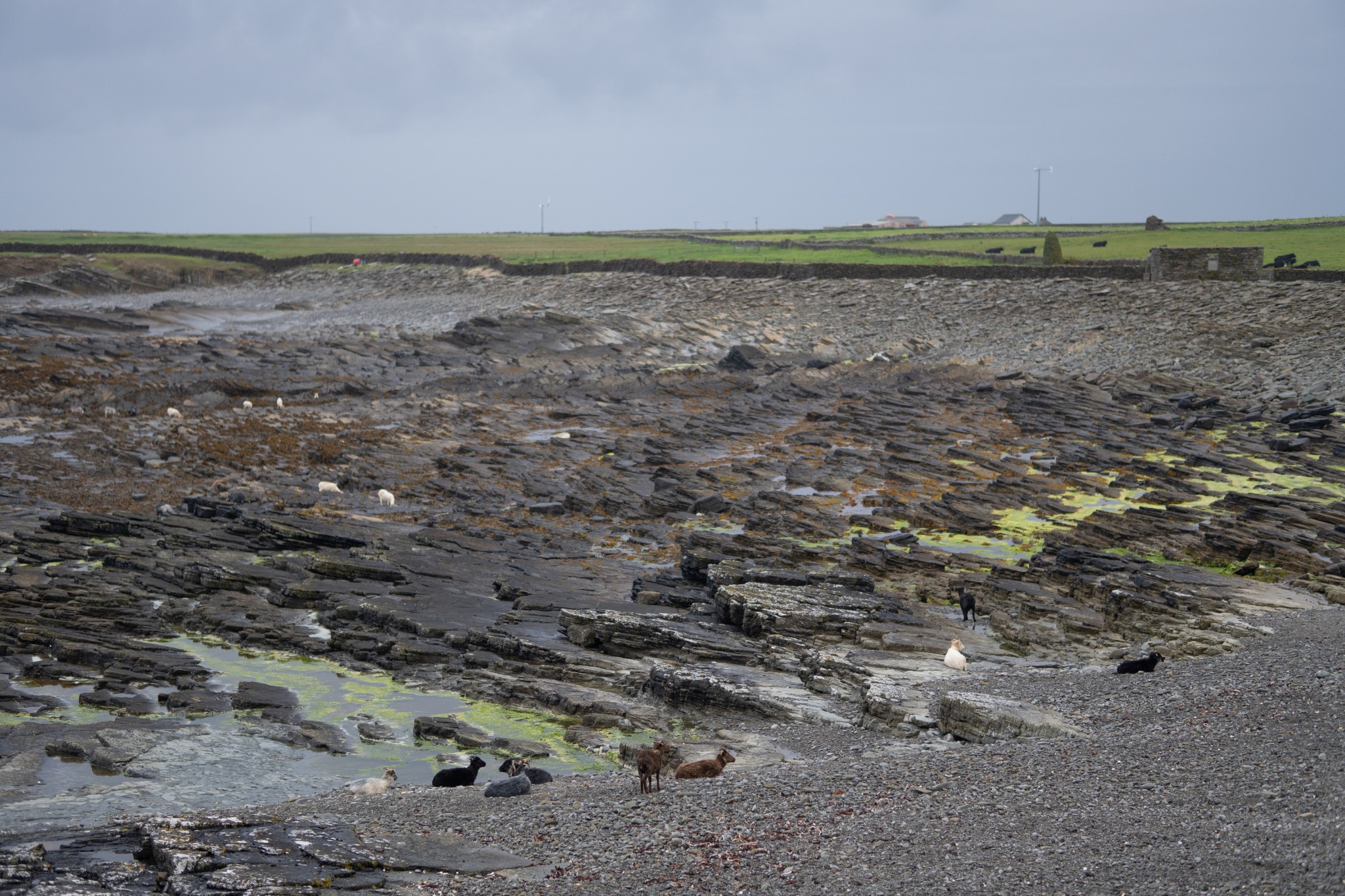
Just after the hall take the first road on the left, heading towards the shore, with Hooking Loch off to your right. After 700m, as the road turns sharply to the right towards Hooking farm, instead carry straight ahead onto a short grassy track to reach a metal gate. As you pass through the gate, you’re also now passing through the sheep dyke itself, joining the famous seaweed-eating sheep as an outcast on the shoreline.
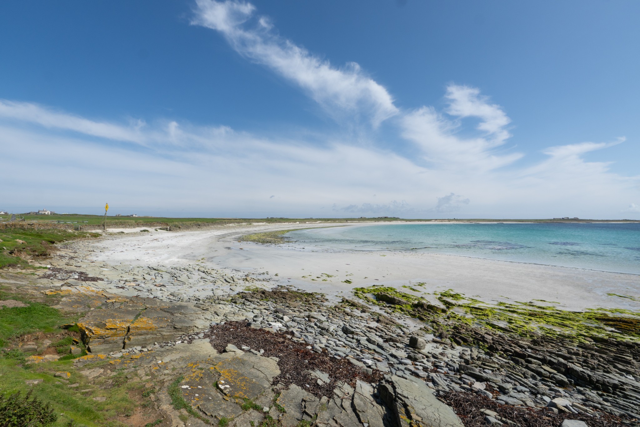
Cross the grass of the closely-cropped machair to reach the shore. This is the wide, sweeping Linklet Bay, which dominates the eastern side of the island. Turn right to head south along the coast, passing below the farm of Hooking to reach a small subsidiary bay of Linklet Bay. Unnamed on the OS or local maps, it can alternate year-to-year between a pebbly storm beach and a secluded sandy stretch of coast.
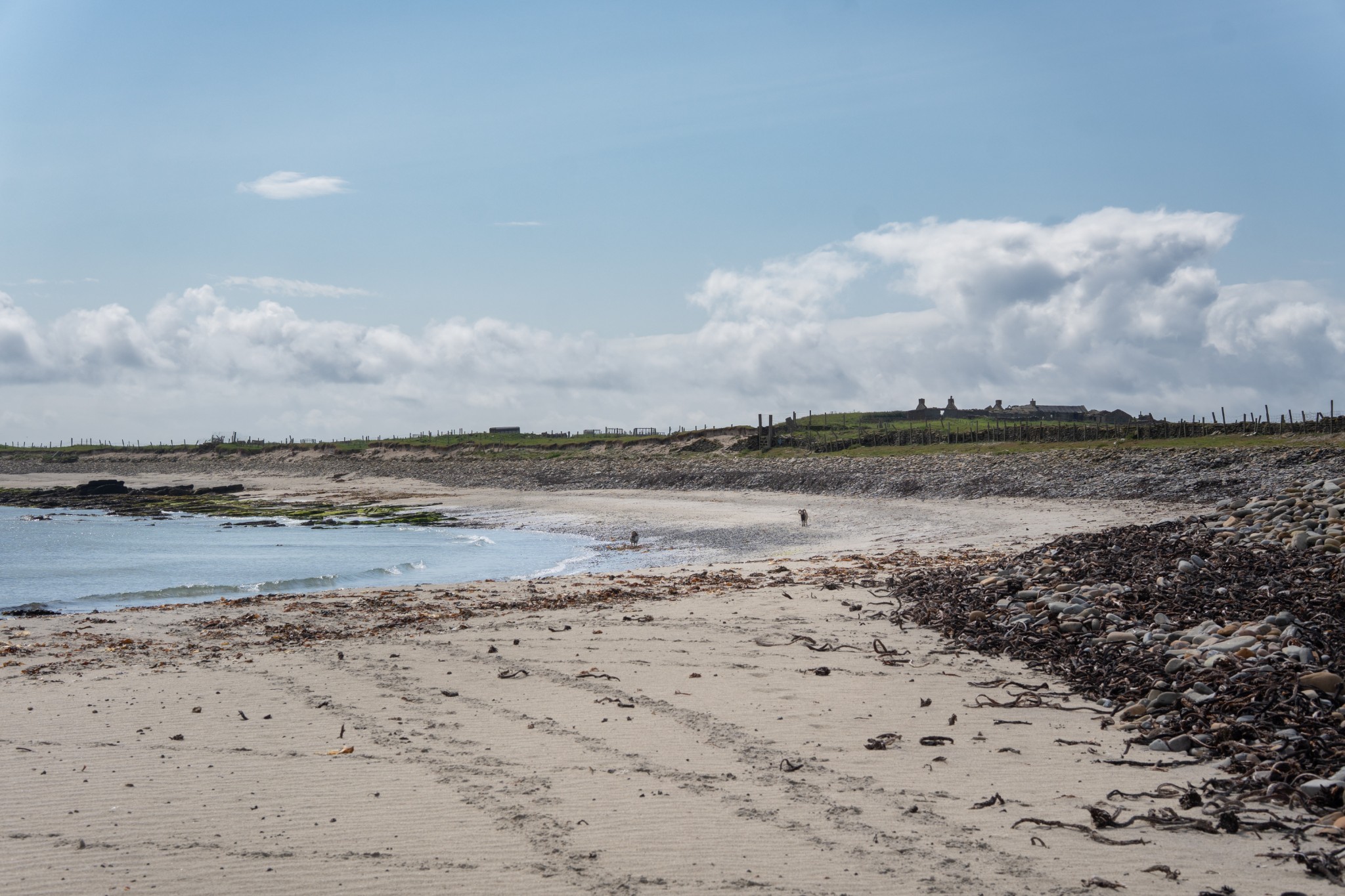
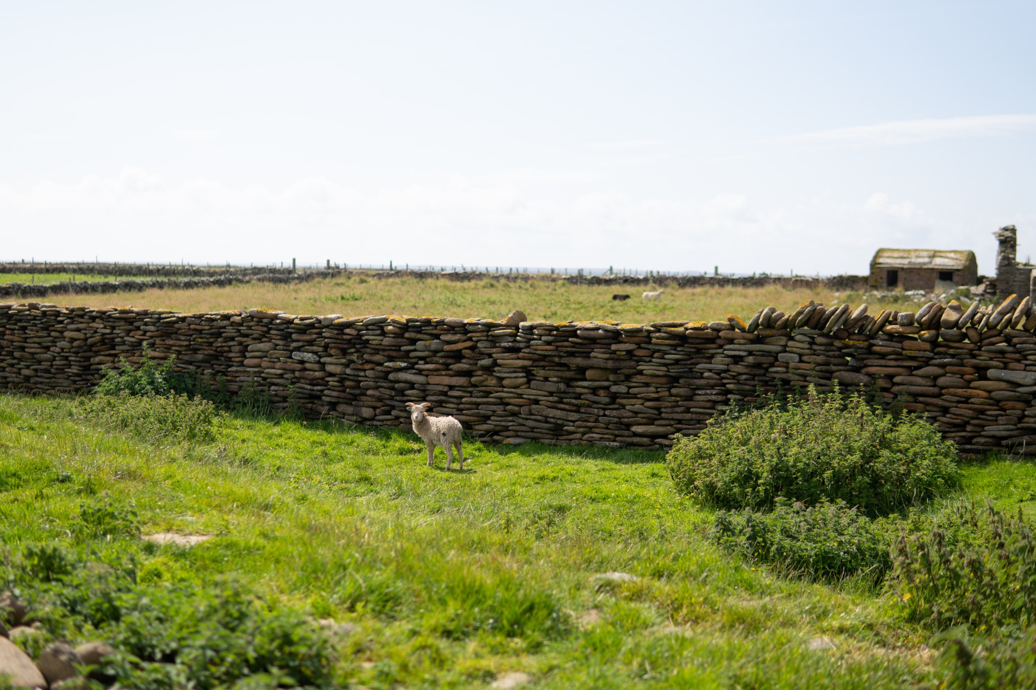
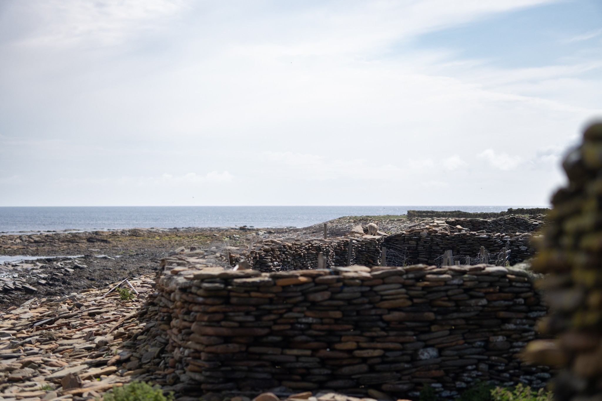
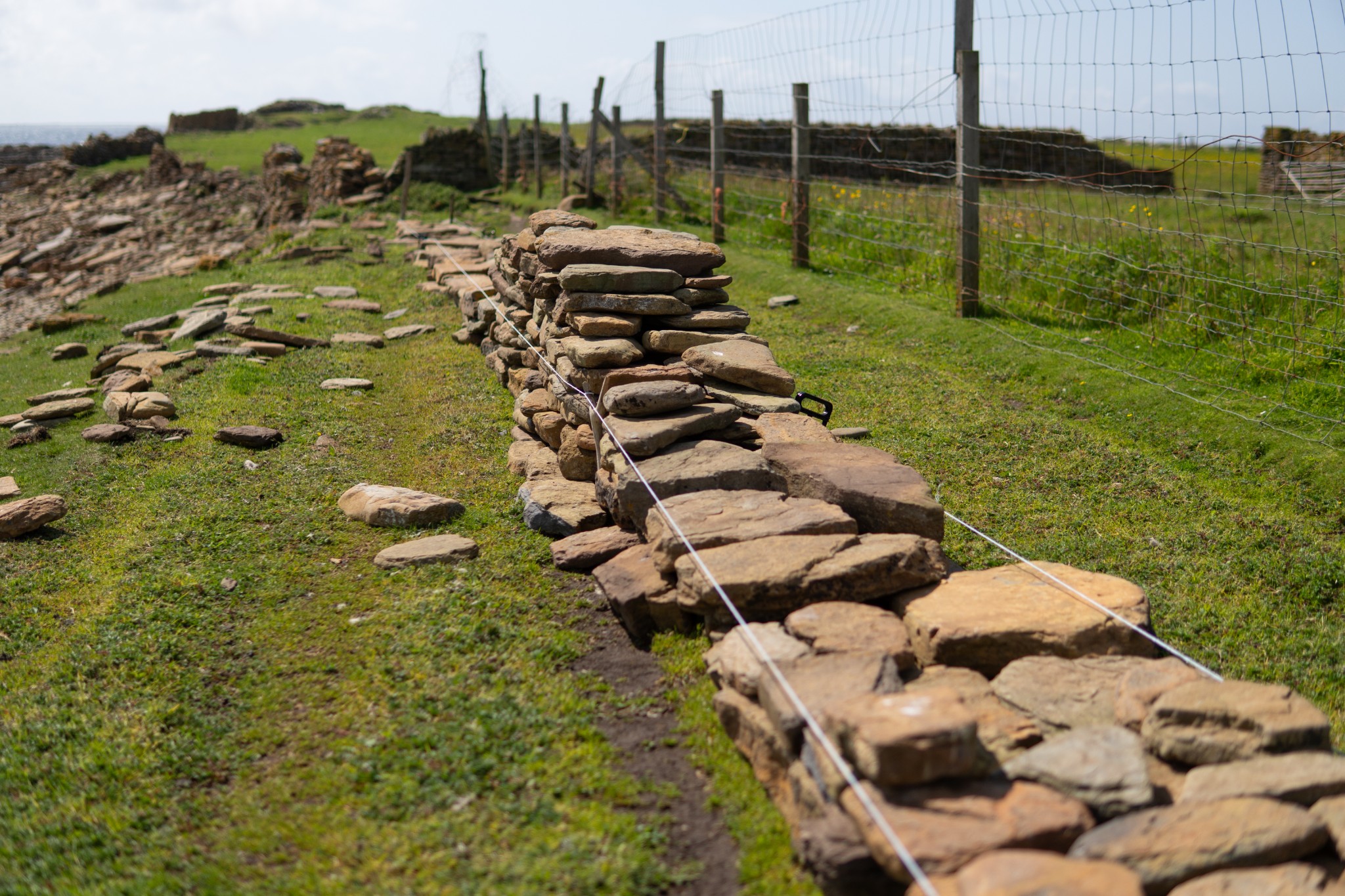
Around 1km south of Hooking the bay ends and you pass the derelict crofts of Stennabreck and Brae. Much of the sheep dyke along this section of coast has been rebuilt in recent years. Originally constructed in the early 19th century, the dyke keeps the island’s unique breed of sheep on the shoreline and away from the more productive interior, which was prioritised for crops and cattle. The sheep gradually evolved to survive primarily on eating seaweed. By the start of the 21st century there weren’t enough islanders fit and able to maintain the Grade A-listed structure, which girdles the island for over 12 miles. The problems were exacerbated by increased storm activity and coastal erosion (the dyke around the head of the bay we’ve just passed has been entirely washed away).
In 2016 an annual North Ronaldsay Sheep Festival was established. It sees volunteers from around the world coming to help islanders restore this unique drystone wall. The sheep themselves provide a vital resource for the island, through both their wool and meat.
A little further along the coast you’ll pass the Bride’s Pund. It’s one of a series of walled enclosures around the island for gathering the flocks of sheep for work such as shearing. ‘Punding’ is very much a community effort involving young and old, and most families in the island have a share in the native flocks.
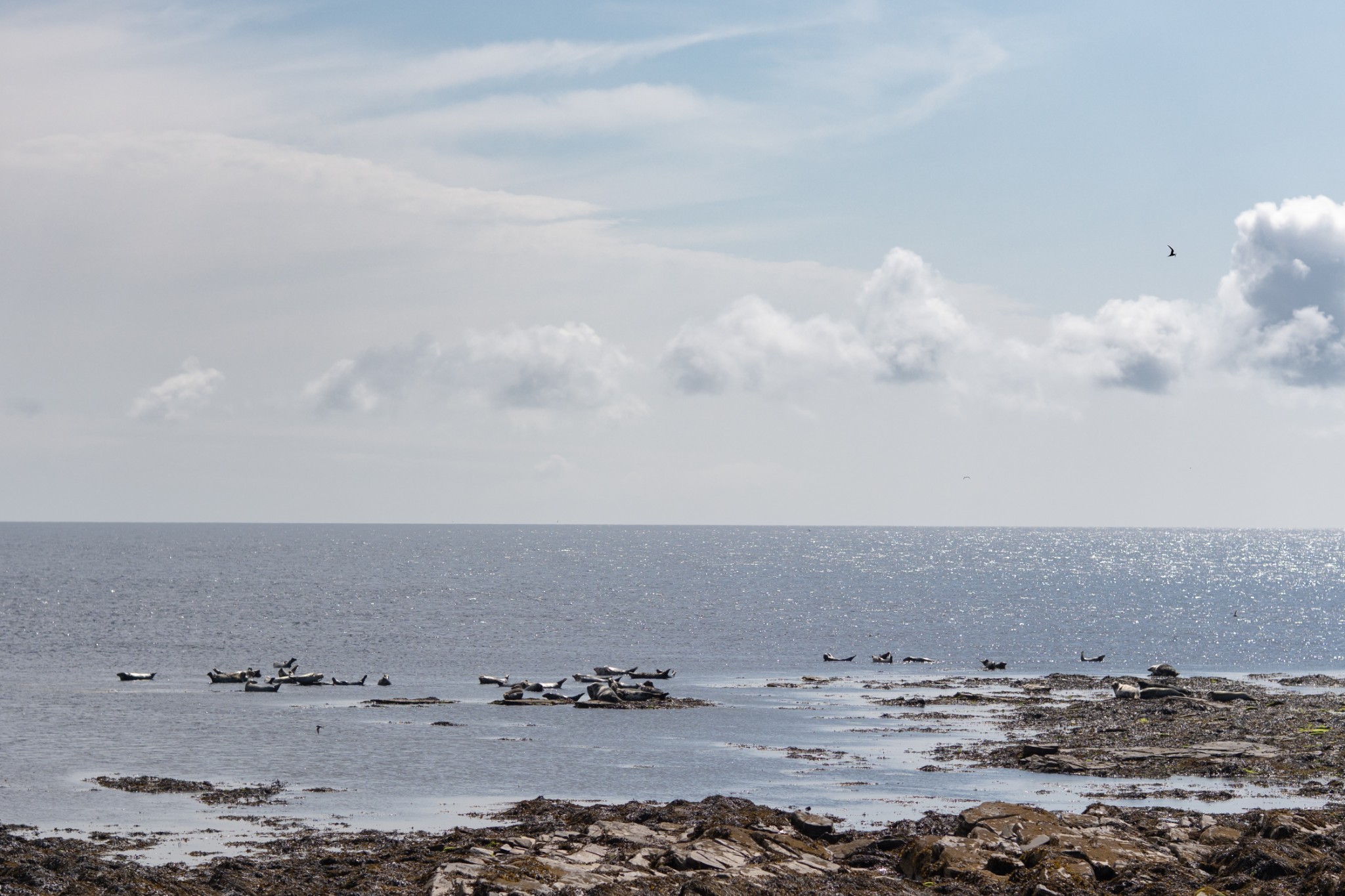
Carry on along the coast to pass round the Point of Bridesness, named after St Bride; there was once a chapel and burial ground here, dedicated to the Irish saint. The headland is often a gathering place for seals, though in 2013 it had a more unusual visitor in the shape of a walrus. A second walrus also came ashore on the island in 2018.
If sea conditions are rough, you may notice waves breaking around a mile to the east of Bridesness. This is the treacherous Reefdyke. The shallow rocks here have claimed many wrecks over the centuries.
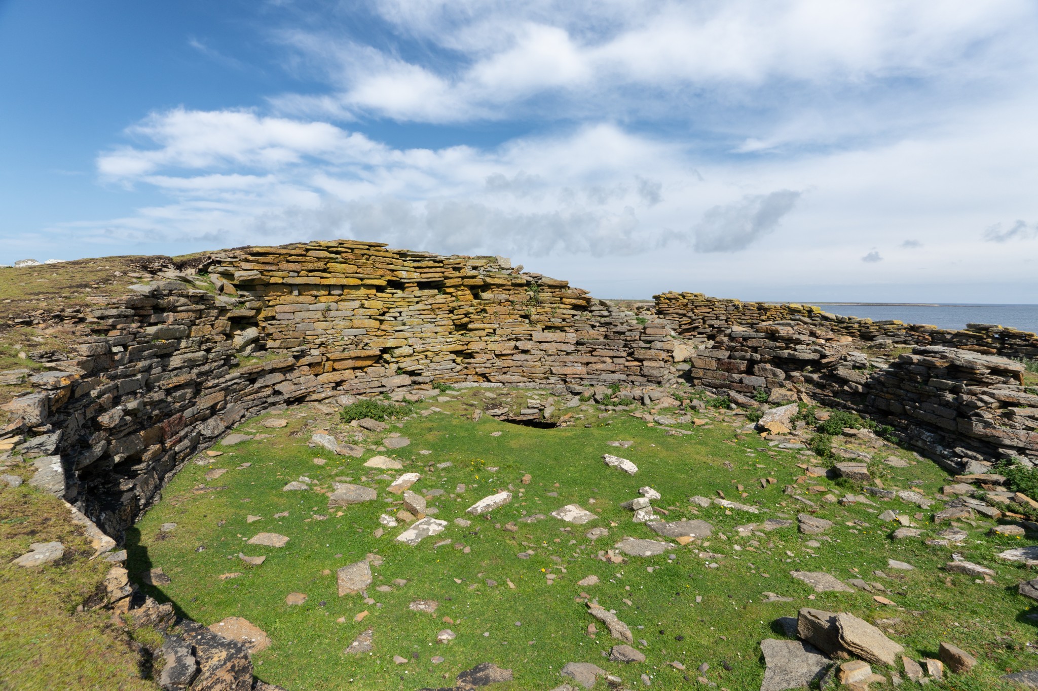
Pass around the bay of Brides Ithy (unnamed on OS maps) for around 1km to reach the Point of Burrian. The remains of a broch and settlement can be seen here. The site is partially eroded and much of the stone from the broch is likely to have ended up within the surrounding stretches of sheep dyke.
Another 1km along the coast brings you to the beautiful sweep of South Bay, or Nouster Bay. When you reach the west end of the bay aim to the left of a prominent yellow rectangular sign (a warning to fishing vessels of a subsea cable making landfall). Next to the yellow sign is a farm gate but around 40m further along you’ll find a smaller, more manageable metal walker’s gate.
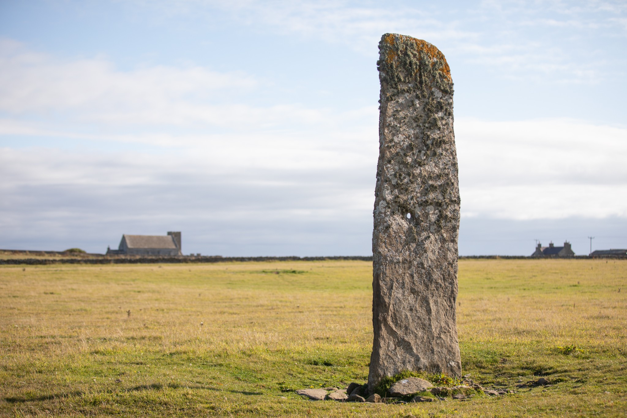
Pass through this gate, turn right to cross the cattle grid and walk 500 metres up the road till you see a small metal gate on your left leading into a field with a solitary standing stone. This is the Neolithic Stan Stane. Local tradition suggests that a giant woman poked her finger through the stone before planting it in the ground – which is certainly one explanation for the distinctive hole in the upper part of this monolith.
Head back towards the road. If you’re short of time or would like to avoid the more challenging section along the west coast of the island, simply turn left to walk 1km along the public road to return to the airfield. Otherwise, turn right to retrace your steps towards the pier at Nouster. Just before re-crossing the cattle grid a track to your right leads to the North Ronaldsay Bird Observatory, which can provide lunches and evening meals (best to book in advance). There’s also a small shop here, though opening hours are limited (1200-1400 daily, at time of writing).
Around 100m beyond the cattle grid you’ll reach the head of the pier at Nouster. Look for a large metal gate on your right just before you head onto the pier. Pass through this gate and follow the line of the dyke around the top of the shoreline. The next two kilometres do require a little care. It can be very slippy underfoot, there is often a drop to your seaward side and the sheep dyke itself is quite unstable in places (never be tempted to touch or lean on the wall for support).
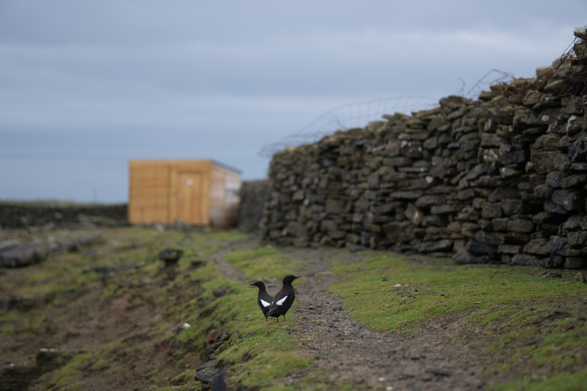
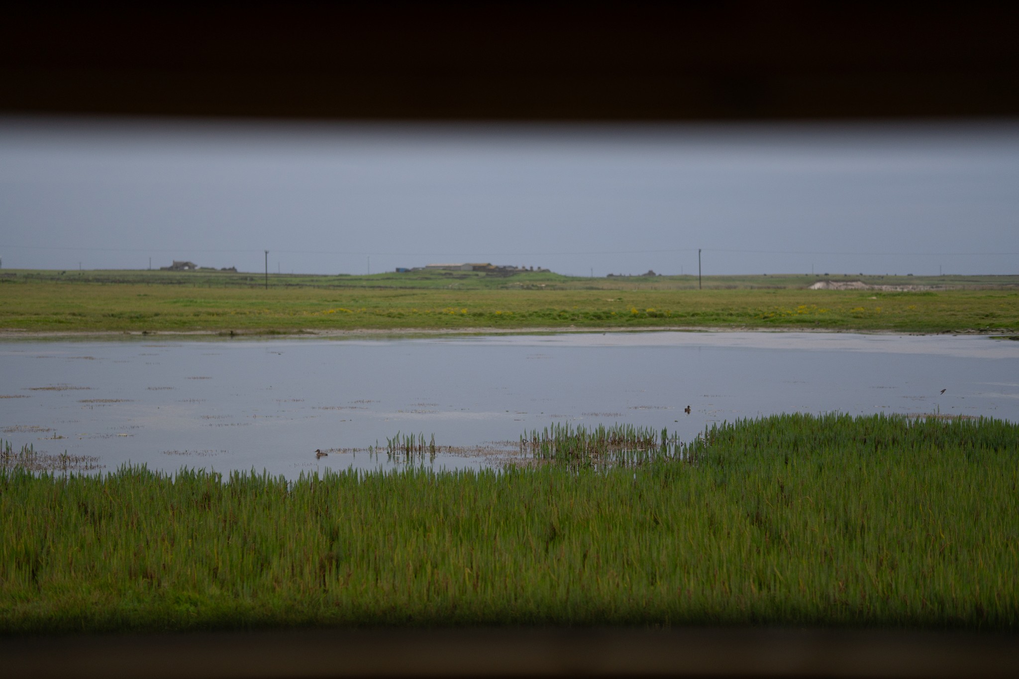
Around 1km after the pier is the bird hide at Gretchen Loch, which provides fine cover for watching a variety of waders and other birdlife. Carry on north for a further 1km. This side of the island is a popular area for black guillemots, called ‘tysties’ here in Orkney, and you’ll often find a pair of them standing in your way, before reluctantly waddling further down the shoreline.
Shortly after passing the island airstrip, you’ll come to the head of a small geo, or inlet, where a metal gate leads you back through the sheep dyke and into a rough field. Keep shadowing the coast in a northeasterly direction – a little inland to avoid Arctic tern nests in spring and summer - to pass through another metal gate and onto an area of coastal heathland. Bear slightly to your right to head diagonally inland towards an obvious metal farm gate.
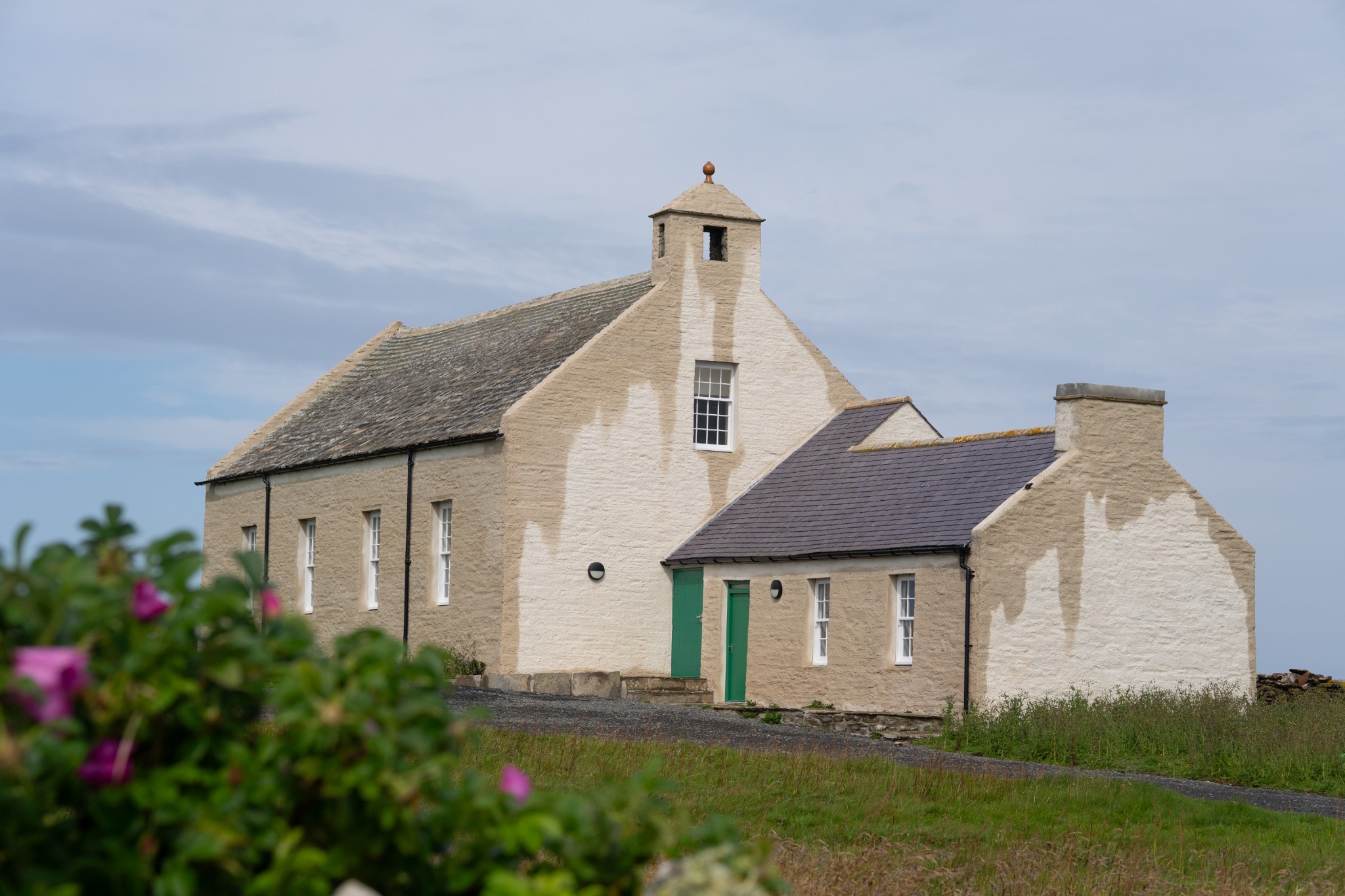
Follow the tarmac road eastwards for 300m to reach a crossroads and turn right. After a further 300 yards look for the recently restored New Kirk. This beautiful building is used for various community events and houses heritage information, as well as temporary exhibitions. Tea and coffee-making facilities are also provided.
From the kirk continue along the road for 100m before turning right to arrive back at the airfield.
Visit the Scottish Outdoor Access Code website for more information and advice on how to enjoy the outdoors responsibly.
- Places of interest
North Ronaldsay might be small but there’s more to this special place than meets the eye. The island's sheep always take centre stage and they provide much sought-after wool, which is spun in the island’s Woollen Mill. Tours are available of the mill, and you can also visit Rinansay Weavings to see the wool turned into textiles, soft furnishings and more.
North Ronaldsay is an important staging post for migrating birds every spring and autumn when an incredible array of visitors drops in. Over recent years some of the special arrivals have included a red-winged blackbird and a Siberian blue robin. These rarities are joined by plenty of other species – expect to see wrens, rock pipits, and wheatears, in and around the island’s sheep dyke. Seals, orca, porpoises and whales can often be seen too.
North Ronaldsay’s lighthouse is the tallest land-based lighthouse in the UK and commands fantastic views over the island and the rest of Orkney from its vantage point at the north end of the island. Tours are available, if you’re fit enough to clamber up the 176 steps to the top.
Nearby, the Old Beacon at Dennis Head is a Grade A listed structure first lit in 1789, helping warn mariners about the dangerous North Ronaldsay coastline.
The island was awarded Dark Sky status in 2021, placing it as one of the best places in the country for stargazing. It's the perfect spot to catch a glimpse of the northern lights too.
- Food & drink
The North Ronaldsay Bird Observatory offers lunches and evening meals, and is also home to the island's small shop which stocks a wide range of goods. Booking meals in advance is recommended - check the North Ronaldsay Bird Observatory Facebook page for more information, or phone 01857 633 200.
- Transport & services
Daily flights with Loganair's inter-isles service connect North Ronaldsay and Kirkwall. Visit the Loganair website to view the current timetable.
There is also a weekly ferry service to the island. View timetables and book online via the Orkney Ferries website. Booking in advance is recommended, and bikes can be carried for free.
Cycle hire is available and a range of bikes can be picked up at the island’s airfield or pier. Helmets can be provided too. Booking in advance is essential, especially during the summer. Phone 01857 633 200 to reserve your bike, or email bikehire@northronaldsay.co.uk or enquiries@nrbo.org.uk
There is a public toilet at the island's pier.
Find out more about North Ronaldsay on the island's Explore page, or visit the official island website.