A combination of geology, plant and animal life, and human history make this a rich and rewarding route for the moderately fit walker.
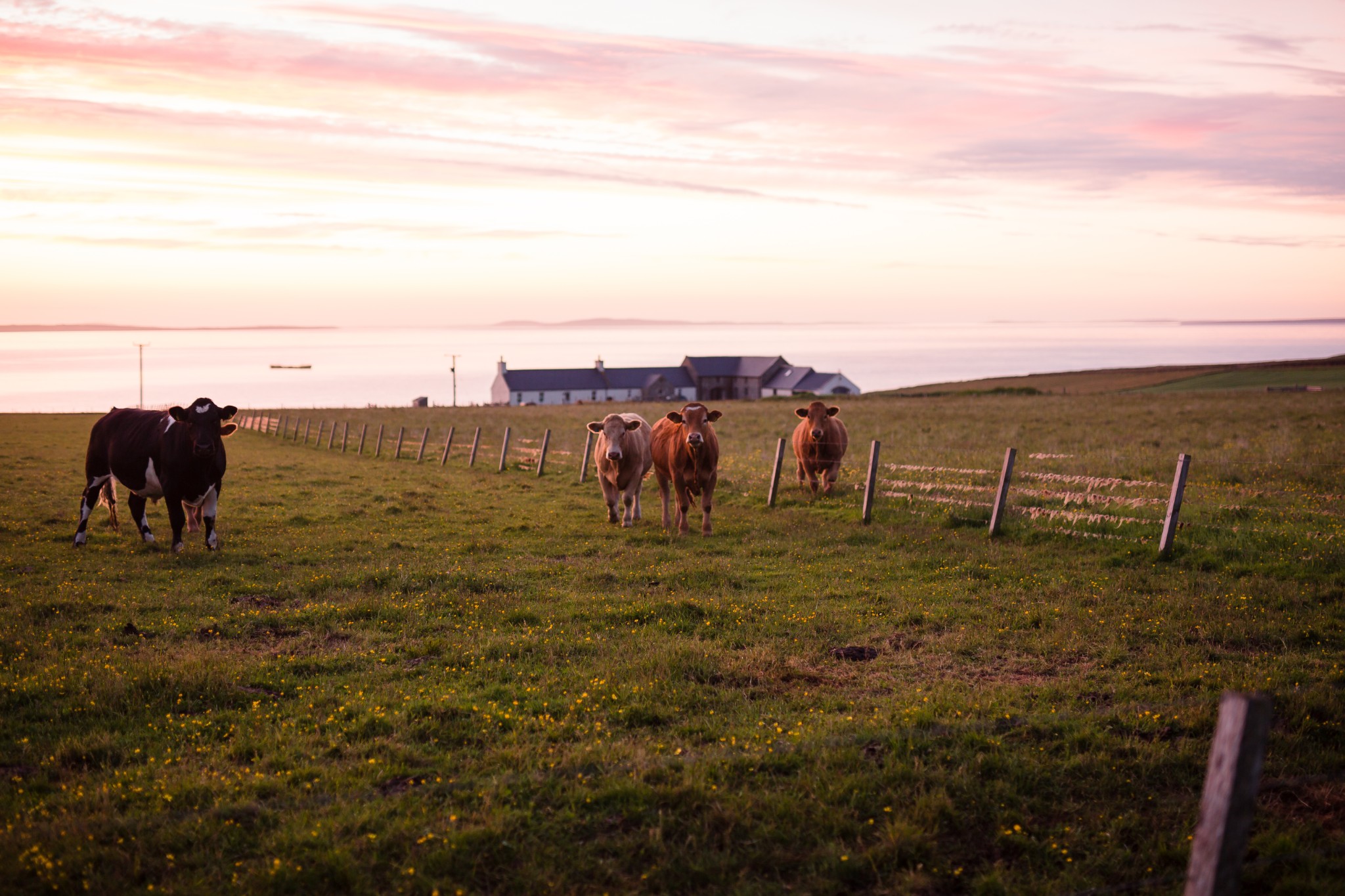
For centuries Orkney’s gentle landscape has been dominated by farming. But on the peripheries lie wilder swathes of ground where nature very much holds court.
There can be few better examples of this than the Mull Head Nature Reserve in Deerness, found perched on the east coast of the Orkney Mainland.
With over 200 acres of coastal grassland, heath and spectacular sea cliffs, this quiet corner of the islands offers excellent walking opportunities and a rich variety of natural highlights.
Distance
9.1km
Grade
Grading: 3
Duration
3.5hrs
Terrain
Coastal heath, mainly flat, but boggy in places. Coastal arable, undulating and steep in places. Agricultural track, mainly good, though one rough section.
Map description
OS Landranger 6; OS Explorer 461
The walk starts at the car park at the end of the B9050. Before beginning, it’s well worth taking a quick tour of the unmanned visitor centre. Discreetly housed in a traditional stone building just next to the car park, it gives a wealth of information about some of the plant and animal life to look out for during the walk.
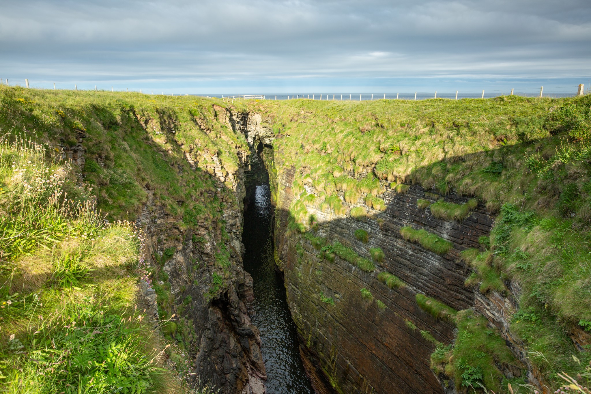
Head east along the path towards the coast for around 200 metres to the Gloup. This impressive collapsed sea-cave is separated from the sea by a substantial land bridge. The 80-metre-deep defile is best seen from either of the obvious viewing spots at each end, where the waves can be seen surging in, continuing their slow but steady process of erosion. Keep well clear of the grassy edges, and be aware that the outward sloping rocks on the seaward side of the land bridge are notoriously slippery.
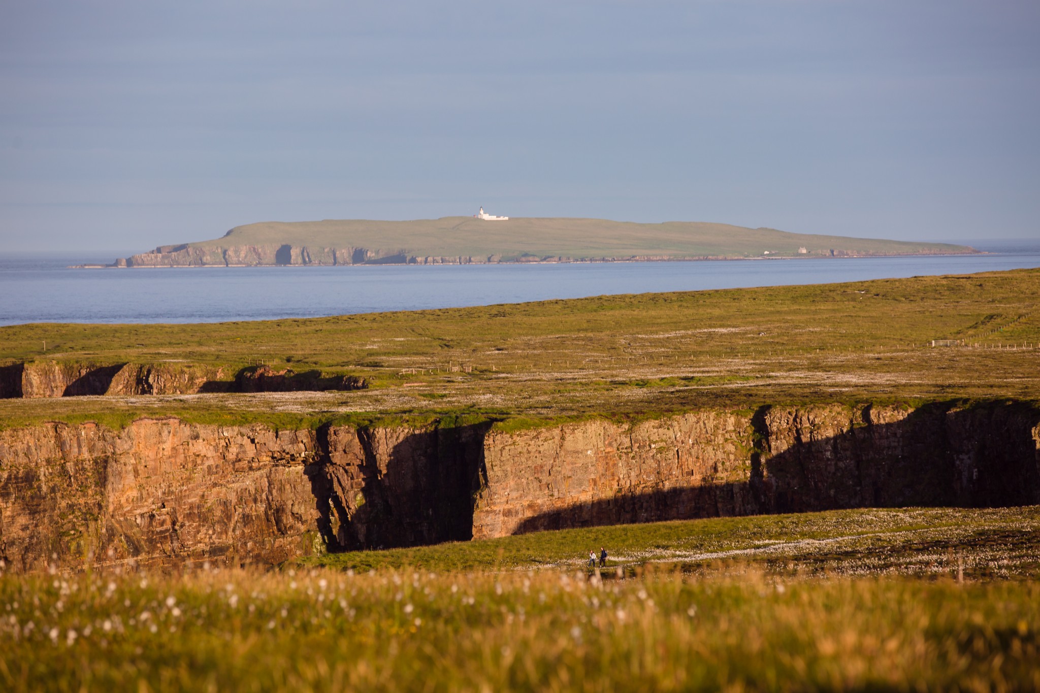
Passing through the wooden gate, follow the obvious track to your left, which leads northwards. In summer the surrounding heathland gives a fabulous display of wildflowers. Looking out to sea, a little to the southeast, you’ll see the island of Copinsay with its lighthouse, and to the north of that the distinctive pudding shape of the Horse of Copinsay.
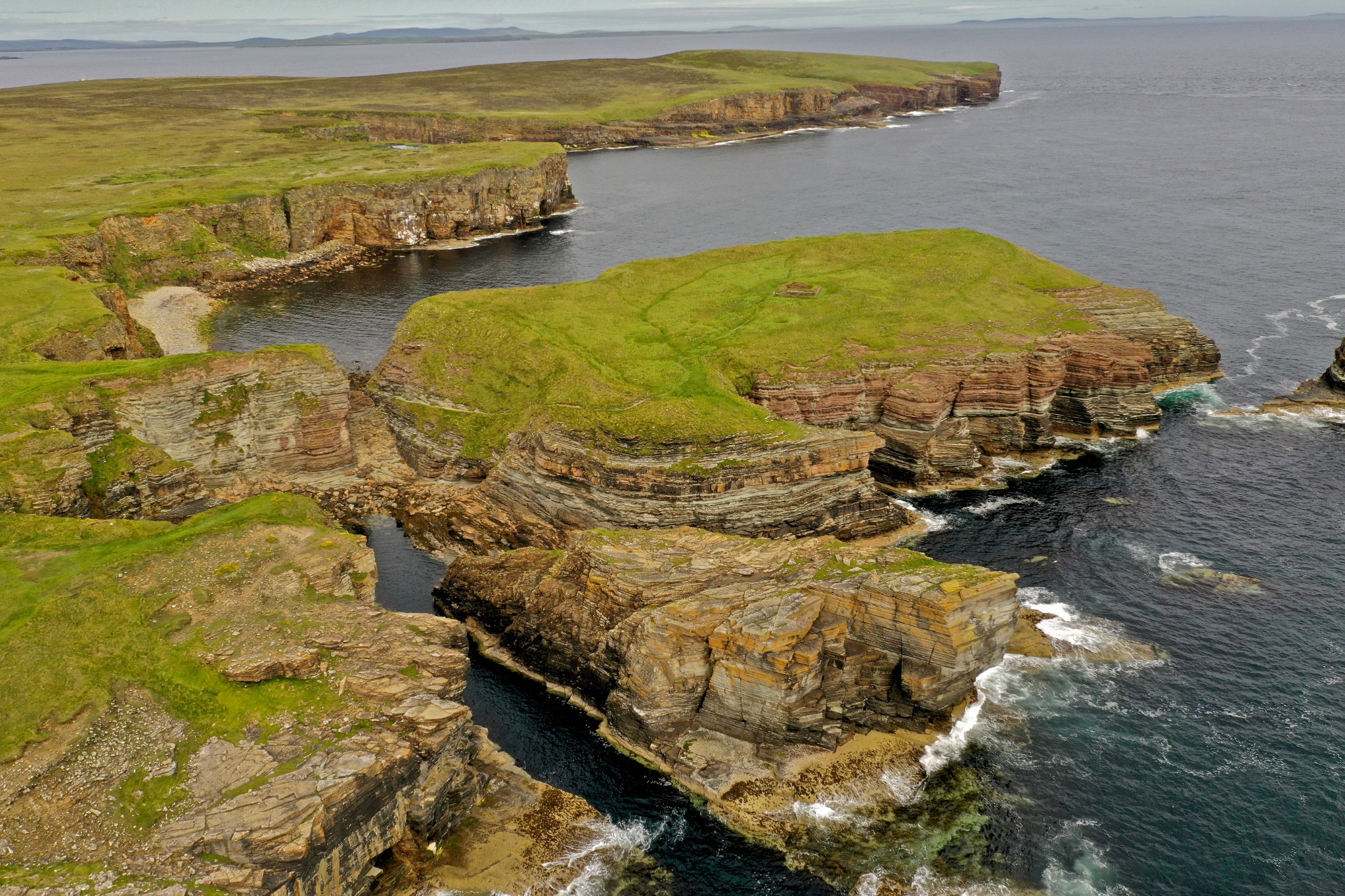
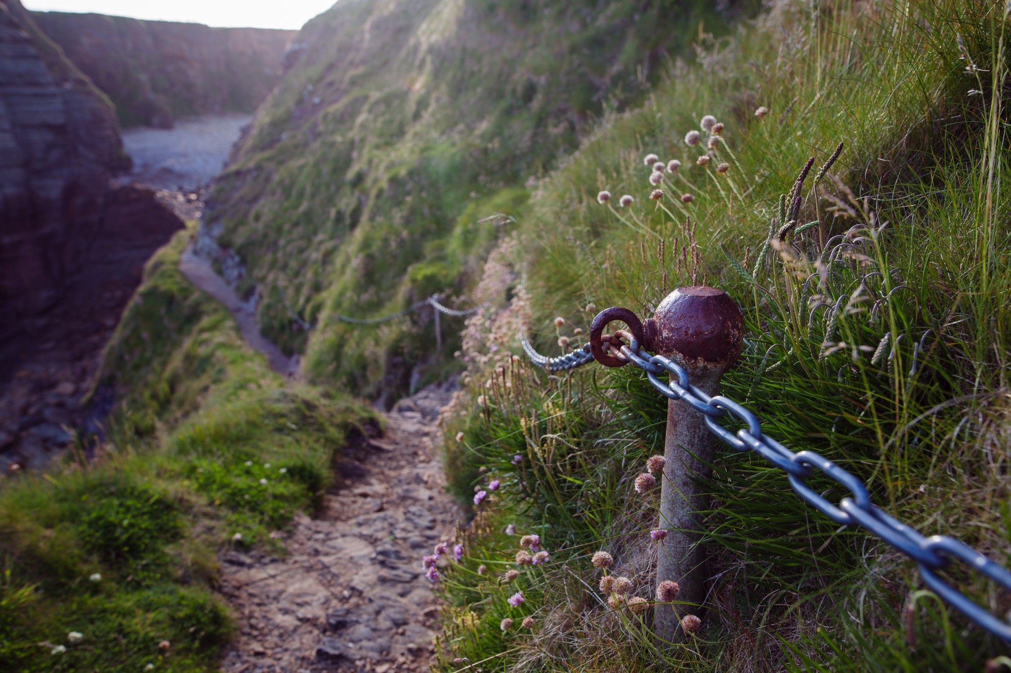
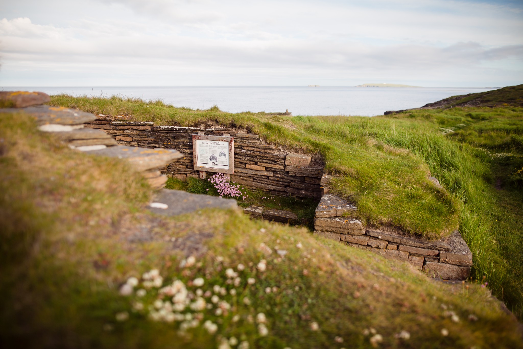
After around a kilometre you arrive at the Brough of Deerness. At first glance this rocky outcrop looks entirely inaccessible, but a rough path leads down, almost to sea level, before rising up a narrow goat-track of a route. Thankfully a well-secured chain provides a welcome handhold, but great care should be taken on all parts of this section of the route. The downward section of path approaching the Brough itself is steep and is prone to erosion and landslips, which Orkney Islands Council monitors regularly. Take extra care when using this path and make sure you are wearing appropriate footwear and are physically fit.
Once on the Brough you’ll notice the walls of a small Norse chapel, believed to date from the 10th century. Slightly less apparent are the remains of a number of other buildings, the outlines of which can just be made out among the grass. These structures suggest the Brough was once a fortified Viking stronghold.
After returning, carefully, to the main route follow the obvious path north which hugs the coast to a kissing gate at the head of Lang Geo, and onwards past a narrow geo (keep well away from the crumbling edges) to the Chip of the Mull. There’s a small stone cairn at this point and it’s a splendid spot to sit and enjoy the views opening up across the north isles, or to watch seabirds wheeling over the strong tidal rips below. Guillemots and fulmars nest on the friable cliffs.
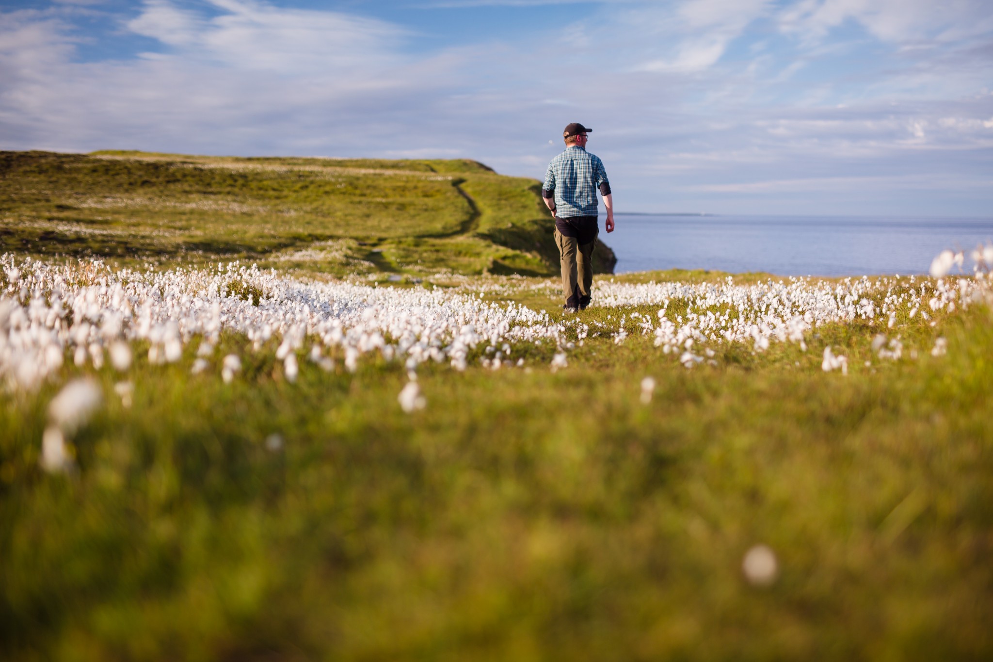
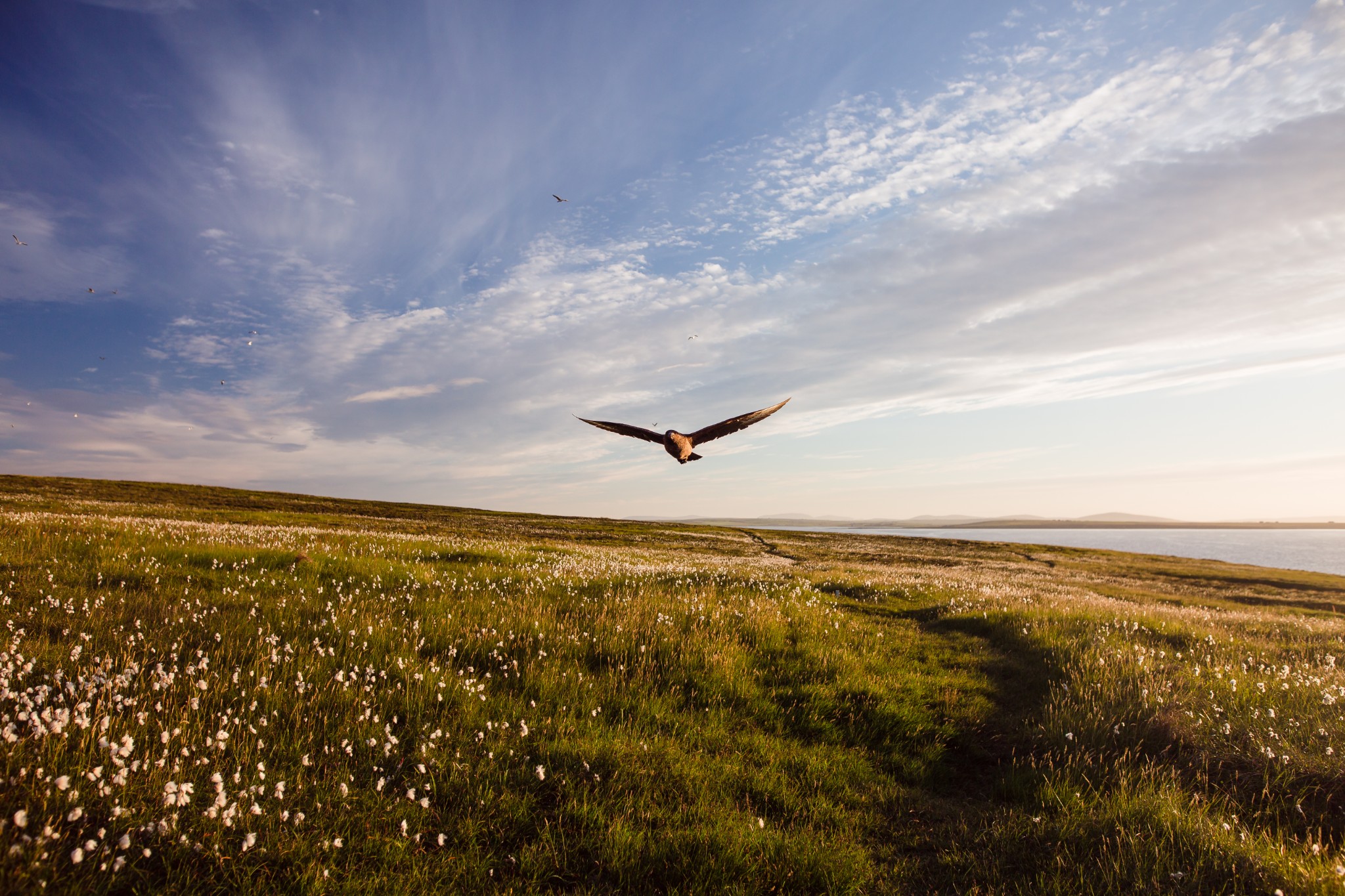
Head west then southwest over Mull Head itself and down again across wonderful coastal heath. During the nesting season great skuas will swoop around your head, leaving you in no doubt that this is their patch. The going does start to get a bit damp under foot, but duckboards have been installed to help with some of the boggiest sections.
Around a kilometre along the coast there’s an abrupt change back to Orkney’s more familiar agricultural landscape. For anyone lacking energy or time, the walk can be cut short here by following the obvious path south back to the car park.
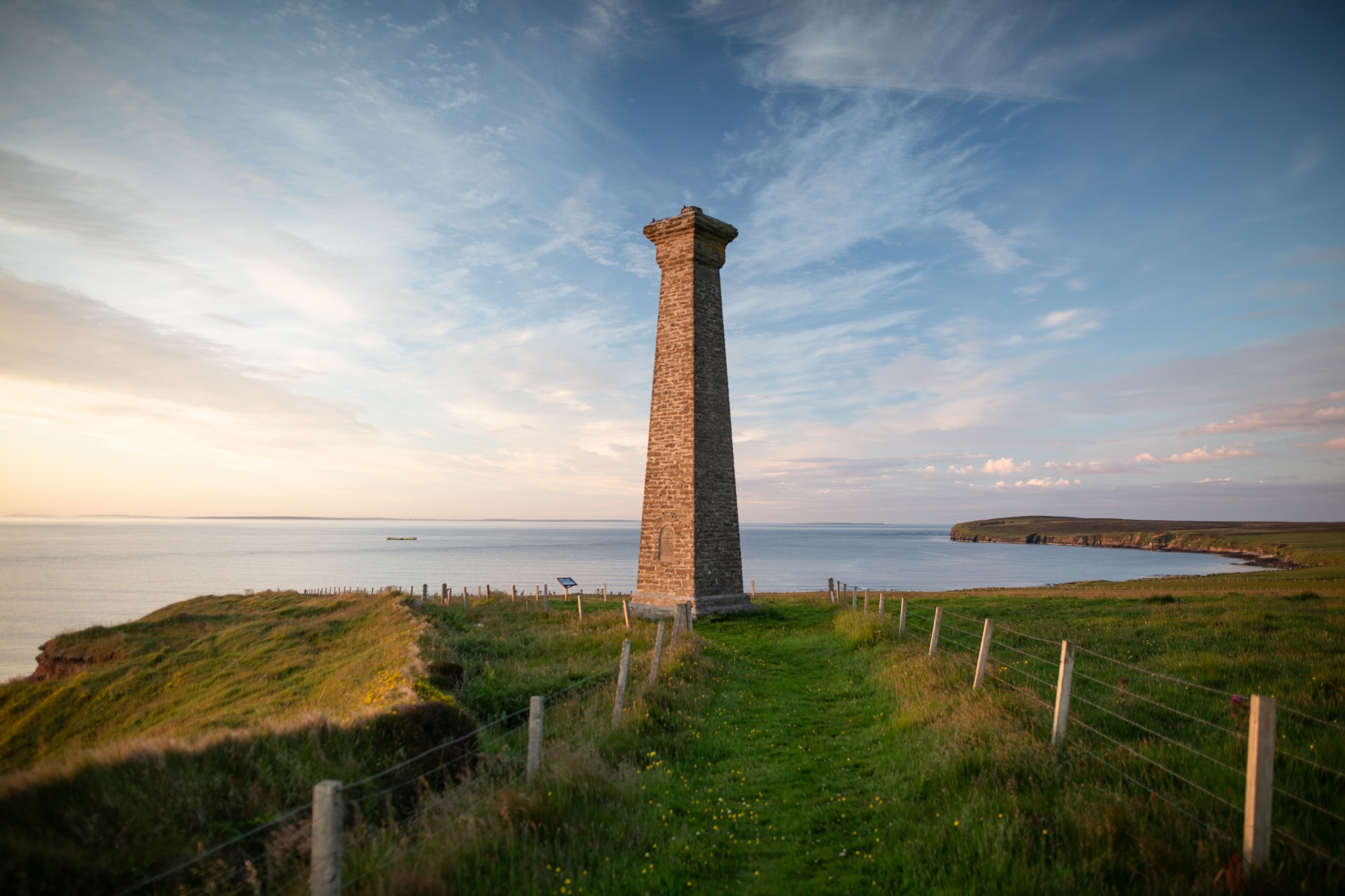
Continue to follow the coastal path as it curves around the bay of Denwick. A tall monument above the low cliffs to the west becomes increasingly prominent. This is the Covenanters Memorial, erected in the 1800s in memory of around 200 prisoners who drowned when the slave ship Crown of London was wrecked here in 1679. The prisoners had been captured following the Battle of Boswell Bridge and were en route to plantations in America when the ship was driven ashore in a gale.
As the land widens slightly to your right, a couple of hundred metres before you get to the memorial, look out for three small stones laid flat and largely overgrown by grass. These are the graves of some of those lost in the sinking.
Follow the path that leads south from the memorial along the edge of farmland, with fine views back east across Mull Head. A kissing gate leads to a small car park and from here head northeast on a footpath which runs parallel, and to the right of, a private vehicular access road. While this road bears to the north, our track – rough at times – carries on east-northeast for a kilometre. At the T-junction turn right, keeping to the grassy track which runs parallel to another stony vehicular track. Orchids, daisies, and buttercups line the route, which leads gently uphill before turning left past a small farmstead. Just after the farmstead follow the grassy track off to the left, which takes an obvious line back to the car park, and the start of our route.
Visit the Scottish Outdoor Access Code website for more information and advice on how to enjoy the outdoors responsibly.
Further information
- Places of interest
Deerness is a thriving community with plenty of things to see and do. Don't miss the beach at Dingieshowe just as you arrive in the parish, where there is another excellent coastal walk. Newark bay is a popular beach with a small slipway for boats.
The parish is also home to the Deerness Distillery which produces award-winning spirits, including gins and vodka. There is a small shop and visitor centre and the owners are more than happy to welcome visitors.
- Food & drink
The parish is home to Deerness Stores, a well-stocked local shop with a large range of food and drink options. The Deerness Distillery's new Dashing Deer Kitchen & Bar offers meals and light bites throughout the day.
En-route to Deerness you will travel through the parish of St Andrews where you'll find Sheila Fleet Jewellery's Kirk Cafe & Gallery, which offers lunches, teas, coffees and homebakes.
- Transport & services
Orkney's number three bus service runs between Kirkwall and Deerness daily, although it stops around 2.5km away from the Mull Head car-park. View the full timetable on the Orkney Islands Council website.
The local community centre offers camping facilities for visitors.
There are public toilets available at Dingieshowe, with one ladies' toilet and one gents' toilet.