A fine out-and-back walk with outstanding views, varied terrain, and one of Orkney’s finest Neolithic chambered cairns thrown in for good measure.
On paper, there might be quite a few reasons why you wouldn’t want to bother with a walk up Keelylang Hill.
It’s topped by Orkney’s radio transmitter mast, along with various other communications gubbins and associated concrete buildings, and much of the route is on the access track for the mast.
But this walk is all about the views. The summit of Keelylang offers a range of vistas that you simply wouldn’t get anywhere else in the islands, and for that reason it’s one of our favourite local routes.
Distance
9km
Grade
Grading: 3
Duration
2.5hrs
Terrain
Rough hill/peat track, short section of wet open hill ground, stony vehicular track.
Map description
OS Explorer 463; OS Landranger 6
Begin at the Firth Community Centre in Finstown, where you’ll find ample parking.
Follow the minor road to the right of the centre, heading uphill past a cluster of houses, before continuing along a grassy track. After around 600m, where the field on your left finishes and the heather begins, turn left to follow the obvious track uphill through heather for 200m to arrive at Cuween, where a number of cairns have been built using stone from the 19th century shallow quarry workings.
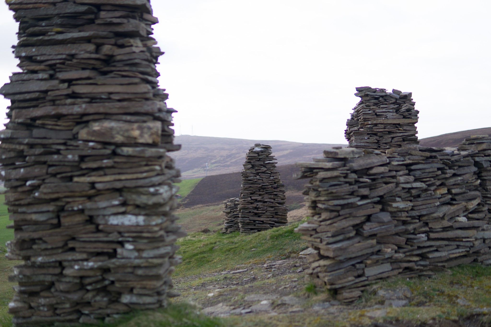
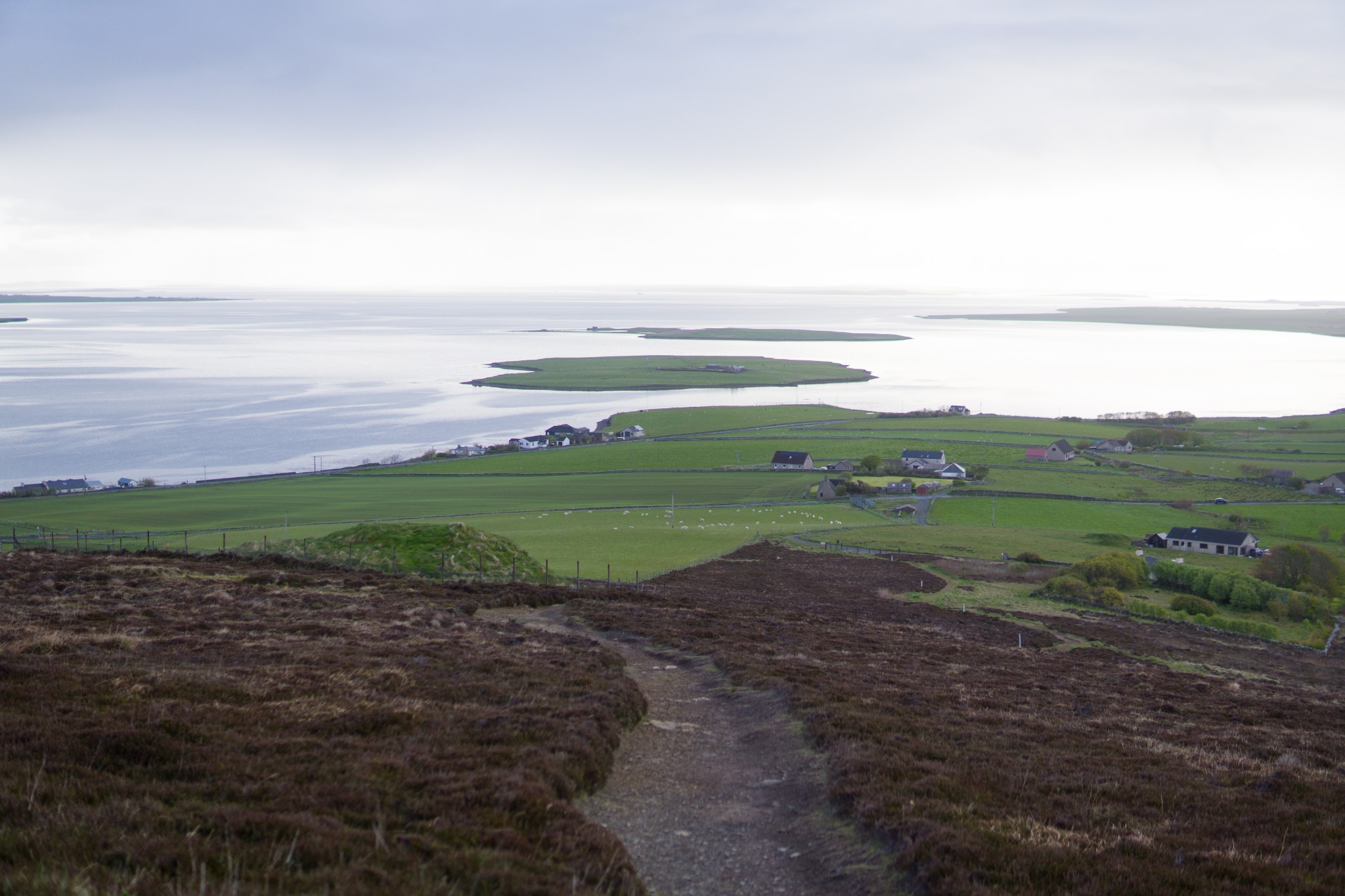
You’re now overlooking the Firth Basin, a beautifully formed bowl of low surrounding hills, with the Bay of Firth and its islands to the north. It was believed to have been an extremely important area during the Neolithic period.
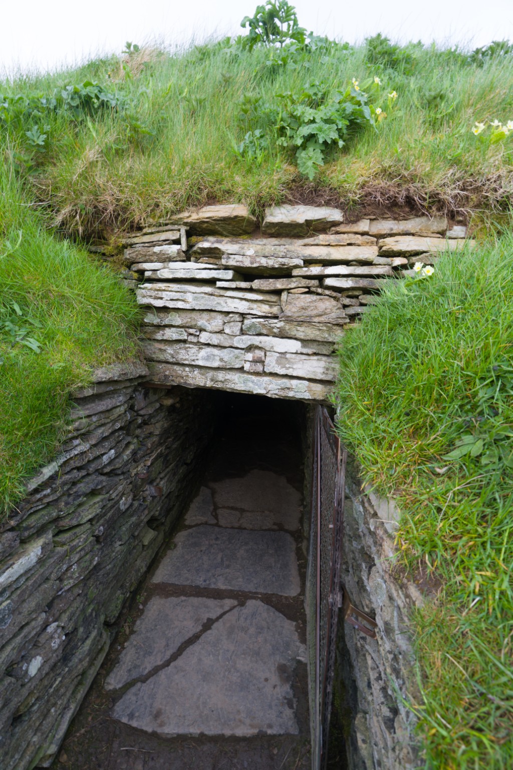
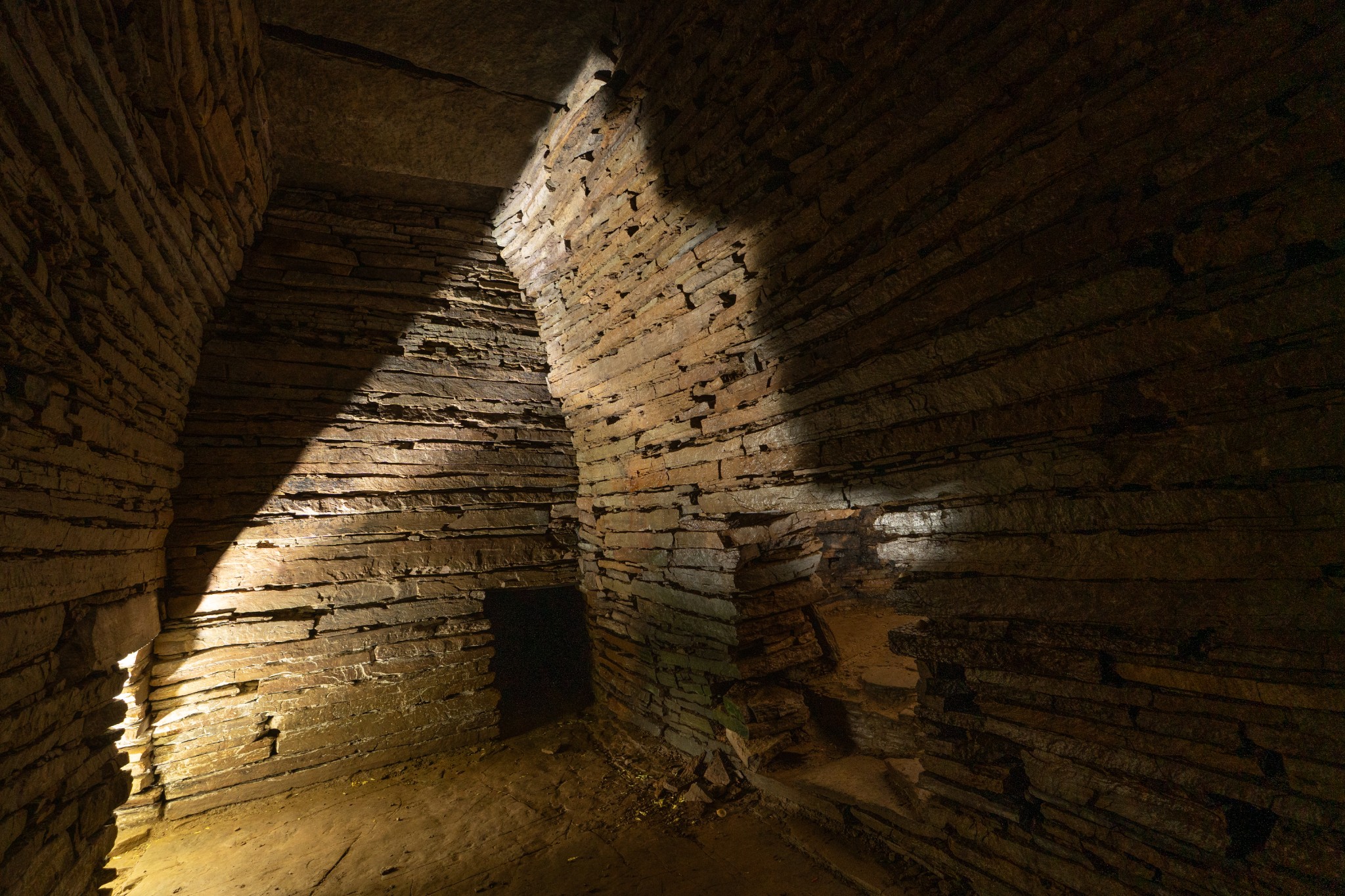
One piece of evidence for this is the well preserved Cuween Chambered Cairn, a short distance to the east of Cuween summit. It’s well worth a visit, if you don’t mind getting your knees and hands dirty getting through the entrance passage. We’d advise taking a headtorch though, as the torch provided on-site often has flat batteries.
Return uphill to the stone stacks. Turn left to head roughly southwest. Head diagonally across the junction where the route crosses over another track. You’ll see here a post with a cross on it. This is the logo of the St Magnus Way and today’s walk follows this pilgrimage route for the first three kilometres or so. Head uphill for 200m before bearing left where the path meets another track coming up from your right.
After a further 200m look out on your left for a series of posts with the St Magnus Way logo which strike out across the open hill ground. Follow these. This section can be very wet underfoot, the route is a little faint in places, and the posts are quite widely spaced, so it's probably best avoided in poor visibility.
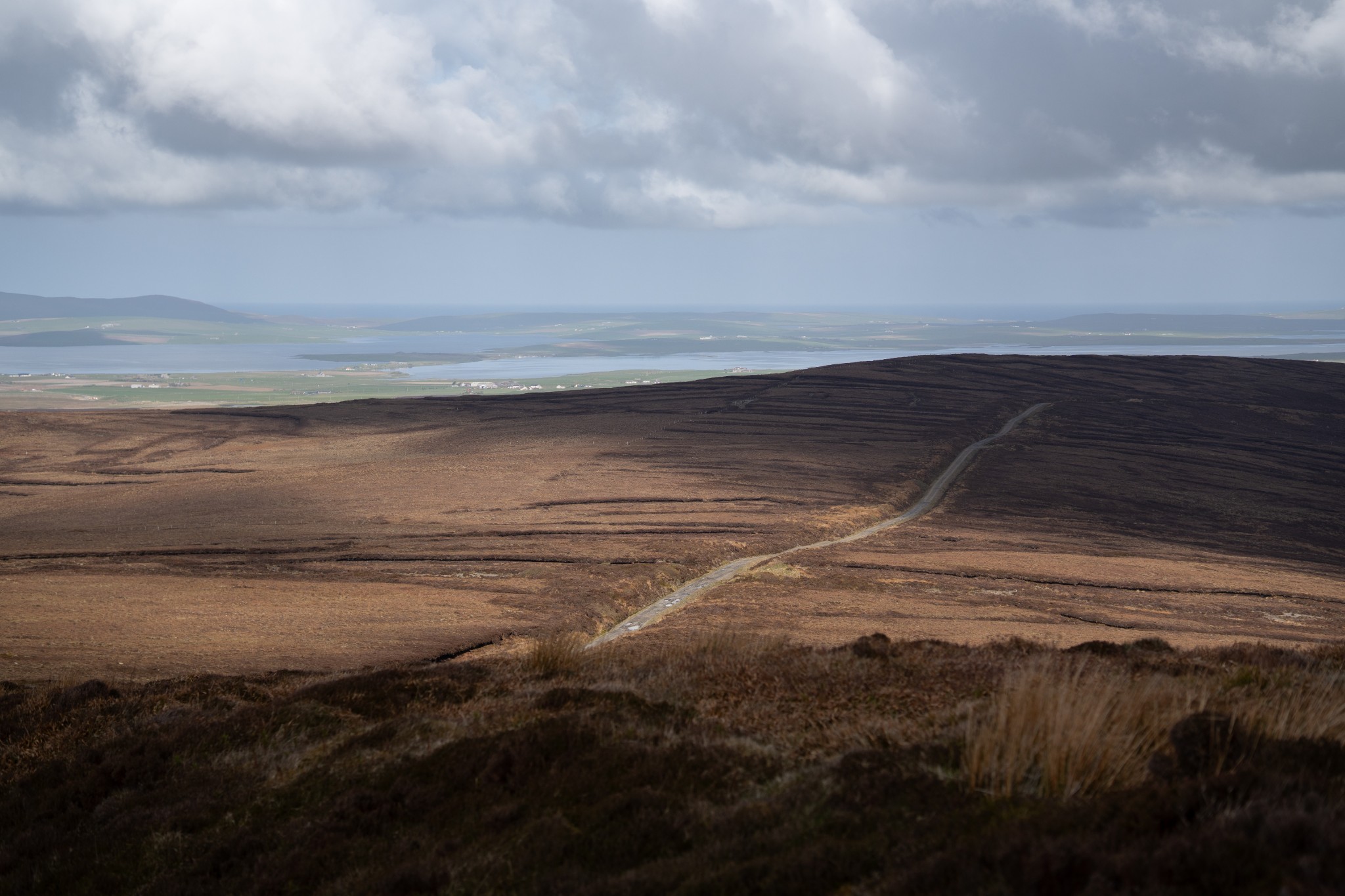
After 400 metres you’ll arrive at the vehicular access track which takes you the rest of the way to the summit. Turn right here to follow the track for 2.6km (ignoring the signpost for the St Magnus Way heading off to your right).
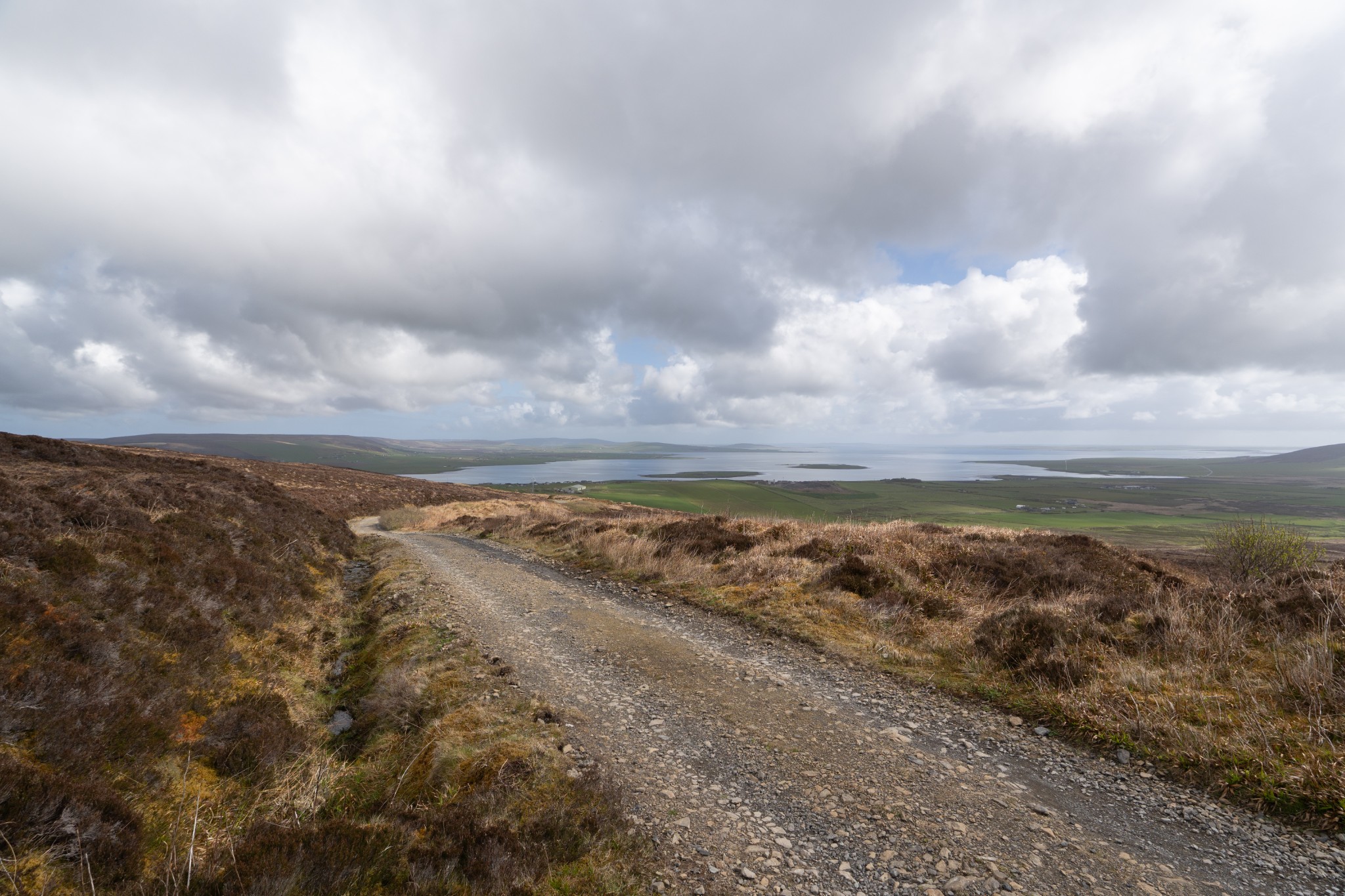
As you head uphill, the views to your left across the Bay of Firth open up further, with the islands of Rousay, Eday, and Westray in the distance.
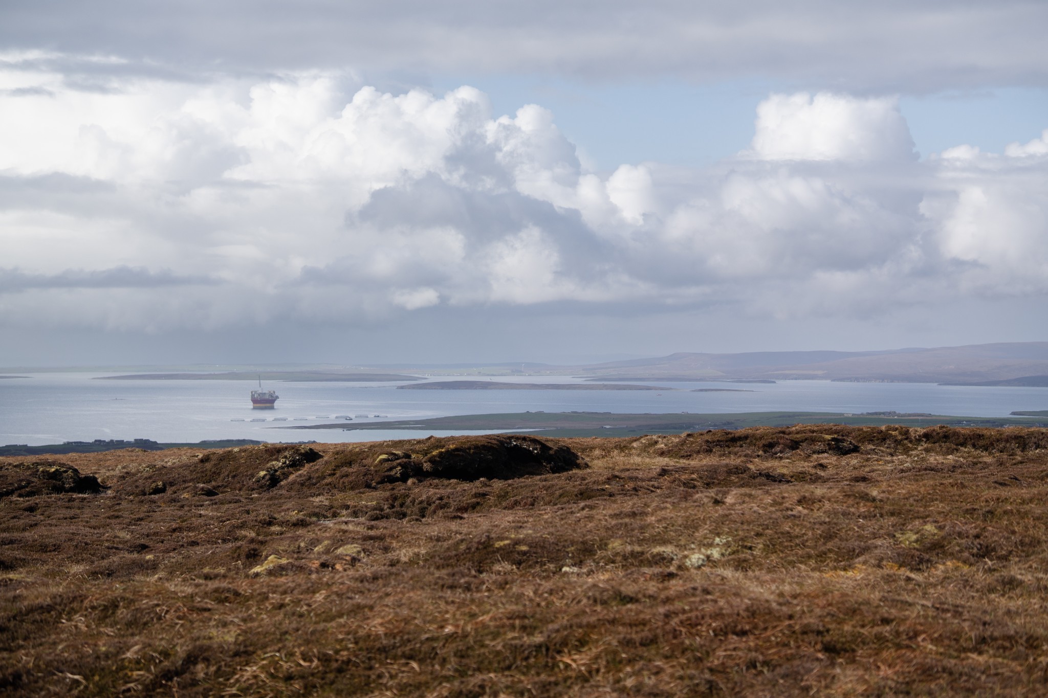
After a steep pull up the final 200m walk just beyond the transmitter buildings to the actual summit. From here the views suddenly open up in all directions; Scapa Flow with the Scottish mainland beyond to the south, to the east Kirkwall and Orkney’s East Mainland, southwest to the hills of Orphir and Hoy’s lofty Ward Hill just peaking in behind, and to the northwest along the line of the track towards the lochs surrounding the Heart of Neolithic Orkney in Stenness.
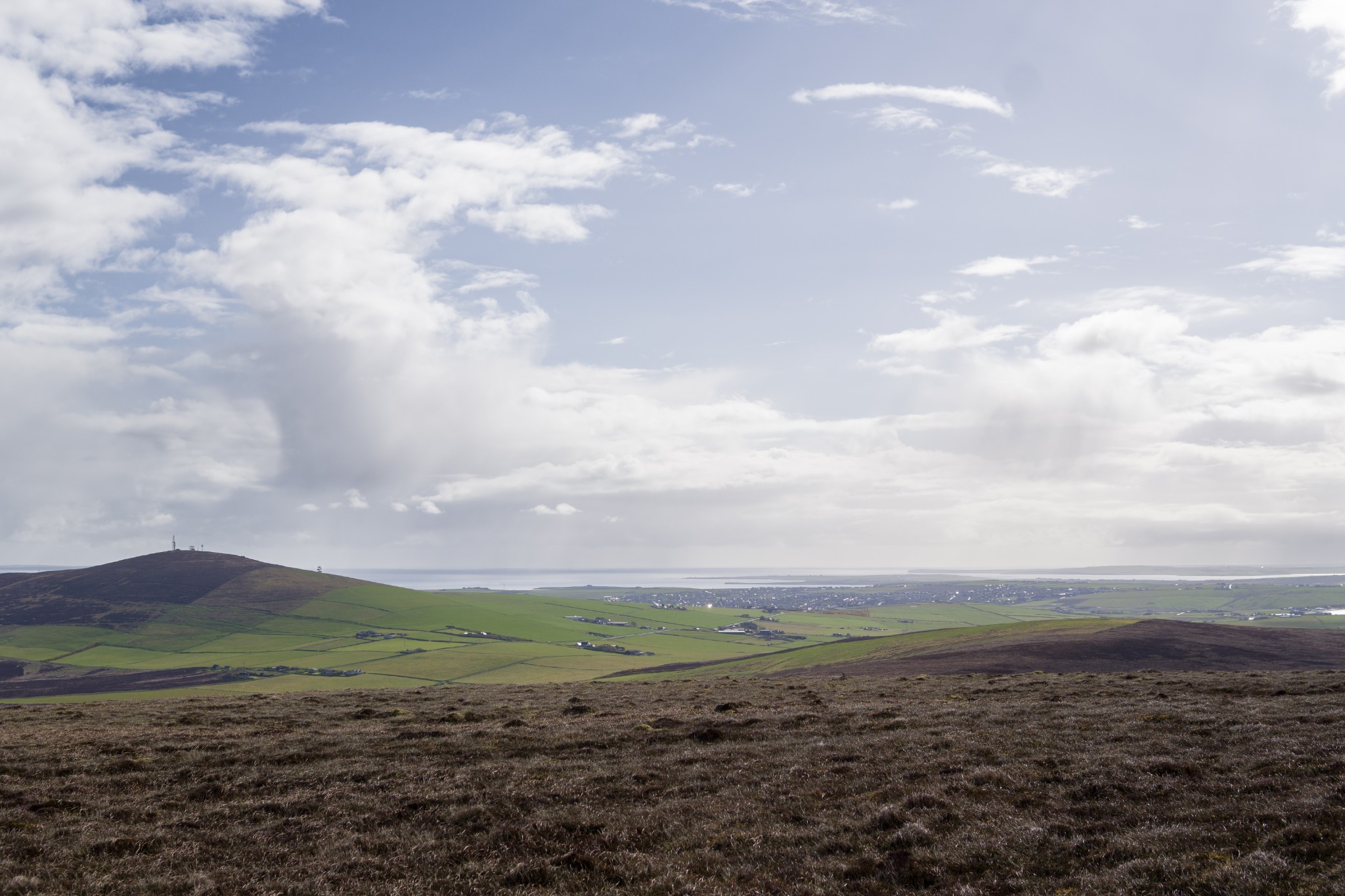
Keelylang’s position slap bang in the middle of the Orkney Mainland gives it an unrivalled overview of our islands. If you’ve chosen your day well, you’ll be well-rewarded with great views. All that's left is to return home by your outward route.
Visit the Scottish Outdoor Access Code website for more information and advice on how to enjoy the outdoors responsibly.
Further information
- Places of interest
The village of Finstown sits at the midway point between Kirkwall and Stromness and offers easy access to all corners of the Orkney mainland.
As well as Cuween Chambered Cairn, as mentioned in our route guide above, you'll find the Wideford Hill Chambered Cairn on the western slope of Wideford Hill, which sits between the village and Kirkwall.
Our Knowes of Trotty walk is a few miles away, offering a gentle route through some fascinating Bronze Age history, and you're only a short distance from Orkney's UNESCO World Heritage Site too.
You can also visit Rosalind Johansson, a talented textile artist who makes art quilts and felt items from her studio in the heart of Finstown.
- Food & drink
The village of Finstown is home to the well-stocked Baikie's Stores and Leighs Real Taste of Orkney takeaway van, offering delicious Orkney burgers and more.
- Transport & services
Orkney's X1 bus service runs through Finstown from Kirkwall and Stromness daily. View the full timetable on the Orkney Islands Council website.
Petrol is available at Esson's Garage in the village.
There is a public toilet in Finstown offering one gents', one ladies', and an accessible toilet.