A fascinating walk exploring the gateway to Scapa Flow, in an island rich with wartime history.
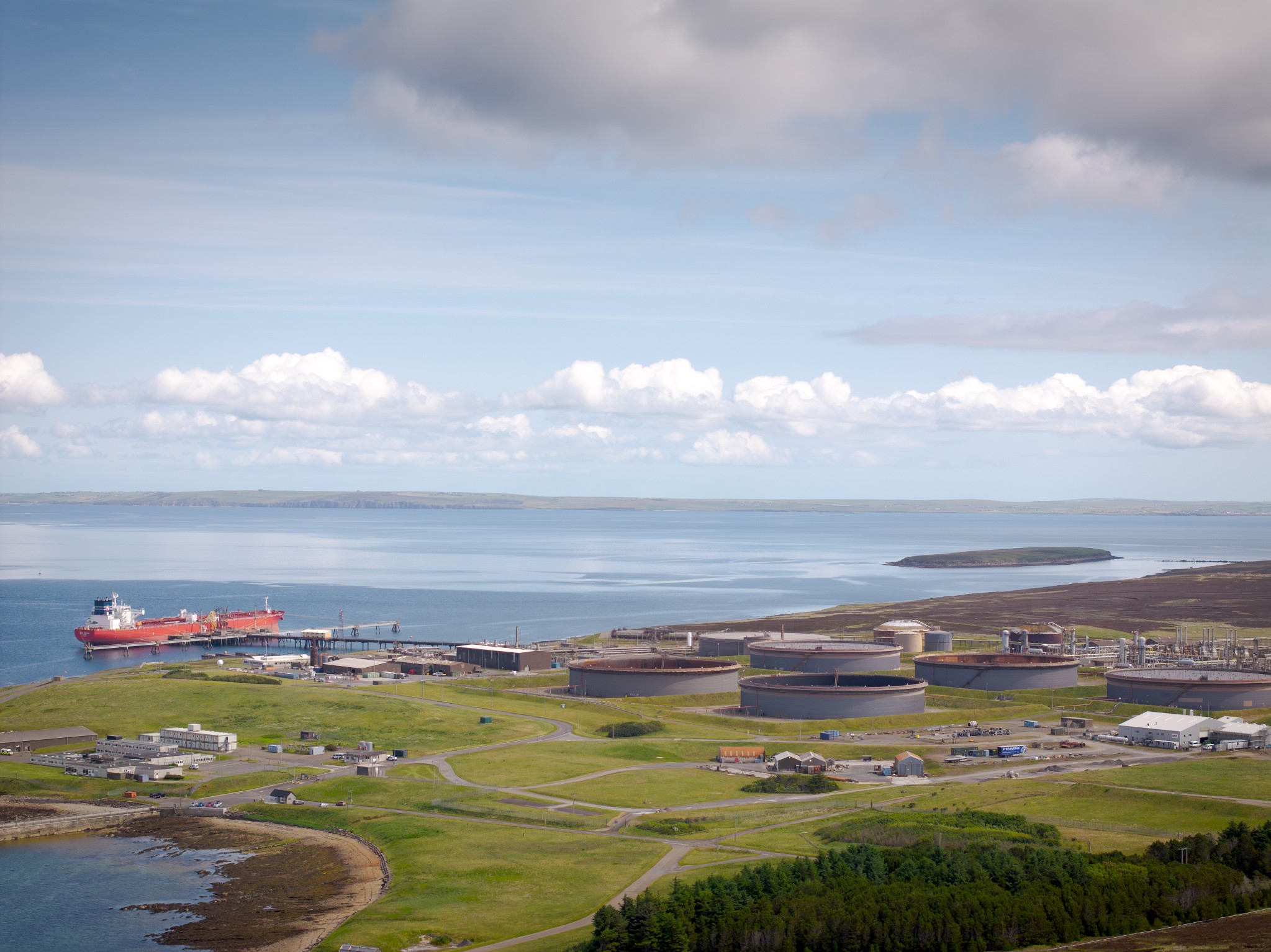
Many visitors to Orkney will tend to overlook Flotta on account of the oil terminal found on the north coast of this small island. But the facility is surprisingly discreet and is hidden from view for much of this walk.
The island was of huge strategic importance during both world wars as a major shore base for naval anchorage of Scapa Flow.
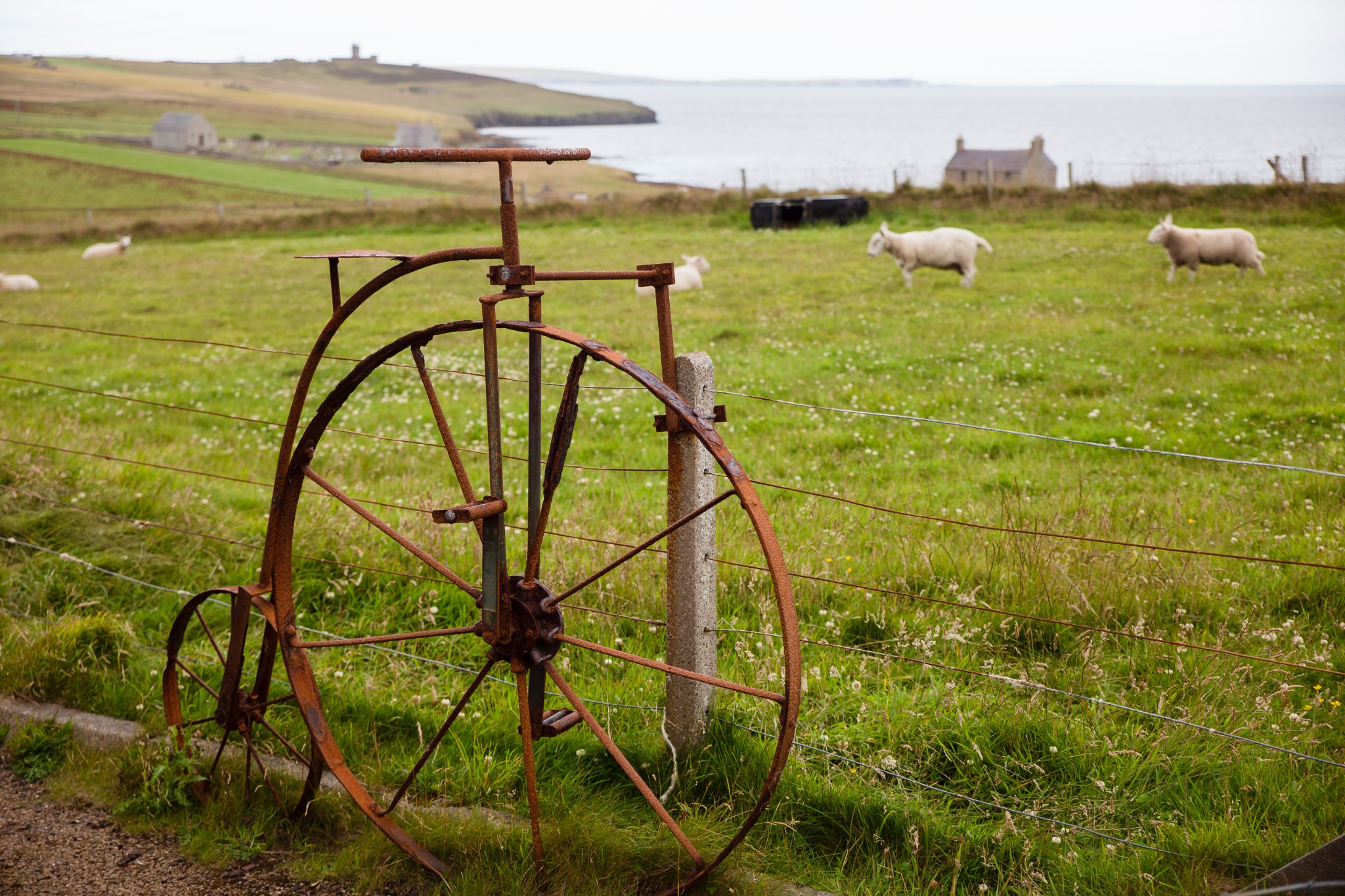
Flotta still has some of the most fascinating wartime sites in Orkney, but there’s plenty here too for those who prefer pastoral views, seascapes and wildlife.
Distance
13.3km
Grade
Grading: 3
Duration
5hrs
Terrain
Minor tarmac roads, long section on return to ferry. Hardcore track. Grassy coastal path, narrow in places with stiles.
Map description
OS Landranger 7; OS Explorer 462
Arriving at the Flotta ferry terminal, turn right to take the road heading south. This part of the island is dominated by the oil terminal. Built in the 1970s, it’s been a major contributor to the economy of Orkney.
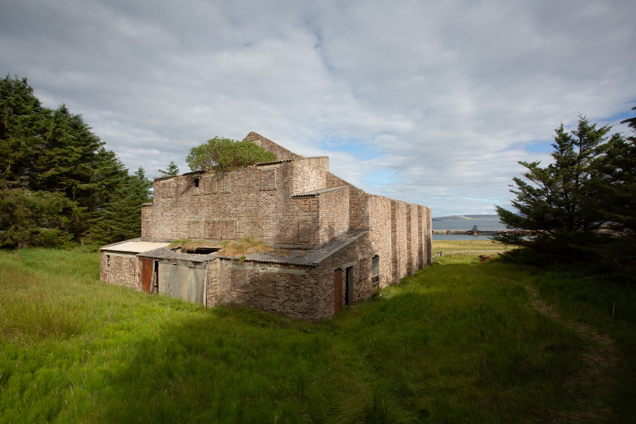
Turning right after around 200m you’ll see a large, derelict building set among trees on your left. This was a cinema for Navy personnel during WW2 and the projection ports can still be seen high up in one of the walls. The surrounding pine trees were planted by naval ratings. These have been supplemented in more recent years with native trees, and it’s a fine spot to appreciate some morning birdsong, with the oil terminal already starting to feel a world away.
Carry on westwards along the coastal road, around the magnificently-named Rotten Gutter, passing a disused airstrip. To your north is the uninhabited island of Fara, while ahead, to the west, lies Crock Ness in the island of Hoy. One of the island’s two Martello towers, dating from the Napoleonic Wars, can be clearly seen on the headland.
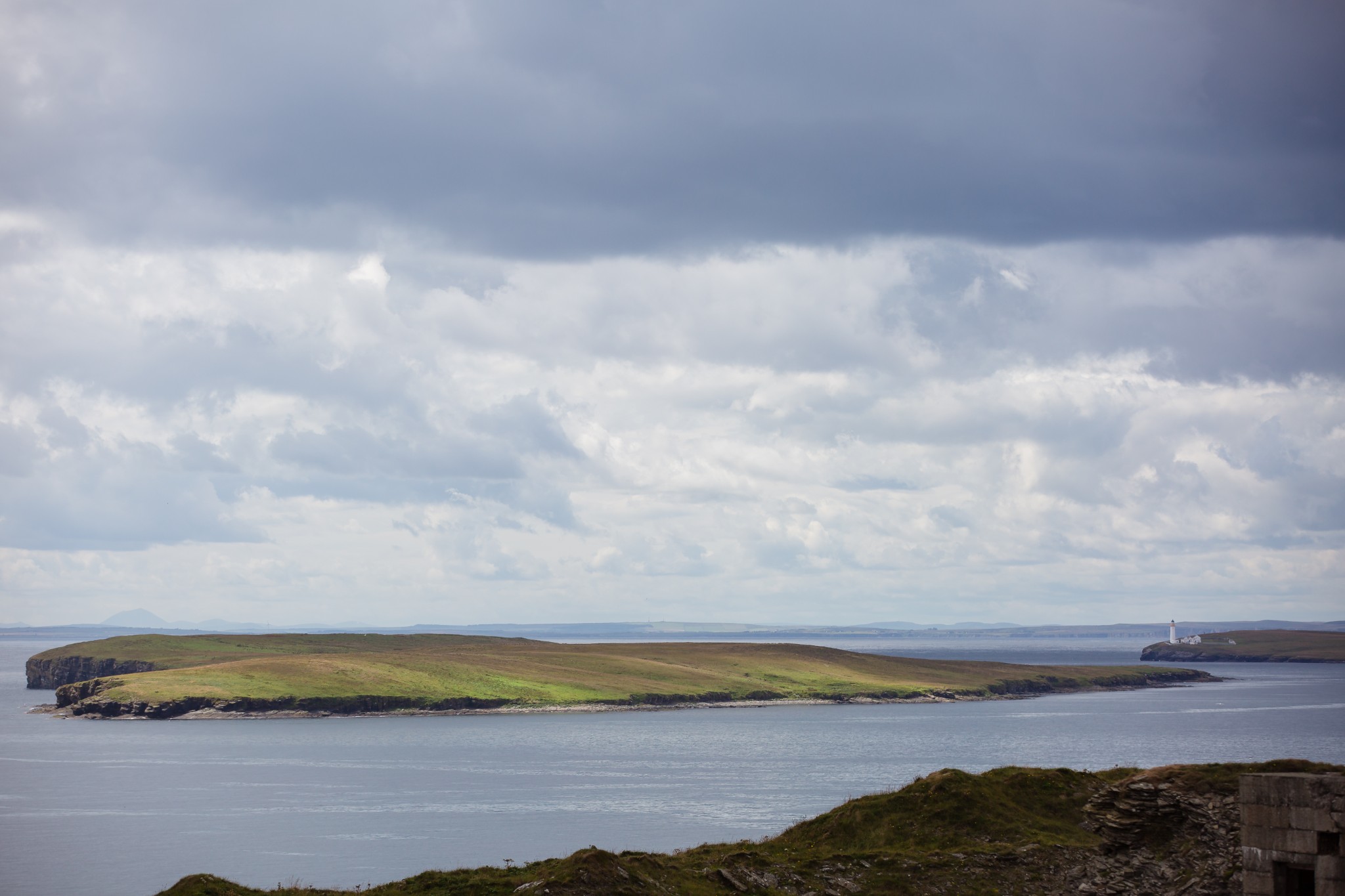
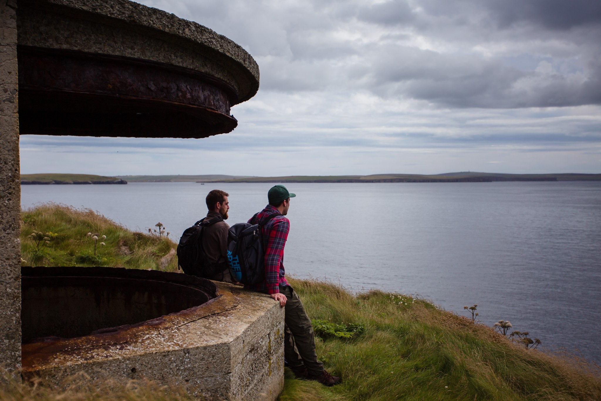
But it’s coastal defences from a more recent conflict which begin to dominate the view as you approach the southwestern tip of Flotta. The WW2 gun emplacements at Innan Neb (3.8km) give a commanding view across Switha Sound. The small, uninhabited island of Switha itself lies to the southeast, with Hackness and Cantick Head in South Walls to the south. The gun emplacements were built to overlook boom defence nets, laid between here and Hackness, effectively sealing-off this potential entrance for enemy vessels into the naval anchorage of Scapa Flow.
After a further 800m, at the eastern end of the bay at Scat Wick, the track meets the end of the public road by a ruinous property called Balaclava (there are a number of houses in Orkney whose names appear linked to the Crimean War, perhaps named by returning Orcadian soldiers). Instead of turning left to join the road, go right following the grassy path above the shoreline, passing round the Head of Banks. A number of stiles need to be crossed due to coastal erosion on the seaward side of the fence.
The path emerges onto the quiet, single-track road at Kirk Bay. There’s a picnic bench here close to the ruinous cottage by the shore. Look for the boat nousts at the western end of the bay, where generations of islanders hauled up their small boats to nestle in the grassy banks.
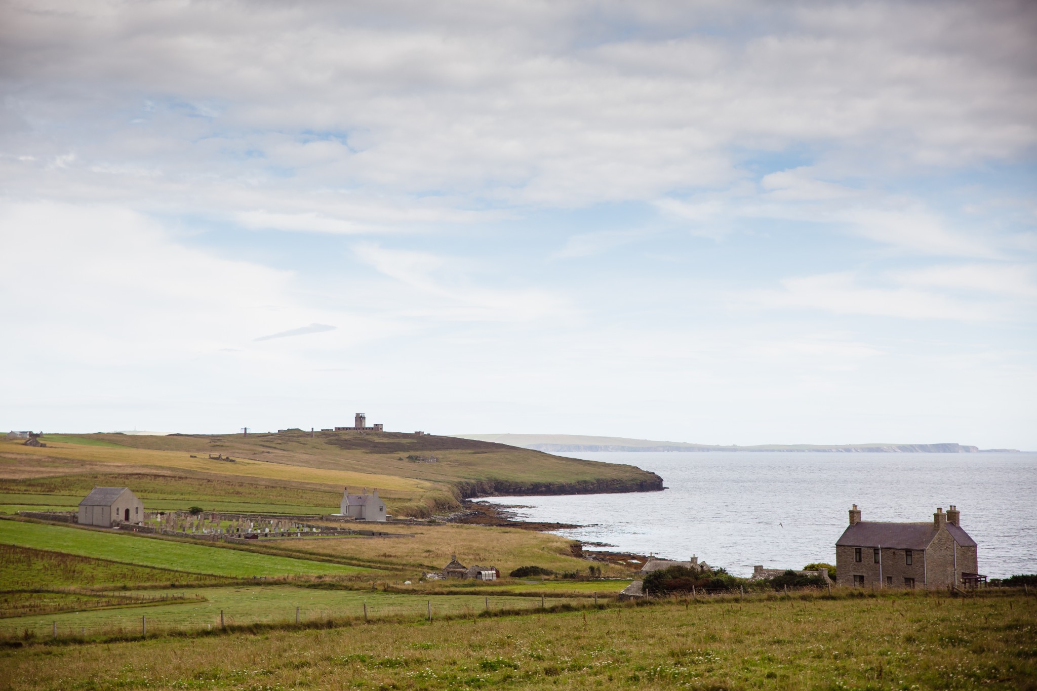
Carry on beyond the church, turning right to follow the cemetery wall, then onto a grassy track to reach the coast. There’s long been a site of worship here at Bayview, attested to by the name Kirk Bay. A beautiful medieval carved stone was discovered here in the 1870s. Featuring a decorative cross, it’s believed to date from the 8th or 9th century, and is now held in the National Museums Scotland collection.
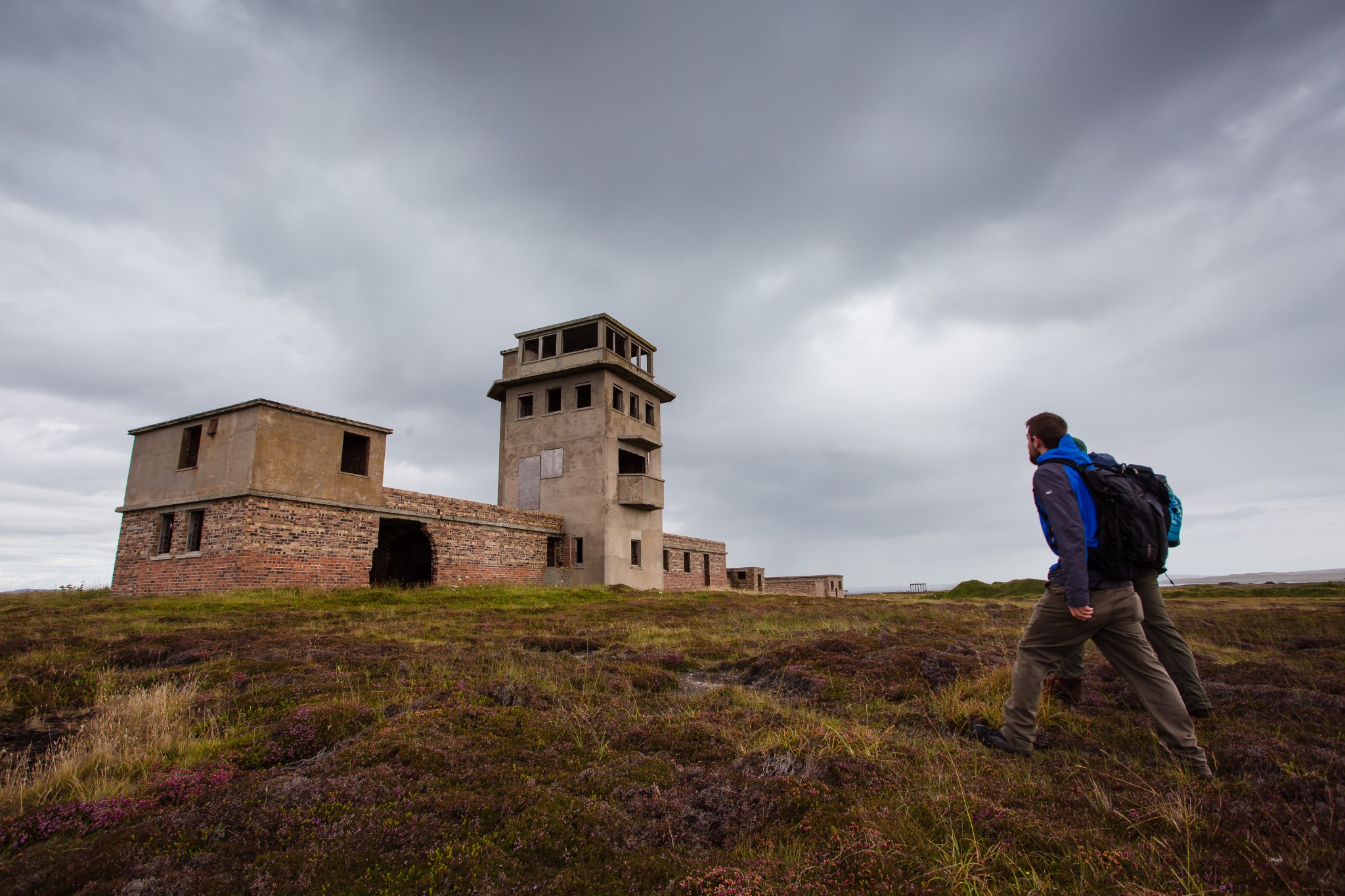
The landscape gently rises and becomes a little rougher as you head southeast along the coast. After passing a substantial ruinous dwelling on your left, head uphill towards the large concrete structure which dominates the headland. This is the Port War Signal Station at Stanger Head (7.2km). From here the various gun batteries covering the southern approaches to Scapa Flow were co-ordinated and it’s an impressively-sited eyrie, with fabulous views down into the Pentland Firth. Do not be tempted to enter any of Orkney’s wartime buildings, as they become increasingly unsafe with every passing year.
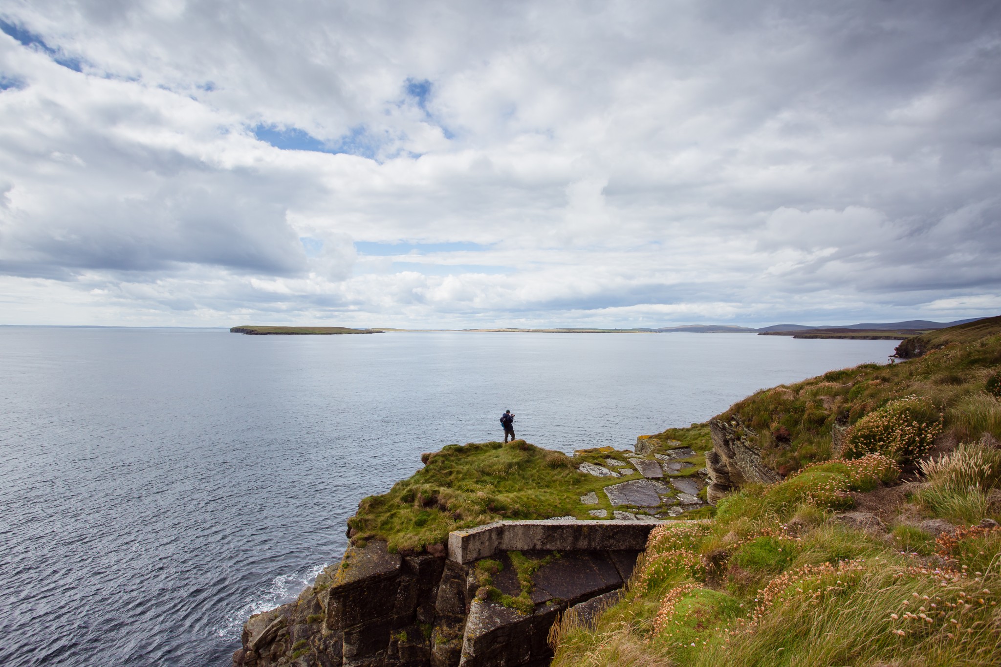
From here head southeast towards the cliffs. Puffins can often be seen along this stretch, but do take care near the edge, which overhangs in places and is extremely brittle. Keeping towards the coast should also avoid the worst of a partially-overgrown spoil heap from the large quarry, used for stone to build the oil terminal. Stanger Head itself is joined to the land by a fairly narrow neck opening onto a broader, grassy headland. It’s a fine spot to break for lunch. Keep your eyes peeled for porpoise and orca, both of which are regularly seen passing through these channels between the islands.
Head back towards the quarry, this time turning right to pick up the track passing to its eastern side, joining the public road after about 600 metres. On the coast down to your right is Kings Hard, where King George V came ashore in 1915 to inspect the wartime defences.
As the road turns right then left, dropping closer to the shore, look for the remains of the impressive Buchanan Battery. Along with the Balfour Battery across the water in South Ronaldsay, its job was to cover the massive boom defences over Hoxa Sound.
After heading a further 300 metres north, turn left to walk along the main (though very quiet) road. After a further 400 metres look for a road on the right leading down towards the shore and the island's excellent Heritage Centre - well worth the short detour. After returning to the main road, continue 3km back to the pier, passing through the most populated part of the island, with views to your right across gently sloping fields to the bay of Pan Hope. On a drowsy summer’s afternoon, it’s hard to imagine just what a hive of activity this island was in both World Wars. In 1917 a crowd of servicemen, estimated at a staggering 10,000, turned up here to watch a boxing match. It feels considerably quieter today.
Visit the Scottish Outdoor Access Code website for more information and advice on how to enjoy the outdoors responsibly.
Further information
- Places of interest
Aside from its wartime heritage, perhaps Flotta's most attractive feature is its nature and wildlife - the island’s moorland is a haven for birdlife. Don’t miss the Cletts, a pair of small sea stacks close to the Port War Signal Station at Stanger Head.
Although not officially part of the Flotta’s Wartime Trail, the Golta Peninsula is a fascinating place to explore if you have time before your ferry. It’s home to the remains of the Z Battery, part of the fearsome Scapa Barrage that erupted when enemy planes were overhead. Golta also hosts the eerie ruins of the First World War YMCA, a recreation hub for Naval personnel, and the St Vincent Pier, so-named as it was built by men from HMS St Vincent.
Our Flotta Heritage Cycle covers many of the sites mentioned in this guide, plus some extra locations.
- Food & drink
The Flotta Post Office stocks a limited selection of snacks and is open Monday to Thursday between 9.30am and 11.30am, on Fridays between 2.30pm and 4.30pm, and on Saturday mornings between 9.30am and 10.30am. These times are subject to change too.
The Flotta Community Summer Cafe is usually open from late-June until mid-August most days of the week, offering a varied menu of soups, sandwiches, and light bites. Check opening times and the latest information on Facebook.
Visitors to the Heritage Centre are welcome to make a cup of tea or coffee too. Anyone planning a visit for a day or longer should bring some extra supplies with them.
- Transport & services
You can travel to Flotta on foot or with your car with Orkney Ferries, with daily sailings from Houton. Visit the website to view timetables and find out how to book. Orkney's number two bus service runs between Kirkwall and Houton daily, with the number five service operating between Stromness and Houton. View the full timetable on the Orkney Islands Council website.
Petrol is available at the same times as the shop opening hours, between 10am and 11am on Mondays to Thursdays and Saturdays, and between 4.30pm and 5.30pm on Fridays.
There is a public toilet at the pier, offering one accessible unisex toilet.