For the more experienced hillwalker this is a route which showcases some of the finest, and wildest, landscape in Orkney.
Geology, wildlife and human history come together to richly reward the considerable physical effort.
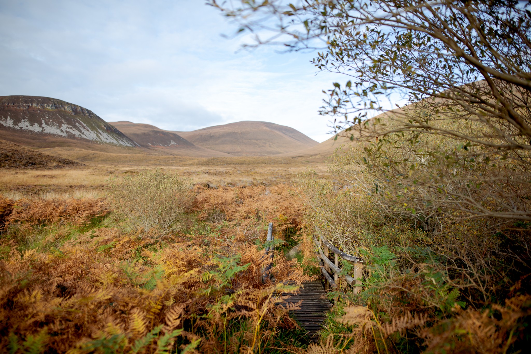
Hoy is Orkney's 'high island', a place completely in contrast to much of the rest of the islands. And its north end is full of spectacular scenery.
From towering sea cliffs to tumbling heather-clad hills, this is an incredibly special place to discover.
Distance
21km
Grade
Grading: 5
Duration
8hrs
Terrain
Steep, exposed hill ground. High clifftops, pathless in places. Often wet underfoot.
Map description
OS Explorer 462; OS Landranger 07
Anyone planning on tackling this route should be aware that it involves rough, pathless terrain with extreme exposure and little or no mobile phone signal. It should only be attempted by experienced hillwalkers with good navigational skills and equipment. Due to the maritime environment, conditions on the summit of Cuilags and around St John’s Head are likely to be similar to those found at higher altitudes on the UK’s highest mountain ranges. An easier, well signposted route to the Old Man of Hoy can be found starting at the township of Rackwick.
The route begins by catching the early foot passenger ferry from Stromness. A short rumble through Hoy Sound brings you to the pier at Moaness, an essential transport link for the north end of the island.
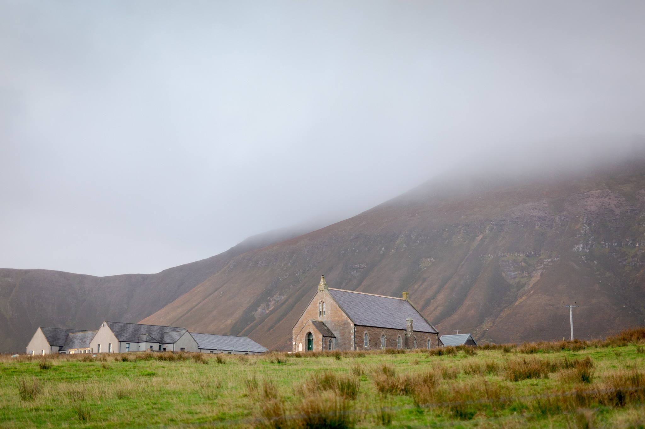
From the pier follow the public road west then southwest directly up the hill. Just after a kilometre lookout for a church on a sideroad to your left-hand side. The Hoy Kirk and Heritage Centre is well worth a look around before you carry on the walk. It’s always open and contains a wealth of information on the history of the area, as well as a superb collection of reference books on the flora and fauna you’re likely to encounter.
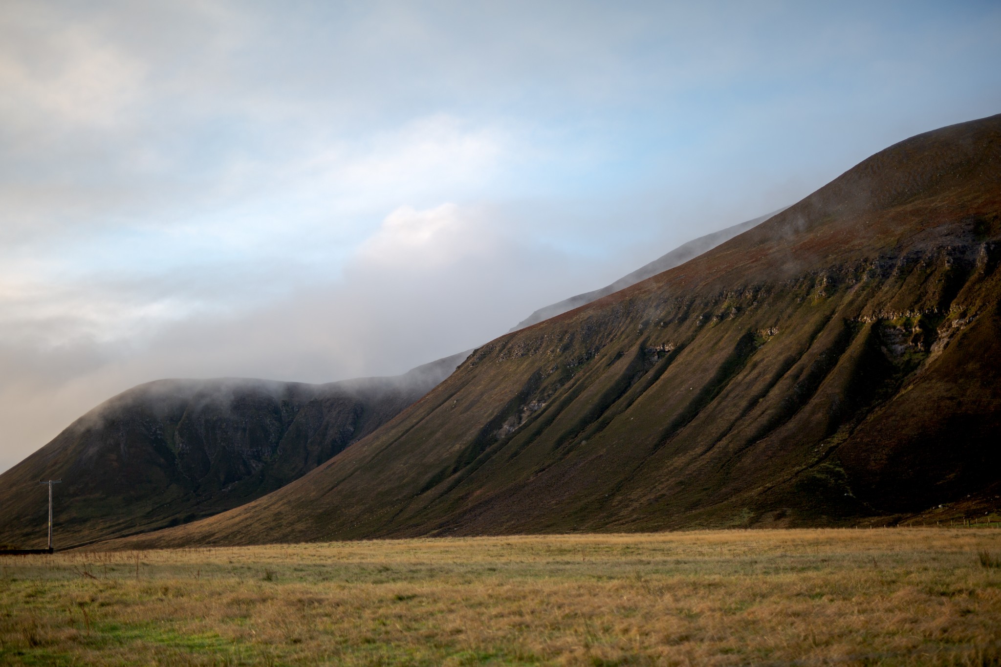
Return to the main road heading uphill. Ahead and to your left are the eroded flanks of Ward Hill, the highest point in Orkney, while on the right the shapelier conical peak of Cuilags, our first target for the day.
As the public road turns sharply to the right, carry straight on along a vehicle track until you reach the outflow of the Sandy Loch reservoir (2.75km). In wet weather, a pair of rock-filled gabions around 30m downstream from the outflow provide a dry-shod crossing of the burn.
From here head west, directly up the heathery slopes of Cuilags. The going becomes increasingly steep before easing off as you get towards the summit. Look out for mountain hares here – they’re brown in late spring and summer before they turn white in winter, an unfortunate choice of camouflage in a landscape that sees infrequent winter snow. It makes the animals an easy target for the golden eagles and white-tailed eagles, which have recently returned to the skies above Hoy.
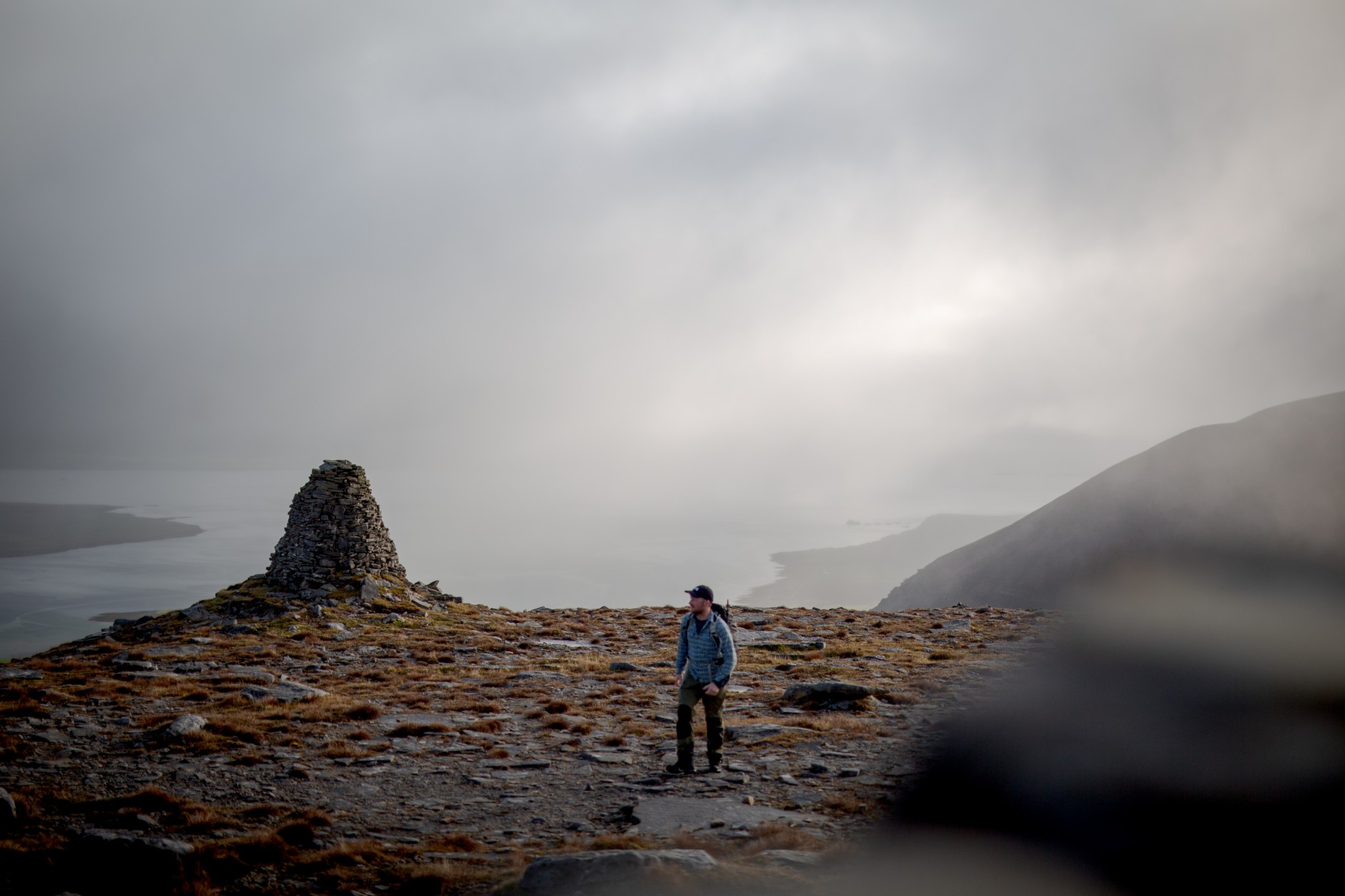
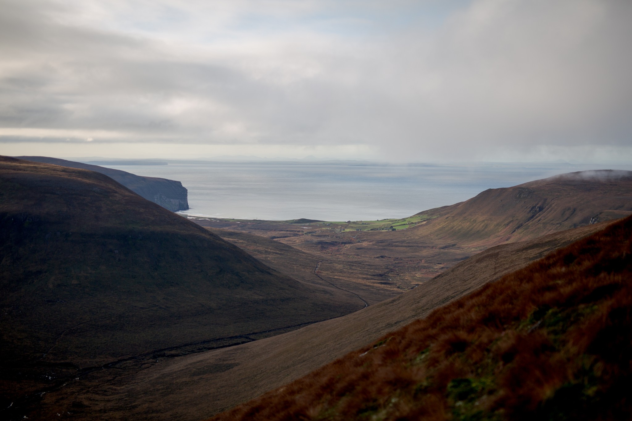
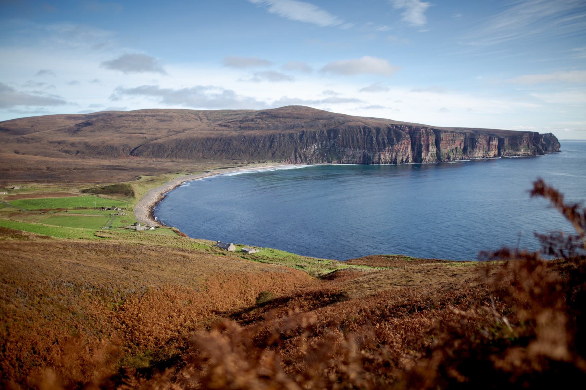
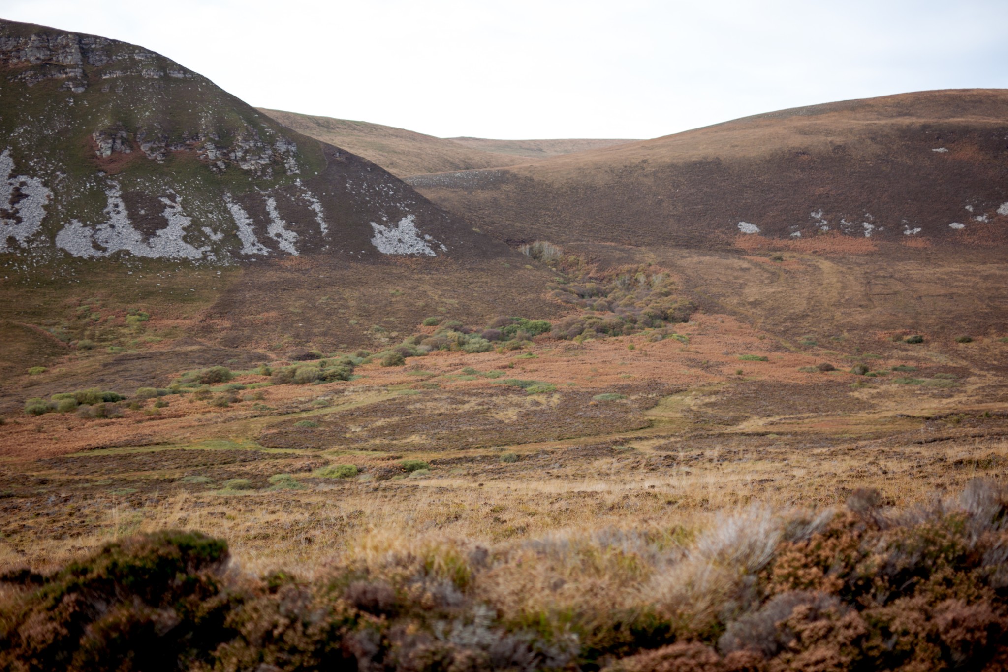
A beautifully-built stone cairn (an important navigational mark for local fishermen) is passed shortly before the summit (3.7km), which is strewn with curious, angular, pock-marked boulders. The views northeast across Graemsay to the Orkney Mainland are fabulous, while south through the glen the township of Rackwick can be seen, with Caithness in the distance across the Pentland Firth.
From Cuilags, head northwest then west to reach Enegars. The brittle crags stand high above Kay Breck, with the Kame of Hoy to the west. These steep slopes rising straight out the Atlantic were a constant hazard to wartime pilots, and the wreckage of a Royal Navy Corsair that crashed here during the Second World War can still be seen scattered along the course of the burn that lies between Enegars and the Kame. It’s just one of four WW2 crash sites in Hoy, between them claiming the lives of fourteen aircrew, including the New Zealand pilot lost here.
From Enegars travel south-southwest, keeping to the easier ground to the east of a cluster of small lochans before heading west-southwest, passing to the north of another lochan and a trig point (with sheltering dyke) to reach the summit of Sui Fea (6km). During the nesting season, from spring into early summer, please bypass the lochans by skirting along the northern slopes of Sui Fea. Red-throated divers nest here, and are easily disturbed.
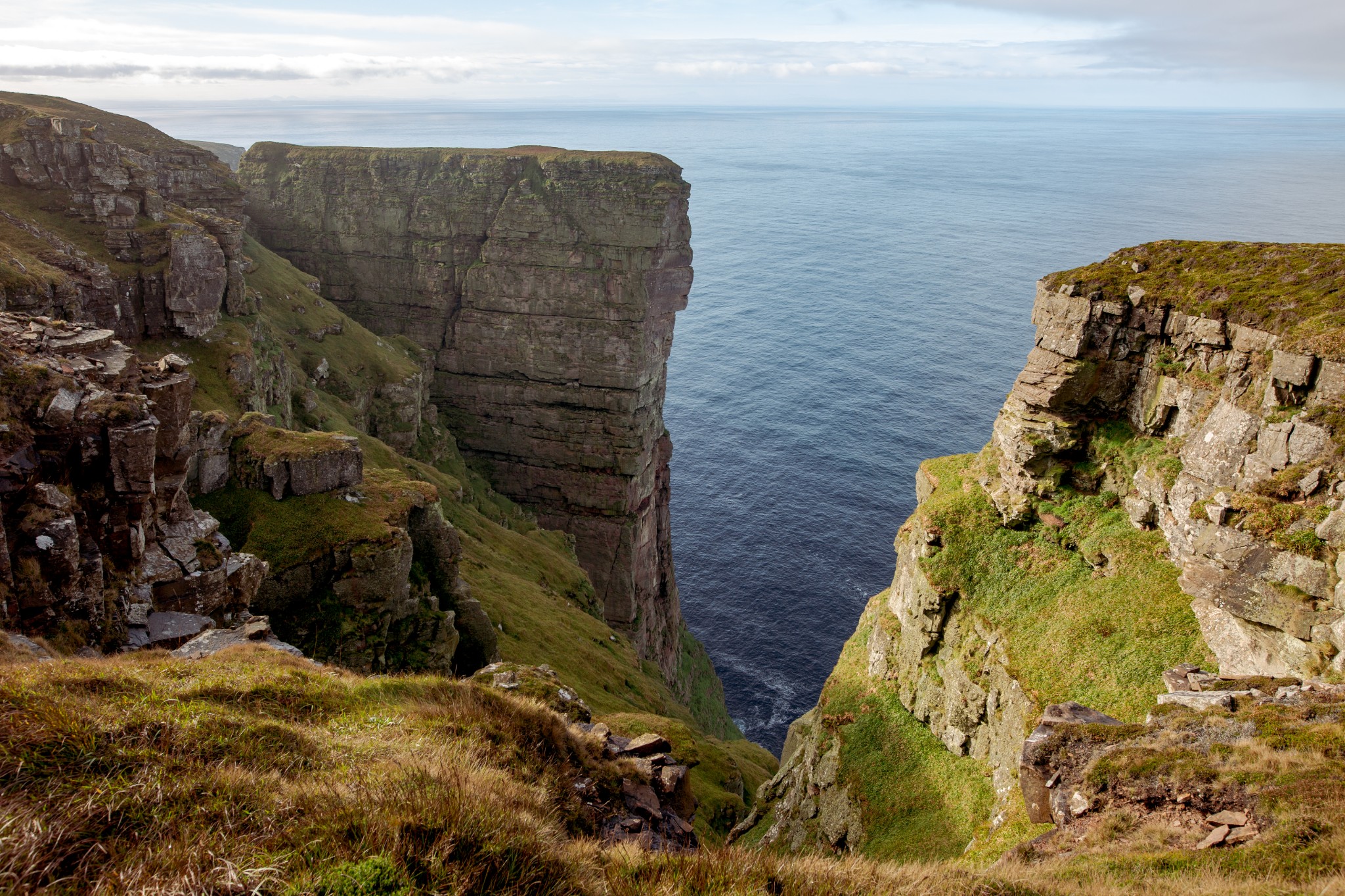
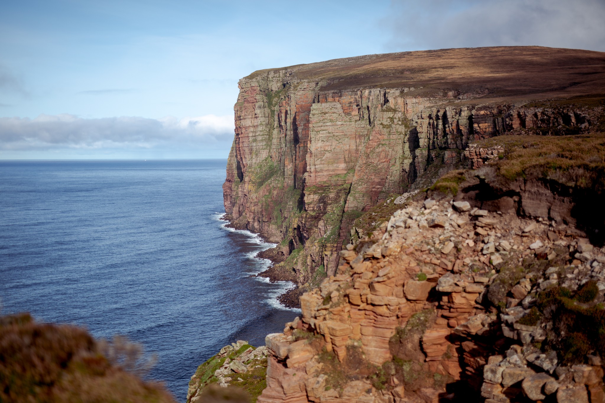
Head northwest to reach the coast at St John’s Head. These are the highest vertical sea cliffs in the UK. The cliffs themselves stand on the outside of an inaccessible mass of rock called Bre Brough, connected to the land by a narrow saddle, but can be well-seen by walking a little to the north. If you’re lucky, a small fishing boat from Stromness hauling its lobster pots below the feet of the cliffs will give a much-needed sense of scale. Bre Brough itself is thought to have been an ancient fort site. It’s unclear whether its purpose would have been defensive or religious, but the remains of a stone dyke can be seen hanging precariously above the saddle of connecting land.
Follow the coast south. The path is sketchy at first but becomes increasingly well-defined, though rather wet in places. Keep well clear of the edge, as exposure and altitude mean that these cliffs are particularly brittle. At times the path crosses the heads of various inlets or geos, over the glacial till which is starting to slump. At these points take a few steps inland of the well-worn route to avoid the obvious danger.
As you cross the headland at The Sow (7.8km), the Old Man of Hoy suddenly comes in view, far below, with the restless waters of the Pentland Firth behind. The toughest part of the route is now behind you and you can take a moment to admire one of Orkney’s finest landmarks, from a vantage point that most people never get to appreciate.
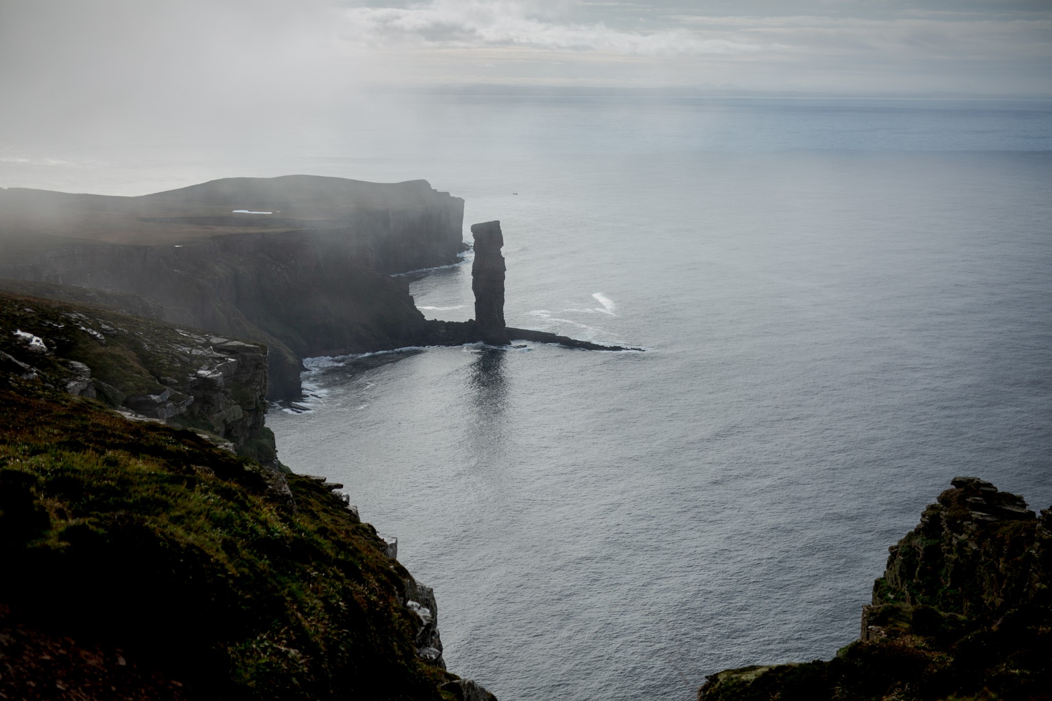
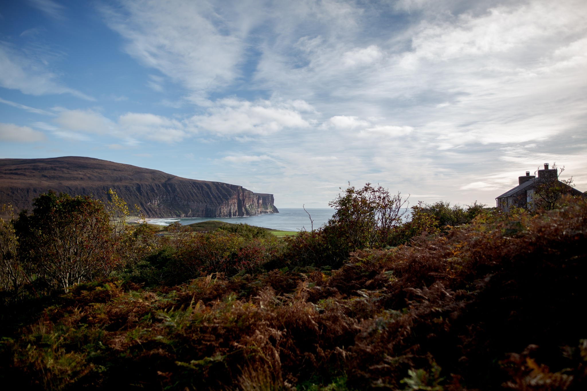
Follow the obvious path to the Old Man of Hoy (9.6km). From here, look back north along the coast you’ve just travelled and the incredible scale of these great cliffs becomes clear.
Pick up the obvious path heading southeast towards Rackwick. The views of the township itself and the cliffs to the south of it are breath-taking as you round the headland and begin to descend into the glen.
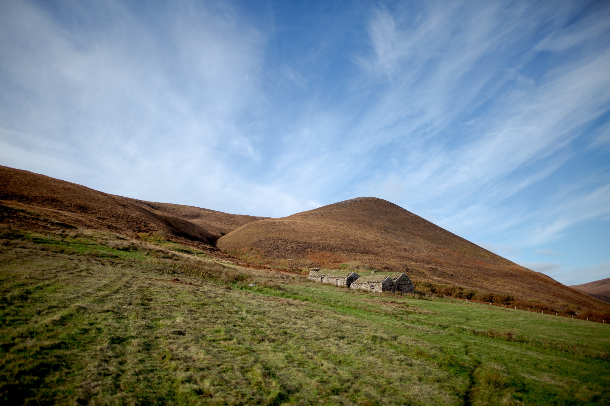
After passing through a wooden kissing gate the route heads diagonally across common grazing before you reach a small thicket of native trees and a burn, turning right then left to arrive at the hostel, with a small museum and visitor centre nearby (13km).
If you have time, then a wander around Rackwick and its incredible beach is well worthwhile. But it’s best to leave around 2hrs for the final leg of the walk from Rackwick through the glen back to the ferry at Moaness (it can be done in an hour and a half but becomes more of a trot than a walk!)
Simply follow the public road north out of the township for around 800m. Immediately after it drops to its lowest point and crosses the burn, look for a path heading off to your left, crossing a wooden footbridge before winding its way north through the glen. It’s a straightforward walk from here back to Sandy Loch, though the route is badly eroded in places and liable to waterlogging.
Look out for Berriedale, across the glen on your left. This is the most northerly semi-native woodland in the UK, and since the RSPB took ownership of this area of land, sheep have been excluded from the glen, allowing the trees to start recolonising the slopes. Here and there small rowan and downy birch line the side of the path – pioneers of a gradual regeneration.
From the north end of Sandy Loch (17.5km) simply retrace your steps back along the public road to the ferry at Moaness.
Visit the Scottish Outdoor Access Code website for more information and advice on how to enjoy the outdoors responsibly.
Further information
- Places of interest
Hoy is a fascinating place to explore. It's Orkney's second largest island, so you could quite easily spend a few days taking in its sites and scenery. Places like Rackwick and the Old Man of Hoy are amongst the most popular locations in Orkney, with other attractions including the Hoy Kirk & Heritage Centre, Dwarfie Stane and the Cra'as Nest Museum all worth a visit.
Towards the southern end of the island and South Walls there is a dramatic change in scenery, but still a lot to see and do. The Scapa Flow Museum tells the story of the Flow's and Orkney's wartime heritage. There are other wartime locations around the island to visit, including the poignant Lyness Naval Cemetery. The Hackness Martello Tower & Battery is an excellent location, and take time to stop off at the Longhope Lifeboat Museum too. The Creative Retreats offers arts and crafts workshops and inspiration days. You can also tackle a wonderful walking route full of coastal scenery at the Hill of White Hamars.
There is an incredible wealth of wildlife in Hoy - from mountain hares to dragonflies and white-tailed eagles - and the coastal scenery is amongst the best in the country.
- Food & drink
Longhope is home to an excellent shop, J.M.F Groat & Sons, selling a wide range of goods, including local produce. The shop also sells fuel and is the island Post Office too. The YM Longhope runs a community café on Tuesdays and Saturdays with a range of lunch options available, and a Lunch Club on Fridays with a two-course meal on offer at very reasonable prices. It’s also a great opportunity to meet local folk for a chat about the island. Find the latest opening times and menu information on Facebook.
The Scapa Flow Museum at Lyness features the Skalpaflòi Café, with a menu full of lunch options, snacks, home bakes and refreshments. It’s open at the same time as the museum itself.
North of Lyness you'll find Emily's which offers a range of tasty lunches and evening meals throughout the year. Check opening times in advance. The Beneth'ill Cafe at Moaness also offers soup, sandwiches and specials, as well as evening meals, during the summer months.
Check out our Hoy cycling routes - the Hoy on Hoy route, and the Lyness to Longhope route - too.
- Transport & services
Daily ferries keep Hoy connected to the Orkney mainland. A ro-ro ferry shuttles between Houton and Lyness, with a passenger only service operating between Stromness and Moaness. View timetables on the Orkney Ferries website.
There is also a community bus service available.
Public toilets are available at the piers at Longhope, Lyness and Moaness. There are also toilets at Rackwick.
Petrol and diesel are available from the J.M.F Groat & Sons shop in Longhope.
A brilliant and challenging walk. Completed Cuilags in July 2022, then Ward Hill in Hoy in July 2023. The Cuilags is by far the more beautiful walk, the views and route are both spectacular and, if the weather is kind, the approach to the Old Man is wonderful. Will be back again in 2024 and 2025 and plan to repeat again if possible. Be prepared for a stiff first climb but take your time and it's worth it.