An introduction to one of Orkney’s most accessible islands, a mere thirty minutes from the heart of Kirkwall.
Shapinsay is an island famous for the quality of its livestock.
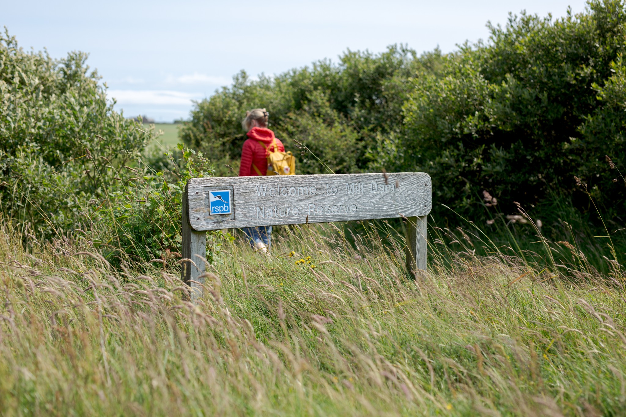
But amongst its green and fertile pasture lies a wilder heart. The RSPB’s Mill Dam Reserve is a fabulous area of wetland. Home to a wide range of wildfowl, it forms the centrepiece to this walk.
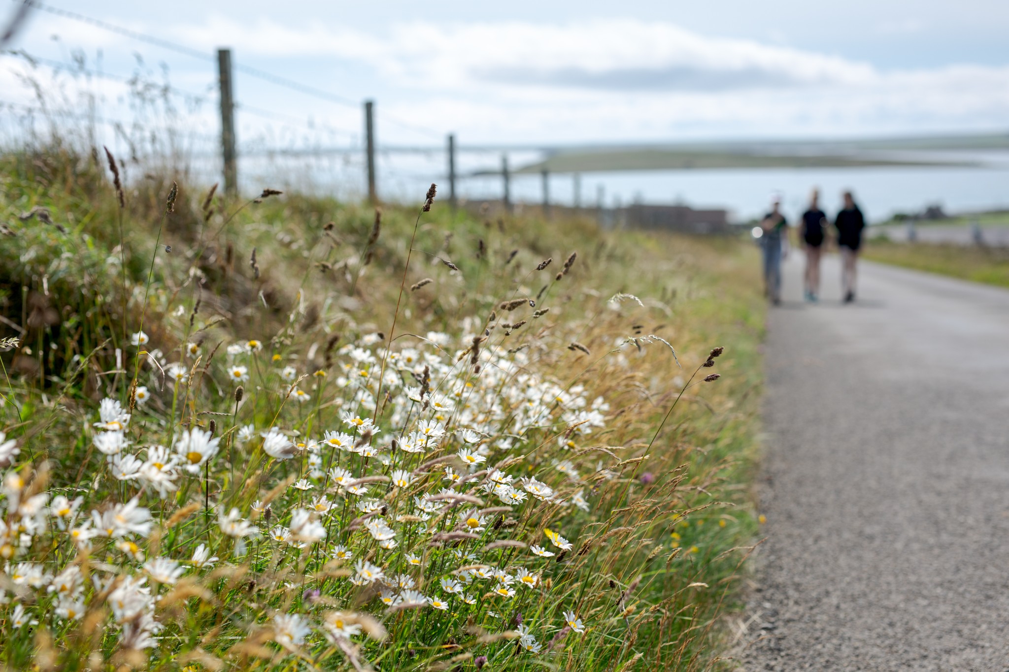
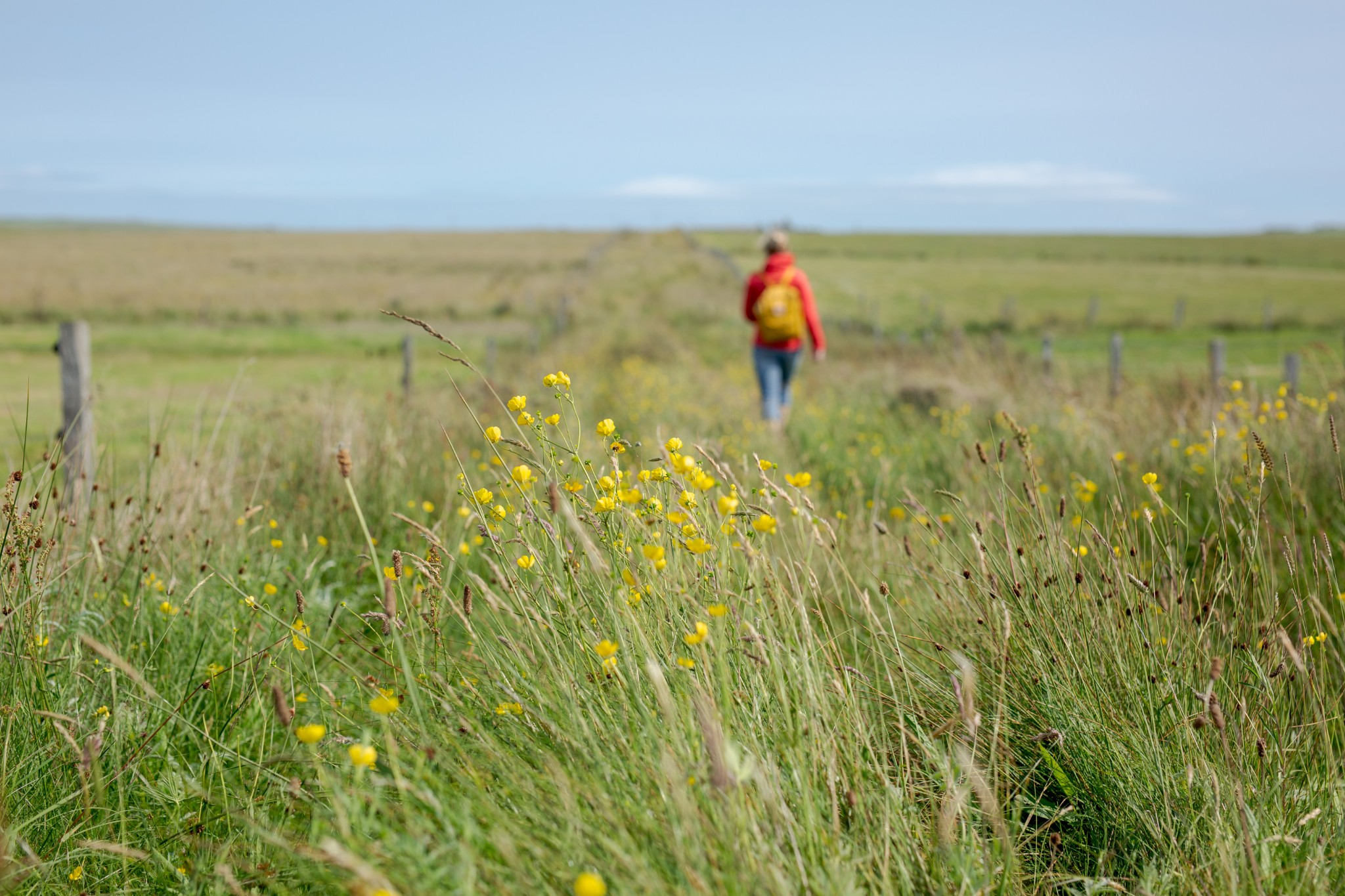
The route is primarily along quiet country roads, with a couple of sections of farm track.
Distance
7.8km
Grade
Grading: 2
Duration
2hrs 15mins
Terrain
Primarily quiet, single track road. Some farm track, which can be overgrown.
Map description
OS Explorer 461; OS Landranger 6
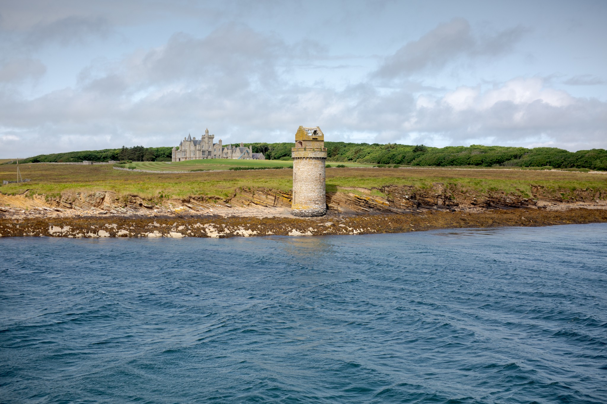
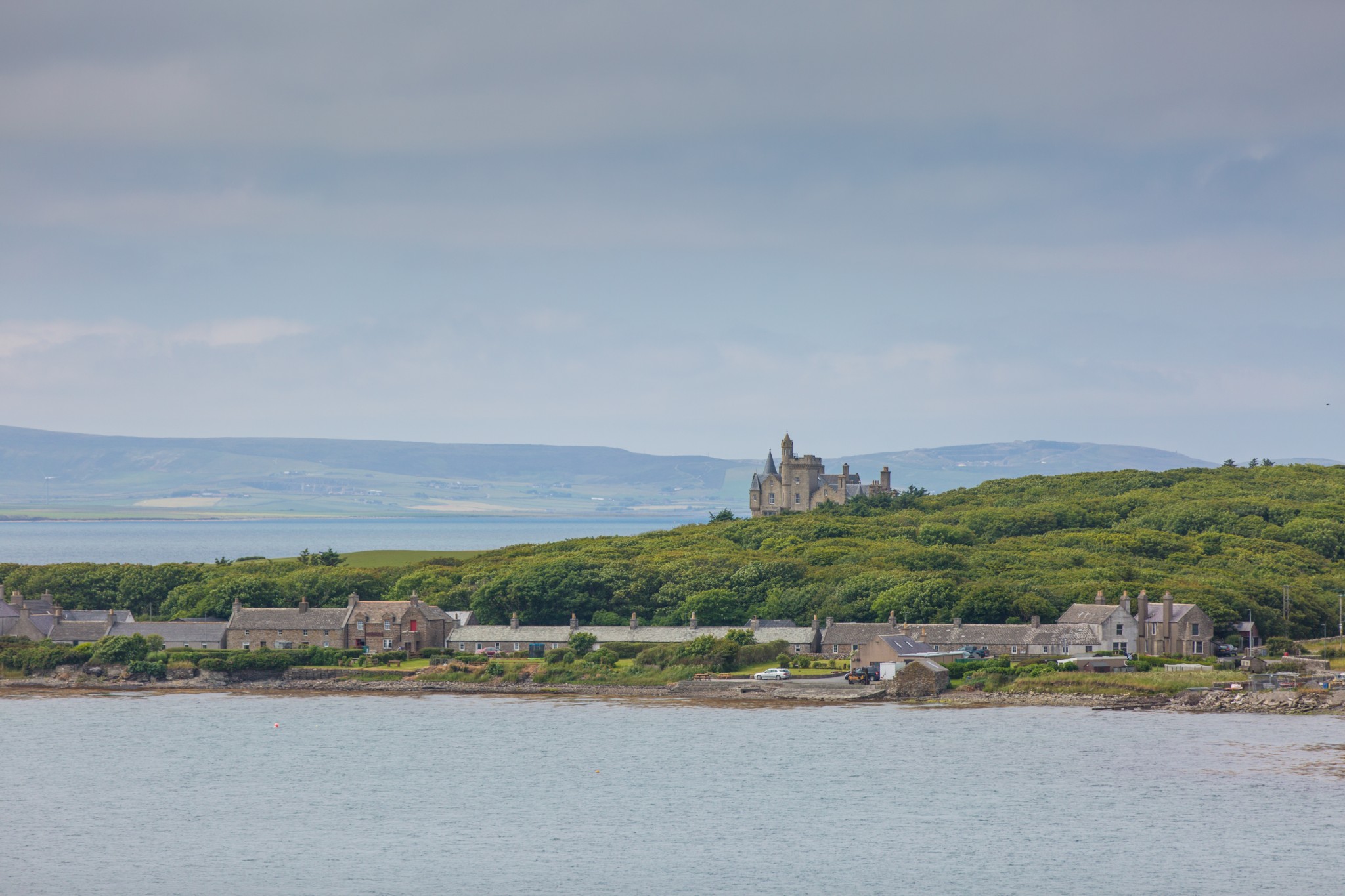
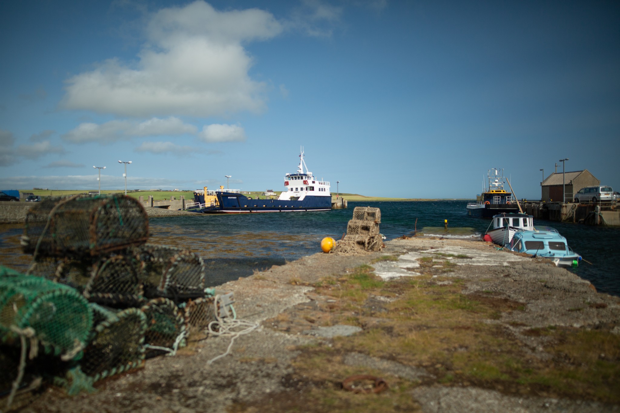
Start your journey by taking the half hour ferry crossing from Kirkwall, which departs from the concrete slipway on the west side of the harbour, alongside the lifeboat pier. As you approach Shapinsay you’ll get a fine view of Balfour Castle. Built in the mid-19th century, it was a grandiose extension to an older, more modest property, and features 365 panes of glass – one for every day of the year. You’ll also see an impressive stone tower on the shoreline which was in fact a salt water shower, topped with a dovecote.
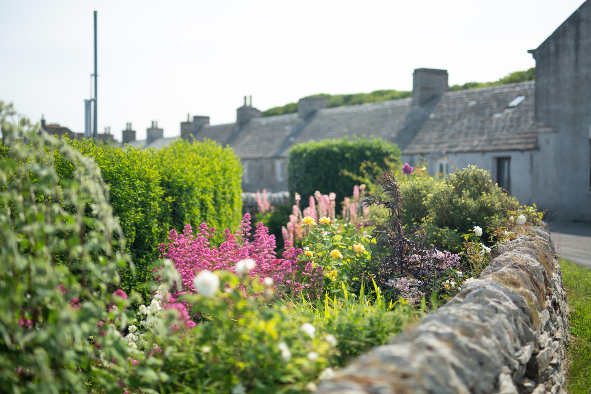
The walk begins the moment you step off the ferry, at the heart of the picturesque Balfour village. It was built slightly earlier than the castle itself, but was all part of the ‘improving’ mindset of the Balfour family, and was Orkney’s first planned village.
Turn right from the pier, heading north along the village, admiring the neat row of cottage gardens across the road to your right. Just after the well-stocked shop, keep to the right at the fork in the road to pass the school. Watch out on your right-hand side for a circular stone building, the remains of a 19th century gasworks, which once provided lighting for both the village and castle.
Turn left at the junction after the school (0.7km) passing a small housing development on your right to head directly north out of the village (the Balfour family’s fastidious attention to detail means that roads, tracks and fields in this part of the island tend to fall on strict lines of north-south and east-west.)
As the road gently rises you get a fine view across the small loch at the Mill Dam. As the name suggests it was created when a dam was installed in the 1880s to provide a controllable source of power for the Elwick Mill.
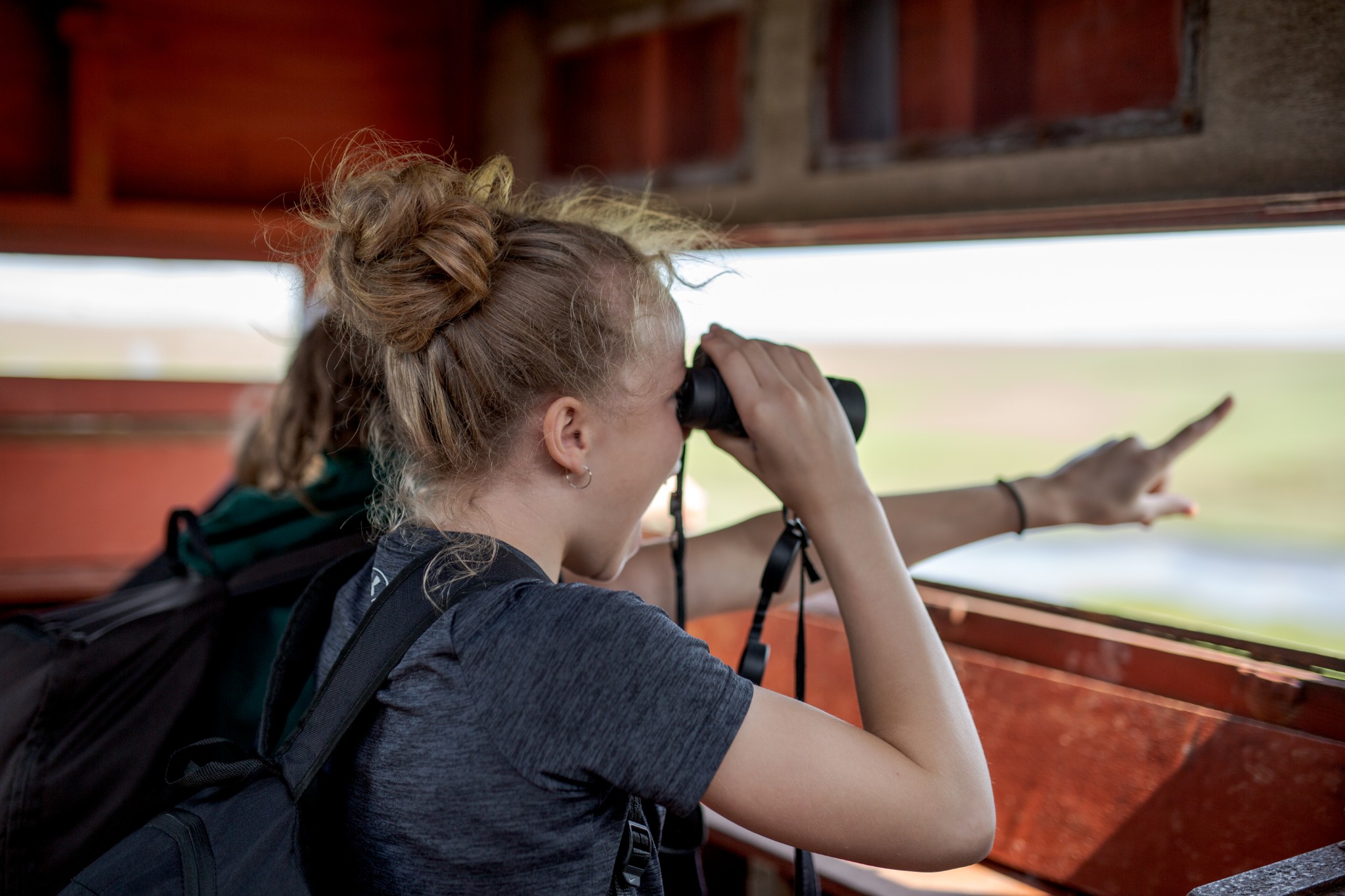
The RSPB reserve’s bird hide is located just to the right of the public road (1.6km) about two-thirds of the way along the loch. It’s the perfect vantage point, perched well above the waters, to give a commanding view of wildfowl such as wigeon, shoveler, goldeneye and teal, as well as waders like redshank and oystercatcher.
From the reserve carry on northwards up the road. As it reaches its summit fine views open up to the north towards Eday and Rousay, with Westray in the distance. Around 800m beyond the reserve hide you’ll come to a junction where a bench on your left provides the perfect spot to stop and admire the scenery. Carry on for another 200m beyond this junction until you see a grassy agricultural track on your right (2.6km). Turn westwards down this track, which is a bit overgrown, and follow it for 1km until you reach the junction with the public road (3.6km).
Turn right to head south. In the summer, on either side, you’ll see evidence of why this island has such a reputation for the quality of its cattle, with a patchwork of lush grazing interspersed with fields of barley.
At the T-junction (4.8km) turn left, before taking the first road on your right after a further 300 metres. When you reach the turn-off to the church carry straight on down an agricultural track. To the left you’ll get good views to the east of the island, while straight ahead lies the String, the narrow stretch of water that separates Shapinsay from the Orkney Mainland. For centuries some of the most important shipping in and out of the islands has moved in and out of this channel with the tides.
After 600m pick up the public road again, turning right to head back towards the village. The island’s war memorial (6.6km) gives a superb viewpoint across Balfour village to the castle behind, and to the left, over Elwick Bay and the small island of Helliar Holm.
Return past the mill and through the village to the pier and your ferry back to Kirkwall.
Visit the Scottish Outdoor Access Code website for more information and advice on how to enjoy the outdoors responsibly.
Further information
- Places of interest
Shapinsay has a number of other attractions if you're planning to stay longer than the duration of your walk. The Iron Age Burroughston Broch is tucked away close to the shore in the north east corner of the island, and you can also visit the Mor Stein standing stone. The Shapinsay Heritage Centre in Balfour village is an excellent introduction to the island.
The island has some wonderful wildlife-spotting opportunities too. Seals often bask on the shoreline close to the village shop and there are plenty of seabirds to see, including guillemots, shags and razorbills. Shapinsay is also rich in flora and fauna, and there are a couple of beautiful, and quiet, beaches to enjoy too.
- Food & drink
The newly reopened Smithy Café & Restaurant in Balfour village offers brunch, lunch and refreshments. The excellent island shop, Thomas Sinclair, is also found in the village and offers a wide range of food and drink options.
- Transport & services
Daily ferries connect Shapinsay and Kirkwall. View timetables on the Orkney Ferries website.
Public toilets are available at the Shapinsay pier. These are the only toilets in proximity to the walking route – which is fairly open in aspect – so walkers of all genders may wish to make use of these or the facilities onboard the ferry, before heading off!
Bike hire is available from the Shapinsay Development Trust - book ahead if you're planning to cycle during your visit. Our Shapinsay Circular cycle route is an excellent introduction to the island.
Petrol and diesel are available from the island shop.